|
The National Weather Service is tracking a storm system that may bring winter weather to Stafford tomorrow morning, Monday, January 15th, and Tuesday morning, January 16th.
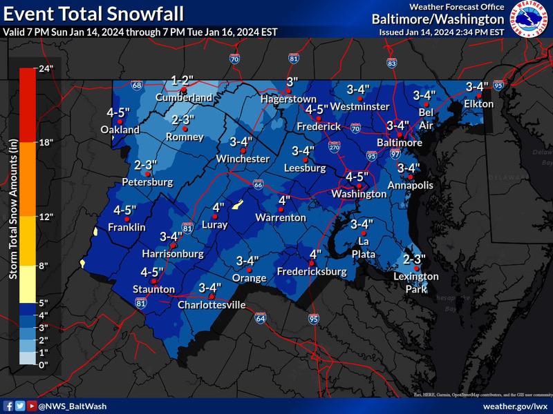
For Monday, a period of snow is POSSIBLE late tonight into Monday morning. Snow amounts of around 1" are expected along the I-95 corridor from Fredericksburg up to the DC metro, and around half an inch up to the Baltimore metro.
If this threat does materialize late tonight through the Monday morning commute, many roads could quickly turn snow covered. This could lead to hazardous commuting conditions.
Snow rates should decrease Monday afternoon as the area enters a lull between events. Intermittent light snow and flurries will be possible all day across most of the area.
The second period of snow is expected Monday evening through Tuesday mid-day, and this is expected to produce widespread snow amounts of 2-3" with isolated higher amounts possible.
Total Storm accumulation from tonight through Tuesday midday are between 3-4 inches, with high end of 6 inches possible.
In addition to the winter weather threat, low temperatures and wind chills will impact the area during the same time period, making any wintery precipitation stick to the ground and roadways.
|