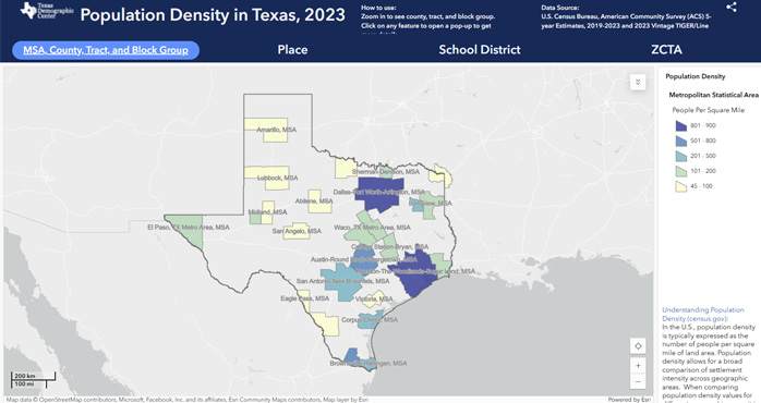
Population density maps are extremely useful for governments, non-profits, and businesses because they can see where the highest concentration of people live to design better infrastructure and provide vital services. Explore our interactive population density maps for MSA, County, Tract, Block Group, Place, School District, and ZCTA geographies in Texas to see how this great tool can help you serve your community. Data used for these maps are based on the latest American Community Survey 5-Year estimates and TIGER/Line data from the Census Bureau. |