|
IN THIS ISSUE...
- A MESSAGE FROM THE PRESIDENT
- FS/PS FREE STUDY REVIEW SESSION FOR FALL 2022
- GPSonBM DATA FOR THE TRANSFORMATION TOOL WILL NOW BE ACCEPTED THROUGH SEPTEMBER 2023
- GPS ON BENCHMARK UPDATE OCTOBER 2022
- WHERE IN CA IS THIS?
- 2nd ANNUAL CLSA SAN DIEGO MARV SYLAKOWSKI MEMORIAL GOLF TOURNAMENT RESULTS
- SURVEYORS A AND B
- SAFETY REMINDERS
- IN THE NEWS
| |
|
From time to time, I am reminded of the unique position that land surveyors occupy. One of the reasons we are exempt from trespass is that we are the profession which can define the location of boundaries on the ground and, hence, testify in a trespass case. Another area is in the preparation of site plans for development which have application to building setbacks, easement locations, and the depiction of public rights of way.
This latter field is being challenged in federal District court by an unlicensed individual who was cited by BPELSG for preparing site plans from record data. The issues are centered about constitutional rights, and the allegation that the Board’s authority is overbroad. It will be a case worthy of paying close attention and, depending upon the outcome at the trial court level, submitting an amicus curiae brief if necessary. Among the points raised is a supposed category of site plans characterized as non-authoritative. That is, those proposed improvements which fall far from property lines and which, at the discretion of the Building Official, may pass muster for its intended purpose submitted by a landowner.
The trial will focus on whatever matters are in dispute after lengthy pre-trial motions. The Board’s response to the initial filing will be forthcoming, and likely will generate a narrowing of triable facts. While I am not a member of the bar, it behooves professional land surveyors to have a solid overview of civil procedure in order to be able to discern dispassionately the important points to ponder.
Appellate decisions are those rulings on matters of law. These opinions are the basis of what trial courts are to consider when ruling on matters of fact. This particular case has potential for addressing basic concerns for a large subset of land surveying services.
Warren D. Smith, LS
President, CLSA
| |
|
2022 publications are now in stock and shipping from the CLSA Store.
2022 PE Act and PLS Act with Board Rules
2022 Complete Package with DVD
2022 Subdivision Map Act & Index
CLICK HERE
| ARTICLE & PHOTO SUBMISSIONS FOR CALIFORNIA SURVEYOR MAGAZINE | Do you have a photo from your field work that would make a great magazine cover? Do you have an idea for an article or have you written an article that you'd like us to consider including in the next issue? Please send your submissions and ideas to California Surveyor Editor, Joseph Waltz. |
NSPS - STOLEN EQUIPMENT REGISTRY
Reminder - NSPS provides a registry of stolen equipment.
| Offers a $.07 per page discount and will automatically donate $.10 per page to CLSA when members download courthouse documents through this website. These instruments include Deeds, Easements, Rights-of-Way, Releases, Liens, etc. | |
Remember to Contribute to the CLSA Education Foundation
The CLSA Education Foundation (CLSA EF) can accept direct contributions, payroll deductions such as the California State Employee “Our Promise” Charitable Campaign, and shopping donations through Smile.Amazon.com. Additionally, you can provide contributions to the CLSA EF through gifts, grants, or bequests, of property, real or personal, tangible or intangible. Please add an item to future Chapter meeting agendas for CLSA Education Foundation discussions.
| |
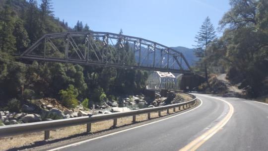
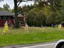
The September “Where in CA is This?” winner was Steve Martin, correctly identifying the intersection of California State Routes 41 (from the south) and 46 about 20 miles east of Paso Robles. The road continuing north from this intersection is McMillan Canyon Road. Steve wins a beverage at the next conference.
Try to identify the location of this month’s photo. Submit your answer to: Rob McMillan.
| |
Surveyors A and B were chatting about their interesting upcoming projects. Surveyor A mentioned he would soon be providing expert witness testimony in a vehicle accident lawsuit with respect to sight lines and distances. Surveyor B expressed his concern that Surveyor A was working outside his scope of licensure by providing testimony that was “Traffic Engineering” in nature. Surveyor B’s contention was that this is traffic engineering as described in Board Rule 404 (qq). Additionally, Surveyor B felt since the activities were not specified in 8726, they were not allowed as an area of practice for Professional Land Surveyors.
Surveyor A disagreed, stating that his testimony would be limited to the analysis of the site conditions based upon his topographic survey. A portion of the definition of “Traffic Engineering” includes “evaluating streets and highways and their networks” which could include analysis of sight distances and lines of sight based on the topography. Surveyor A argued that he would not be providing any analysis or measuring of the traffic flow. Any questions outside of the topographic analysis aspects would simply be answered as “not within the scope of my Professional Land Surveyor license.”
Surveyor B contacted me for my view on the matter. My perspective is that assuming Surveyor A was competent to do so, if Surveyor A was analyzing topographic data to make site line and distance determinations that would be completely within his purview. Further, I suggested to Surveyor B that 8726 does not limit the land surveyors area of practice but limits unlicensed persons from practicing within those areas listed.
What are your thoughts on the matter? Submit your answer to: Rob McMillan
| |  |
|
FS/PS FREE STUDY REVIEW SESSION FOR FALL 2022
Fridays from - 5- 7 PM (PST), VIA ZOOM (link below)
| |
Oct 7, 2022 | 5:00 PM
Oct 14, 2022 | 5:00 PM
Oct 21, 2022 | 5:00 PM
Oct 28, 2022 | 5:00 PM
Nov 4, 2022 | 5:00 PM
Nov 11, 2022 | 5:00 PM
Nov 18, 2022 | 5:00 PM
Weekly: Join Zoom Meeting
https://laccd.zoom.us/j/87616612669
Meeting ID: 876 1661 2669
Any Questions please reach out to the following:
| |
GPSonBM DATA FOR THE TRANSFORMATION TOOL WILL NOW BE ACCEPTED THROUGH SEPTEMBER 2023
New NSRS Modernization Release Timeline: Mid-2025
NGS will release the data and a limited set of tools for the Modernized NSRS by mid-2025. See the July 2022 edition of the NSRS Modernization News or the June 9th, 2022 NGS Webinar “It’s 2022, Are You Done Yet?” for more information on the revised schedule and what will, and will not, be included in that release.
Given this revised timeline, NGS will keep the doors open for submissions of GPSonBM data for the transformation tools through the end of September 2023. Data submitted before the doors are closed will be considered for use in the 2020.00 Reference Epoch Coordinate (REC) adjustments. Data that passes through the adjustment quality-control process will be used to assign REC coordinates on marks in the Modernized NSRS. Marks with valid coordinates in both NAVD 88 and NAPDG2022 will be used to create the transformation grids that will be released with the modernized system.
Once released, the transformation grids will remain static and the points used will serve as the definitional points in the NAVD88-NAPGD2022 transformation. New GPSonBM observations submitted to NGS after September 2023 will have RECs and Survey Epoch Coordinates (SECs) computed in the new frames, however they will not be added into the set of points that define the transformations.
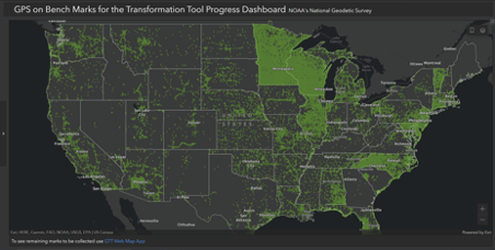
| GPS ON BENCHMARK UPDATE OCTOBER 2022 | GPS on Benchmarks dashboard showing completed 10km hexagons | |
California is now at 35% complete on the 10km priority hexagon goals and 42% complete on the 2km hexagon goals. Progress has been picking up lately with Caltrans District 1 submitting a number of observations along the North coast, Caltrans District 8 has started submitting observations, Philip Melcher of Provost & Pritchard continues to be very prolific, Orange County is going to submit some, Ventura County has submitted some and will submit some more, Sacramento County has submitted a good number of observations on benchmarks, with many more surveyors participating.
The Central Coast Chapter of CLSA has had a great volunteer program.
READ MORE
| 2nd ANNUAL CLSA SAN DIEGO MARV SYLAKOWSKI MEMORIAL GOLF TOURNAMENT RESULTS | |
The San Diego CLSA Chapter held their second annual Marv Sylakowski Memorial Golf Tournament on Friday, October 14th, At Riverwalk Golf Course. Reports from attendees indicated that it was another fun tournament. Although only about 50 players participated, many local firms made donations but could not attend due to heavy workloads.
As a Chapter scholarship fundraiser, according to Chapter leadership, the event was a great success raising around $7,000 to support land surveying education. Many thanks go out to those who organized, sponsored and participated in the event. Thanks also to Riverwalk for writing off many empty golfer slots.
- Longest Drive: womens - Jenn Marshall (Towill)
- Closest to the Pin: womens - Jenn Marshall (Towill)
- Longest Drive: mens - Derik Jans (Team Triple D)
- Closest to the Pin: mens - James Nicolau (Paradigm)
Grand prize raffle: 100lbs smoker - Dirk Nasland
- 1st - Team BHA Inc
- 2nd - Team Triple D and the OTL Macho Men
- 3rd - Team Hunsaker & Assoc
Scores for the scramble are not published here as they were not provided by the Chapter. Additionally, there was some grumbling from one of the teams that the winners must have “accidentally” lost count of strokes on their score card on several holes. The exact quote was “I don’t see how they (BHA Inc.) shot that far under par. We were cheating on our score card and only scored par!”
What activities does your Chapter hold to raise funds? Submit your answer to: Rob McMillan
| |
In other Sports News...
The San Diego Padres Beat Los Angeles Dodgers in Major League Baseball’s National League Divisional Series! The Padres advance to face the Philadelphia Phillies in the National League Championship Series.
Let’s go Padres!
| | |
|
SAFETY REMINDERS
Utah Council of Land Surveyors (UCLS) posted this photo of a skeleton crew on their Facebook page. October is the month of Halloween, but don’t wait until the end of the month to watch out for kids. Remember to consider the upcoming fall time change and shortening daylight in your crew scheduling activities.
Also, with the temperatures falling slightly, reptiles are out there seeking sources of warmth, so watch where you step and reach. Use the buddy-system when working near roadways, and ensure that each crewmember clearly understands and performs their assigned tasks.
| | |
|
Congratulations Dirk De Valk, PLS new CA SLC Boundary Determination Officer
Dirk is active in CLSA at both the state and local level. He held positions with Burrell Consulting Group, Psomas, and Wood Rogers in the last decade. Dirk has a B.S Degree in Hydrographic Surveying from Amsterdam University of Applied Sciences.
The California State Lands Commission manages 4 million acres of tide and submerged lands and the beds of natural navigable rivers, streams, lakes, bays, estuaries, inlets, and straits. The Commission also monitors sovereign land granted in trust by the California Legislature to approximately 70 local jurisdictions that generally consist of prime waterfront lands and coastal waters. The Commission protects and enhances these lands and natural resources by issuing leases for use or development, providing public access, resolving boundaries between public and private lands.
READ MORE
| |
|
Congratulations Rafi Hanna, PLS new Senior Project Surveyor at Psomas
Rafi is active in CLSA at both the state and local level, having served as a CLSA Director for the San Diego CLSA chapter. He has previously worked for WH Pacific, Walsh Engineering and Surveying and Dokken Engineering.
Rafi holds a Bachelor’s degree in Civil Engineering from the University of Mosul and an Associate’s degree in Land Surveying from Southern Alberta Institute of Technology.
| |
Paul Goebel Represented CLSA at the NSPS Fall Meeting | |
First year for California as a full member! | |
|
NCEES Provides a Speakers Kit
The NCEES Speaker’s Kit makes it easy for licensed #engineers and #surveyors to present the value of licensure to different groups. Each kit includes a Speakers Guide, a PowerPoint presentation that can be modified by discipline, a script, and videos.
LEARN MORE
| |
|
Geomatics Program Receives $100,000 Donation
Louisiana’s only four-year geomatics program, located at Nicholls State University, received a $100,000 donation from the Louisiana Society of Professional Surveyors (LSPS) to hire a new faculty member.
READ MORE
| |
|
California Man Fined $1,000 For Drawing Lines On Maps
Ryan Crownholm, an entrepreneur in Los Angeles, is fighting the state of California for giving him a fine of $1,000 for drawing maps. He was issued a citation from the California Board for Professional Engineers, Land Surveyors, and Geologists, who claimed that Crownholm and the site were illegally practicing land surveying without a license. The licensing board stated that to depict the location of property lines and fixed features requires a license.
READ MORE
| |
|
Property Lines: “Everything You Need To Know”
The Nasdaq website featured a short write up on property lines, such as: “Hiring a professional surveyor can provide the most accurate assessment although it’s the most expensive.”
READ MORE
| |
|
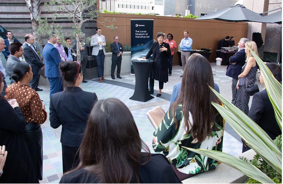
Stantec Re-opens Downtown Los Angeles Office
Stantec is proud to announce the official reopening of the downtown Los Angeles office. We recently hosted key clients for an open house celebration where we shared VR tours of the Lucas Museum of Narrative Art and heard from Sandra Jackson-Dumont, director and CEO of the Lucas Museum.
Los Angeles is a city at the center of art, culture, and commerce. A global hotbed for innovation and creativity, our municipal, institutional, and private clients in LA push the boundaries of architecture and engineering.
Stantec has been laying the groundwork for enhanced mobility in LA through planning, designing, and delivering transit centers, O&M facilities, light rail systems, express busways, bike and pedestrian pathways, and highways. We are also passionate about protecting California’s coast. Our environmental, water, ecology, biology, and remediation experts help make certain that natural resources are safeguarded for future generations.
Together, we are transforming LA into one of the most exciting metropolitan destinations in the world. Learn more about the LA office and recent projects here.
| |
Thank You CLSA Sustaining Members | | | | | |