NASA Harvest's Monthly News | | |
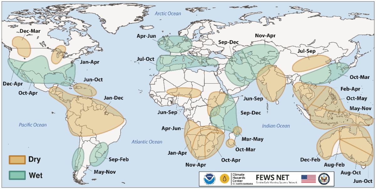
El Niño can shift rainfall and crop conditions across major farming regions. Because it can often be forecast months ahead, it also gives analysts and decision-makers time to identify where agricultural risks may develop and prepare before harvests are affected.
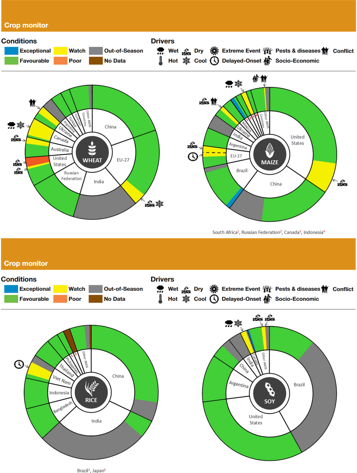
A new GEOGLAM Crop Monitor special report examines how the developing 2026–27 El Niño could affect major crops and growing regions. The report finds that the largest risks are likely to be regional rather than global, with Southern Africa being a major area of concern as its maize season will overlap with the expected El Niño peak. Central America, India, and Australia may also face negative yield impacts, while rice is the crop most likely to decline at the global level.
NASA Harvest’s Weston Anderson and Brian Barker also spoke with Foreign Policy and the BBC about the developing El Niño and what it could mean for agriculture and food production.
Read the full report and related coverage below:
GEOGLAM Crop Monitor: El Niño 2026-2027: Anticipated Climate and Agricultural Yield Impacts
Foreign Policy: Farmers Worldwide Brace for El Niño
BBC: The risk of a ‘super’ El Niño is rising. Here’s what it means for North America
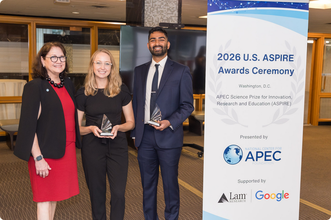
| | | | NASA Harvest’s Artificial Intelligence and Machine Learning Lead, Hannah Kerner, has received the 2026 U.S. APEC (Asia-Pacific Economic Cooperation) Science Prize for Innovation, Research and Education. The award recognizes her work using AI and satellite data to strengthen agricultural monitoring, food security, and resilience. Kerner will now represent the United States in the APEC-wide competition. | | | | NASA Harvest’s Markets, Trade, and Supply Chains Co-Lead Brian Barker joined an IFPRI-AMIS webinar on the forces shaping global food commodity markets. He reviewed current crop conditions and explained how the developing El Niño could affect production, trade, and food markets in different regions. | | |
Virginia Tech is hiring a Research Associate or Research Scientist to join an interdisciplinary team led by NASA Harvest partner Elinor Benami. The team works across agricultural economics, remote sensing, insurance, finance, and conservation, including research on how Earth observation data can inform agricultural index insurance, premium ratings, and the value of conservation practices.
The position will support geospatial and administrative data analysis, statistical and causal inference, data visualization, manuscript preparation, and communication with academic, policy, and industry partners. The selected candidate may also contribute to grant development and ongoing research collaborations with organizations including USDA, the Gates Foundation, and Microsoft AI for Good.
The role may be filled at the Research Associate or Research Scientist level, depending on experience. Candidates should have a relevant quantitative degree, strong data analysis skills in R or Python, and experience evaluating agricultural, economic, or policy questions. The position is based in Blacksburg, Virginia, with some remote work possible by agreement. Priority application deadline: July 30, 2026.
Learn more and apply here!
| | Abstract Submissions are Open for AGU! | | |
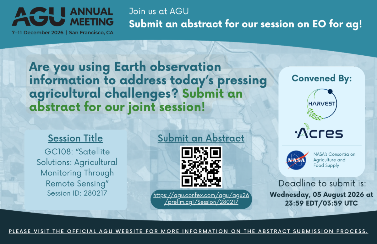
NASA Harvest and our sister consortium, NASA Acres, are co-convening a session at American Geophysical Union 2026 on how satellites and other Earth observation tools are being used to monitor agriculture and food supplies.
The session, Satellite Solutions: Agricultural Monitoring Through Remote Sensing, will bring together work on crop conditions, early warning, field data, higher-resolution sensors, faster data delivery, cloud computing, AI, and other approaches shaping agricultural monitoring in the United States and around the world.
We welcome submissions from researchers, practitioners, and others working across agriculture, food security, and remote sensing.
Learn more and submit an abstract here!
| |
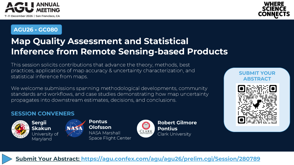
NASA Harvest's Agricultural Statistics Lead Sergii Skakun is co-convening a session at American Geophysical Union 2026 on how researchers assess the accuracy, uncertainty, and statistical reliability of maps created from remote sensing data.
The session, Map Quality Assessment and Statistical Inference from Remote Sensing-based Products, will feature new methods, standards, and case studies addressing map errors, reference data uncertainty, small-area estimation, change detection, and how uncertainty affects downstream estimates and decisions.
Researchers and practitioners working in remote sensing, mapping, statistics, and Earth science are invited to submit abstracts. Learn more here!
| | |
NASA ARSET is offering a free three-part training on the newly launched NISAR mission, which uses radar to observe Earth's surface day and night and through most weather conditions. Participants will learn how to access, visualize, and analyze NISAR data, with examples covering flooding, earthquakes, landslides, and other Earth science applications.
Sessions will be held July 2, 9, and 16 in both English and Spanish.
Learn more and register here.
| | | |
NASA ARSET is offering a free, online training on using NASA Earth observations for reservoir and water utility management. Participants will work with data on precipitation, snow cover, soil moisture, runoff, streamflow, and water levels to monitor reservoir inflows, support water-release decisions, and manage flood risks.
Sessions will be held August 4, 6, and 11, with two time options available each day.
Learn more and register here.
| | | | | |