Wisconsin Coastal Resilience Newsletter | | |
Greetings from the Wisconsin Coastal Resilience Team!
This month's newsletter contains:
Member-to-Member Updates:
- Introducing the Wisconsin Great Lakes Coastal Leadership Academy!
- J. Philip Keillor Wisconsin Coastal Management-Sea Grant Fellowship
Lake Michigan Water Level Update
Resource Highlights:
- Rebuilding Safer: A Guide to State and Local Adaptation
Around the Great Lakes:
- Milwaukee County Parks Bluff Assessment Tool
Funding Opportunities:
- Great Lakes Fish and Wildlife Restoration Act Grant Program
- Flood Mitigation Assistance (FMA) Grant Program
- GLOS Year-Round and Winter Observing RFP
- Cooperating Technical Partners Program
- C. D. Besadny Conservation Fund
- Brennan Ocean Mapping Fund FY28
Trainings & Webinars:
- Coastal Inundation Peer-to-Peer Discussion Series
- National Floodplain Restoration Inventory-Natural Floodplains Alliance Webinar
- Sustaining and Restoring Our Wetlands
- Social Science Basics for Coastal Managers: Oral History for Coastal Managers
Conferences & Events:
- Lake Michigan Day
- Healing Our Waters–Great Lakes Coalition Great Lakes Conference
- Great Lake Commission Annual Meeting
| | Introducing the Wisconsin Great Lakes Coastal Leadership Academy! | | |
Local, county, and Tribal government staff, want to attend the Wisconsin Great Lakes Coastal Leadership Academy? Let us know!
The Wisconsin Coastal Leadership Academy is an in-person coastal resilience workshop for local, county, and Tribal government staff hosted by the Wisconsin Coastal Management Program and Wisconsin Sea Grant. Two workshops will be held for the Lake Michigan region in Milwaukee on October 20th and in Two Rivers on October 22nd from 9:00 AM to 4:00 PM. This opportunity will provide practical training and resources to promote understanding of Great Lakes coastal hazards and implementation of adaptation strategies suitable to local conditions. Participants will bring their own coastal hazard challenges to the Academy and can expect to leave with tangible steps towards building resilience.
Interested in attending? Please fill out the form below. It should only take five minutes to complete. Registration will be limited, so preference will be given to communities who can participate as groups of three or more with multiple departments represented.
For more information, contact Cailin Young at cailin.young@wisconsin.gov, or visit the Wisconsin Coastal Resilience website.
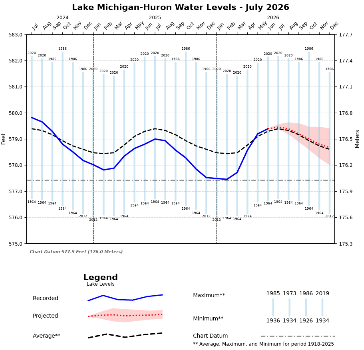
| | J. Philip Keillor Wisconsin Coastal Management-Sea Grant Fellowship | The Wisconsin Sea Grant College Program and the Wisconsin Coastal Management Program seek postdoctoral and post-master’s candidates interested in tackling science and policy challenges related to increasing coastal community resilience across the Great Lakes region. Together, these programs will fund a state fellowship position, named in honor of a longtime Sea Grant coastal engineering expert Phil Keillor, to celebrate his legacy in building resilience in Wisconsin communities. The Fellow will work closely with Wisconsin Coastal Management Program’s Coastal Hazards Work Group, Sea Grant’s coastal engineer, local government representatives, and researchers from a variety of fields to tackle the important challenge of connecting science related to coastal processes–including flooding, erosion, and storms–with communities that could benefit from the information. Applications are due August 30, 2026. | | July 2026 Water Level Update | | Lake Michigan water levels peaked in July and decreased 1 inch by the end of the month. Lake Michigan is now 1 inch above the long-term average water level for July. Water levels are forecast continue their seasonal decline and decrease another 2 inches in August. | | Rebuilding Safer: A Guide to State and Local Adaptation | | |
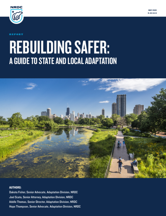
Traditional disaster management systems, often designed to restore communities to a pre-disaster status quo, fail to address certain vulnerabilities or to build long-term resilience. The result is a cycle of repeated loss, widening inequities, and growing financial strain on households, businesses, and governments. State and local governments can break that cycle of repeated loss. Drawing on lessons from across the country, this guide highlights practical opportunities for strengthening disaster resilience through policy, governance, and investment. The strategies outlined here are designed to help states and local governments reduce future losses, protect public health and safety, and ensure that recovery efforts produce stronger, more equitable outcomes.
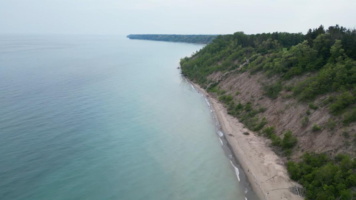
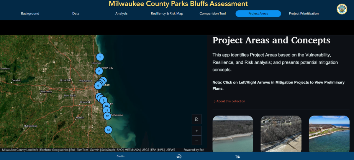
| | Milwaukee County Parks Bluffs Assessment Tool | | Coastal erosion along Lake Michigan bluffs threatens safety, habitats, recreation, public access, and infrastructure. This website serves as a collaborative tool for Milwaukee County and its consultants to assess erosion risks along Lake Michigan bluffs, prioritize mitigation strategies, and develop solutions to protect parkland. Through interactive visualization of conditions and risk quantification, the platform supports informed decision-making for the 13 waterfront parks. | | Great Lakes Fish and Wildlife Restoration Act Grant Program | |
The U.S. Fish and Wildlife Service is currently accepting grant proposals for projects to protect, restore and enhance fish and wildlife habitat within the Great Lakes basin. This year’s total grant funding under the Great Lakes Fish and Wildlife Restoration Act is projected to be $3.5 million. Final funding decisions will be made in December 2026. See the Notice of Funding Opportunity F26AS00062 at Grants.gov for additional details.
Eligible Applicants: Tribes, states, municipalities, watershed associations, non-profits, institutions of higher education, and other eligible organizations
Application Deadline: August 3, 2026
| | Flood Mitigation Assistance (FMA) Grant Program | | |
The Flood Mitigation Assistance grant program is a competitive program that provides funding to state, territory and local governments and federally recognized Tribal Nations. Since the National Flood Insurance Reform Act of 1994 was signed into law, funds are used for projects that reduce or eliminate the risk of repetitive flood damage to buildings insured by the National Flood Insurance Program.
Eligible Applicants: States, U.S. territories, and federal recognized Tribal Nations can submit applications on behalf of subapplicants; eligible subapplicants include local governments, including cities, townships, counties, special district governments, state agencies, and federally recognized tribal governments
Application Deadline: August 6, 2026
| |
GLOS Year-Round and Winter Observing Request for Proposals | |
The existing Great Lakes observing network collects limited over-winter data because many observing platforms are seasonally operated. As a result, critical information is lacking during late fall, winter, and early spring, reducing our ability to support commercial shipping and fisheries, understand ice processes and seasonal ecosystem dynamics, evaluate climate-driven changes, and develop and validate forecasting tools. To address these challenges, the Great Lakes Observing System (GLOS) is soliciting proposals to support the development, deployment, and operation of technologies and observing approaches that improve year-round monitoring of the ecological health of the Great Lakes. GLOS expects to fund 3 projects, up to two years in duration. Proposals should not exceed $250,000.
Eligible Applicants: Governmental agencies, non-profit organizations, academic institutions, and for-profit organizations based in the United States
Application Deadline: August 10, 2026
| Cooperating Technical Partners Program | |
The Cooperating Technical Partners Program is part of FEMA’s ongoing efforts to strengthen the nation’s flood resilience by building capability and capacity at the state and local level. FEMA is leveraging the expertise and capabilities of state, local, tribal and territorial governments and community organizations to deliver high-quality flood maps. This funding opportunity is focused on completing existing flood hazard and mapping projects across the country, to reduce flood risk and enhance flood-resilient communities. No new projects can be started at this time.
Eligible Applicants: Communities, state or regional agencies, universities, territories, tribes and nonprofits
Application Deadline: August 17, 2026
| C.D. Besadny Conservation Fund | |
The C.D. Besadny Conservation Fund was established to invest in conservation and education projects that benefit Wisconsin’s lands, waters, and wildlife, and that connect people to Wisconsin’s outdoors. Grants up to $5,000 are available. Grantmaking priorities include projects that engage communities in Wisconsin who have been historically excluded from Wisconsin’s conservation efforts and projects that build climate resiliency of Wisconsin’s lands, waters, and wildlife through natural climate solutions or climate adaptation, especially those aligned with the Wisconsin Initiative on Climate Change Impacts (WICCI). Eligible applicants include nonprofits, government units, American Indian nations or tribal communities, and universities.
Eligible Applicants: Nonprofits, government units, American Indian nations or tribal communities, and universities
Application Deadline: September 1, 2026
| | Brennan Ocean Mapping Fund FY28 | | |
NOAA’s Office of Coast Survey and National Geodetic Survey announces the FY2028 Rear Admiral Richard T. Brennan Ocean Mapping Fund program. This program invites non-Federal entities to partner on jointly funded ocean and coastal mapping projects of interest. Proposers benefit from this opportunity by leveraging NOAA's contracting expertise, including its pool of pre-qualified technical experts in surveying and mapping, as well as data management to ensure that the mapping data are fit for purpose and are usable for a broad set of purposes. NOAA will match selected non-Federal partners at a 70:30 NOAA: partner ratio for contract mapping projects totaling up to $1,000,000 for ocean, coastal and/or Great Lakes mapping data (subject to appropriations). Register for the informational webinar on August 13.
Eligible Applicants: State and local governments, Tribal entities, universities, researchers and academia, the private sector, non-governmental organizations (NGOs), and philanthropic partners
Application Deadline: October 16, 2026
| | Coastal Inundation Peer-to-Peer Discussion Series | | |
Translating Inundation Science and Communicating Flood Risk
August 12, 1pm-2pm, Virtual
Exchange proven strategies for communicating flood risk, delivering technical assistance, and translating complex inundation science concepts for non-technical audiences, communities, and local decision-makers.
Managed Retreat and Community-driven Relocation
August 20, 1pm-2pm, Virtual
Discuss the unique challenges of communicating about and planning for retreat, while sharing successful strategies for community-led relocation.
Applying National Coastal Inundation Tools to Local Decisions
Sept 3, 2pm-3pm, Virtual
Troubleshoot the challenges of scaling down national-level data products for localized decision-making.
Compound Flood Risk: Modeling, Communication, Planning
Sept 15, 2pm-3pm, Virtual
This session focuses on a highly-requested issue for the Coastal Inundation CoP. Share peer-to-peer solutions for compound flood modeling and total water assessments.
| | National Floodplain Restoration Inventory Webinar | |
August 25
2pm
Virtual
Join the Natural Floodplains Alliance to learn about the National Floodplain Restoration Inventory, a compilation of state-and national-scale databases documenting past floodplain restoration activities created in partnership by Conservation Science Partners and American Rivers. This updatable inventory is the first of its kind and aims to centralize information on floodplain restoration projects across the United States so that practitioners and policy experts can better inform improved project evaluation, planning, and policy development. This webinar will showcase the new inventory and allow attendees an opportunity to provide feedback on this evolving dataset.
| Sustaining and Restoring Our Wetlands | |
August 27 & 28
9am-4pm
Ellison Bay, WI
This workshop, led by University of Minnesota professor Chris Lenhart, will introduce students to wetland restoration and management issues and techniques with a focus on Door County peatlands: fens, bogs and cedar swamps. On day one, you'll learn about the ecology, history and cultural connections of the local ecosystems and actions that individuals can take to get involved with or support wetland conservation and restoration. Day two will take you out into the field.
| | Social Science Basics for Coastal Managers: Oral History for Coastal Managers | | |
September 3
5pm-7pm
Virtual
Oral histories are a tool for learning detailed information about people, places, and events. This course provides participants with the knowledge to co-create oral history interviews they can use in multiple settings to understand the human dimensions of coastal work, complement economic approaches, and inform research and management needs.
| | |
August 14
Manitowoc, WI
Lake Michigan Day highlights the significant opportunities for continued restoration and protection of Lake Michigan and the broader Great Lakes Basin, while also addressing ongoing challenges. With an excellent lineup of panelists, speakers, and lightning talks, every August Lake Michigan Day provides a forum for practitioners, decision-makers, and community leaders to learn about ongoing collaborative, community-focused water and land conservation work.
| Healing Our Waters-Great Lakes Coalition Great Lakes Conference | |
September 24-25
Detroit, MI
The Great Lakes Conference brings advocates, professionals, and community members from around the region to a Great Lakes city to learn, share, and network around Great Lakes issues - including restoration needs and successes, water infrastructure, Great Lakes policy, environmental justice, emerging issues, and more! The conference also features field trips that take participants throughout Detroit to share our host city’s vibrant history and see firsthand the exciting water work happening throughout.
| | Great Lakes Commission Annual Meeting | |
October 6-8
Toronto, ON
Our meetings offer an opportunity for Great Lakes stakeholders to convene with colleagues and share perspectives on important Great Lakes issues. Join us as we continue to address issues of common concern, develop shared solutions and collectively advance an agenda to protect and enhance the region’s economic prosperity and environmental health.
| | |
For questions about the CALM Network, or to submit something to the newsletter, contact:
Jake Kolanowski
jacob.kolanowski1@wisconsin.gov
608-261-9197
| | |
For questions about Lake Michigan coastal hazards or how to address them, contact:
Adam Bechle
bechle@aqua.wisc.edu
608-263-5133
| | University of Wisconsin Sea Grant Institute | (608) 262-0905 | 1975 Willow Drive, 2nd Floor, Madison, WI 53706 | | | | |