|
The American Society of
Le Souvenir Français Inc.
Monthly Bulletin - Vol. V, No 8
August 2025
| | |
Tribute to Samuel de Champlain
| | |
Cover illustration:
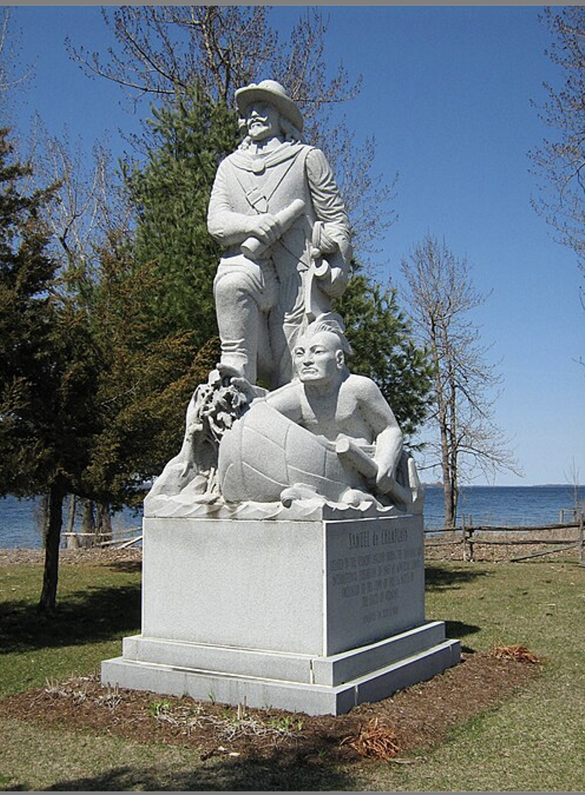
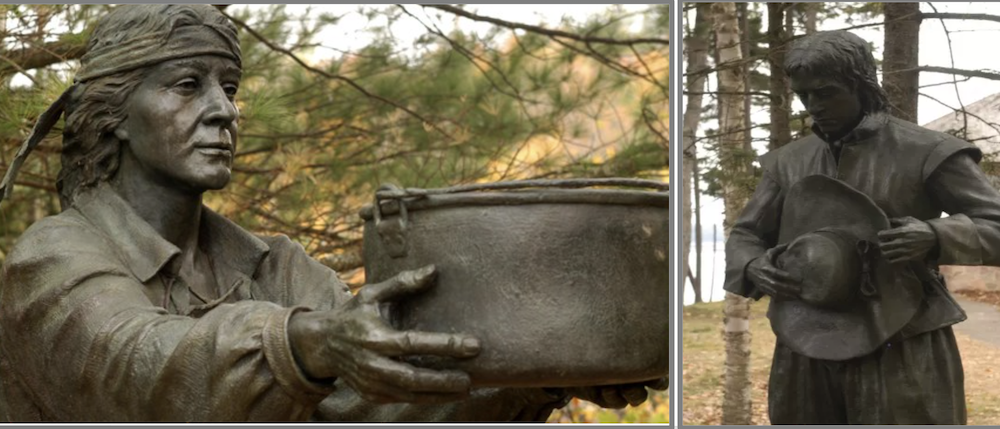
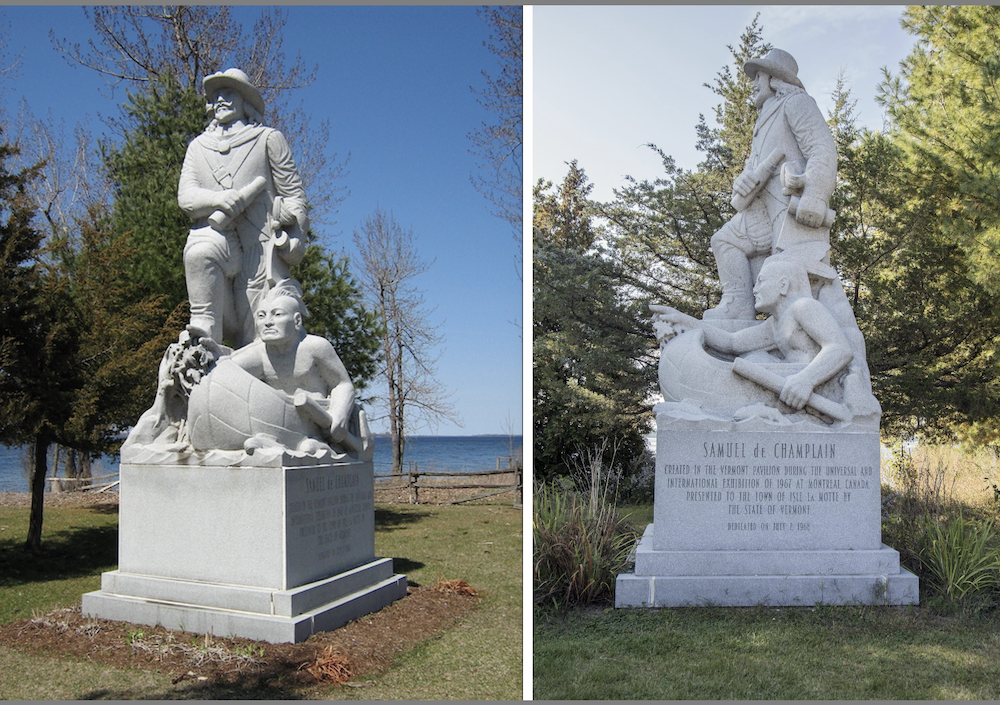
Samuel de Champlain and Native American guide in Isle La Motte, Vermont, at the site Champlain is said to have first set foot (and encamped) in 1609. Lake Champlain is in the background. (Sculptor E.L.Weber, 1967; Photo by Matt Wills, 2009), By Mfwills - Own work, Public Domain, https://commons.wikimedia.org/w/index.php?curid=6624139
| | |
Editorial
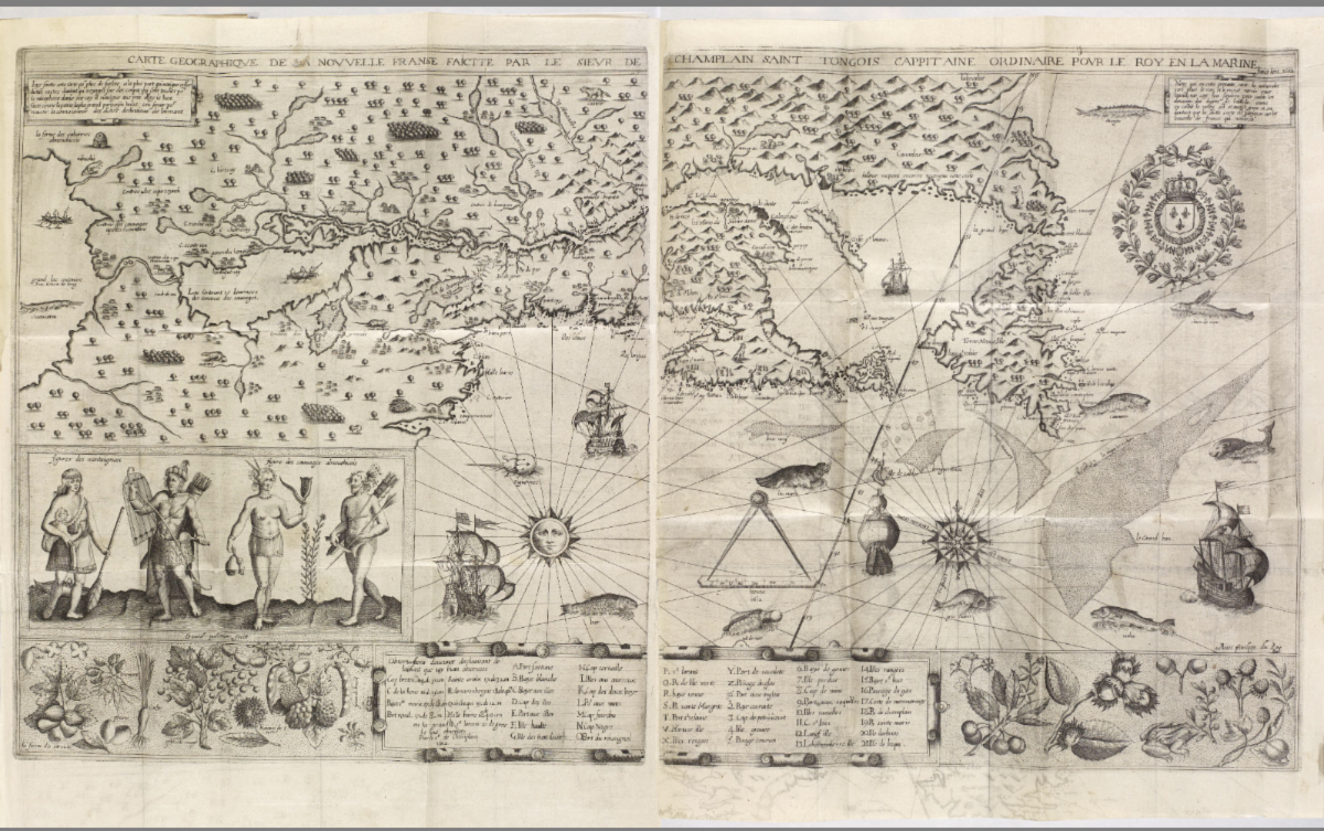
Famed founder of Québec and Founder of New France, Samuel de Champlain was a extraordinary cartographer, explorer, and administrator. He sailed across the Atlantic no less than twenty-one times in the 1600's, and his detailed maps served as a guide to navigators for decades.
In Canada, he is indeed a fatherly figure still very much present. In the United States, he is remembered and honored with multiple statues and markers throughout Maine, Massachusetts, Vermont, and New York.
This month of August, we invite you to travel back in time with him this side of the border, discover some of the most beautiful sites in the nation, and meet some of his other brave companions who deserve more recognition.
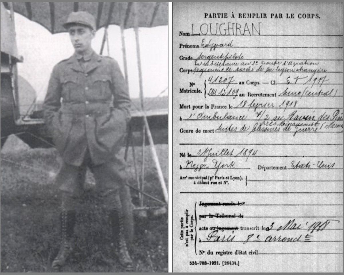
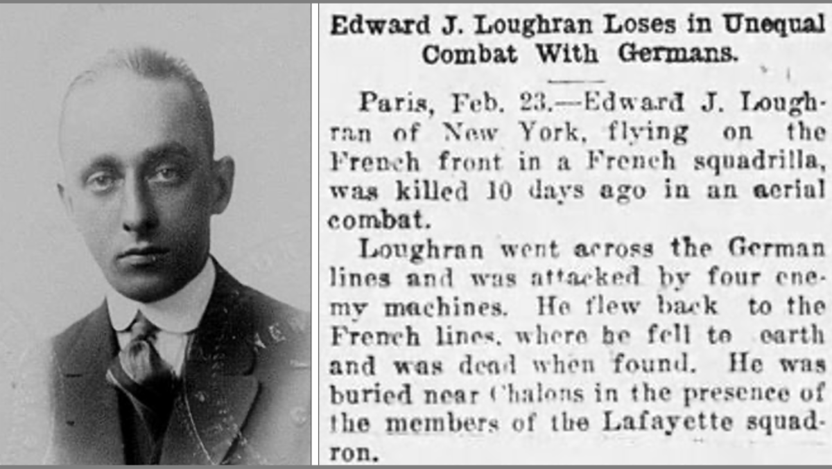
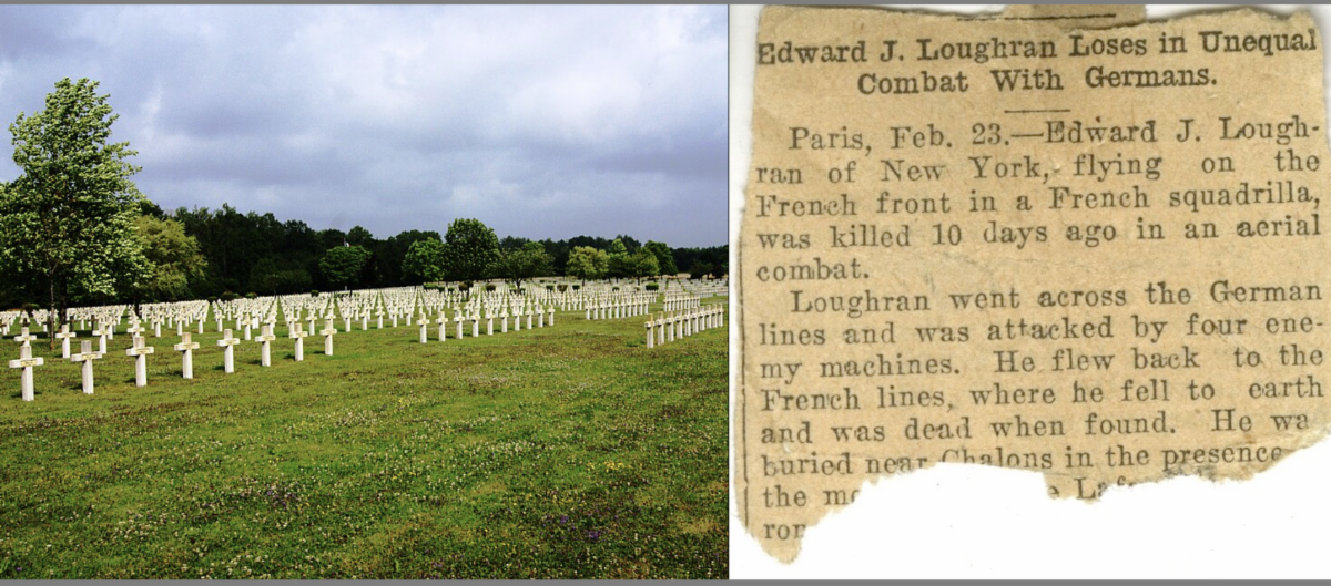
As always, Part Two of our Bulletin will honor this month another brave American volunteer who "Died for France " in World War One: Sergent Edward J. Loughran, of New York, who was killed in combat on February 18, 1918, southeast of Minaucourt-le-Mesnil-lès-Hurlus, a commune in the Marne, département in Northeast France.
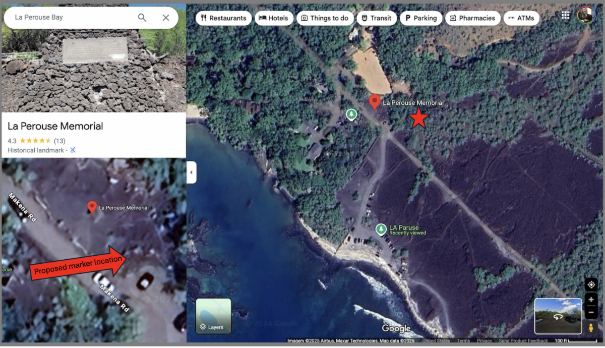
Part Three, "News and Save the Dates" will cover events since our last Bulletin, including several commemorations for the ongoing Bicentennial of Lafayette’s Farewell Tour. We are almost nearing the end of the Bicentennial, and will relay the latest announcements from the American Friends of Lafayette. We will also share the latest news from other memorial, civic and patriotic associations, as well as our own updates on several important projects your Society has been actively pursuing.
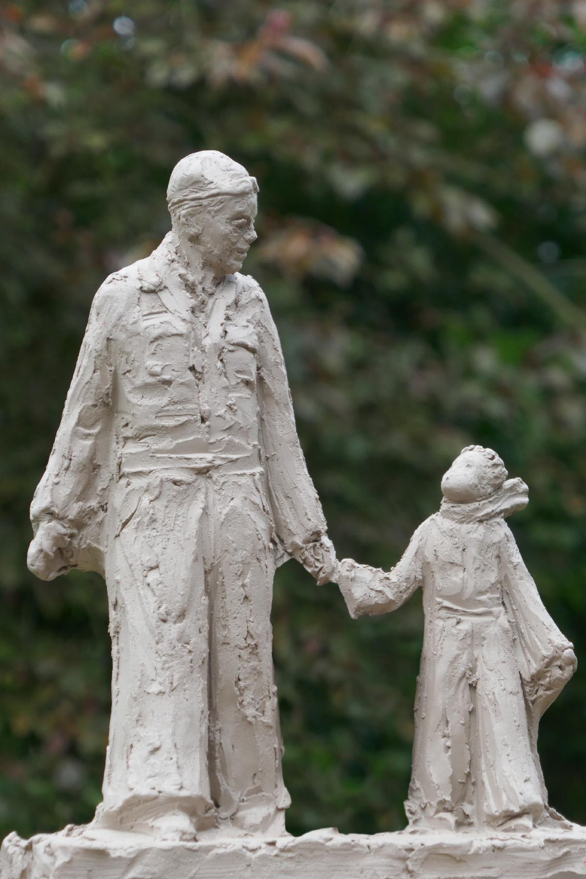
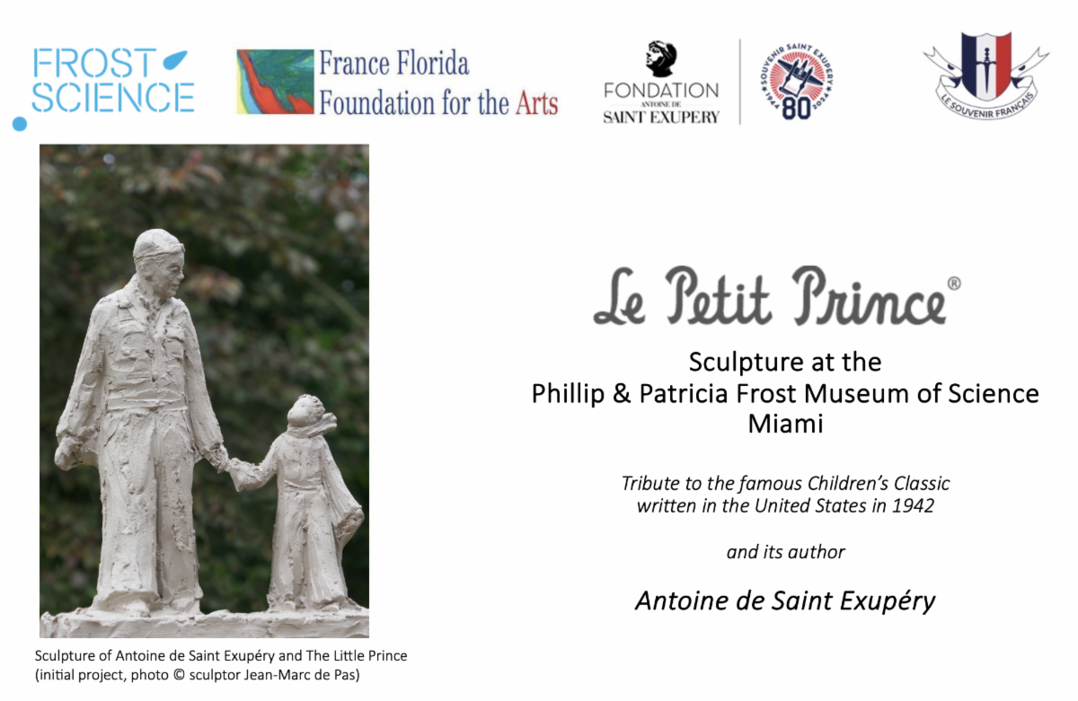
One of our most cherished project is the installation of the bronze sculpture of Antoine de Saint Exupéry and Le Petit Prince in the heart of downtown Miami. In this month of August, when the nightly spectacle of the sky is replete with shooting stars, we cannot help to think of the famous aviator and this quote: “All men have stars, but they are not the same things for different people. For some, who are travelers, the stars are guides. For others they are no more than little lights in the sky. For others, who are scholars, they are problems... But all these stars are silent. You -You alone will have stars as no one else has them... In one of the stars I shall be living. In one of them I shall be laughing. And so it will be as if all the stars will be laughing when you look at the sky at night..."
Happy vacation reading!
On behalf of the Board of Directors,
Thierry Chaunu
President, The American Society of Le Souvenir Français, Inc.
| | |
PART ONE
Samuel de Champlain
Founder of New France
| | |
Above:
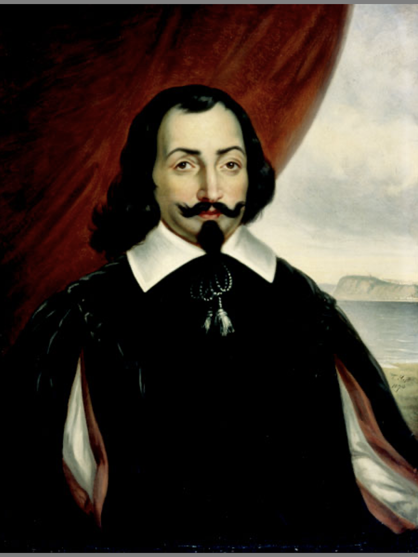
Samuel de Champlain, by Théophile Hamel (1870) - Collection of the Governor General of Canada, La Citadelle, Québec, Public Domain, https://commons.wikimedia.org/w/index.php?curid=525161 . This portrait was done after the one by Ducornet, based itself on a portrait of Michel Particelli d'Émery by Balthasar Moncornet. No authentic portrait of Champlain is known to exist.
| | |
Samuel de Champlain
His accomplishments
Samuel de Champlain* (born near La Rochelle, probably in 1574, as he was baptized 13 August 1574 – died 25 December 1635 in La Ville de Québec) was a French colonist, navigator, cartographer, draftsman, soldier, explorer, geographer, ethnologist, diplomat, and chronicler. A lot of titles for one man!...who made between 21 and 29 trips across the Atlantic Ocean (the number varies according to historians) and founded Québec, and New France, on 3 July 1608.
• Allied with northern Indian tribes, he defeated the Iroquois on Lake Champlain. That and a similar victory in 1610 enhanced the prestige of the French among the allied tribes, and fur trade between France and the Indians increased.
• In 1620 the king reaffirmed Champlain’s authority over Quebec but forbade his personal exploration, directing him instead to employ his talents in administrative tasks. He died of a stroke in Québec in 1635 and the exact place of burial is not known with certainty.
• Champlain is memorialized as the "Father of New France", "Father of Acadia", with many places, streets, and structures in northeastern North America bearing his name, most notably Lake Champlain.
• Exploration and Mapping:
Champlain was born into a family of sailors and started exploring North America in 1603 with the help of François Gravé Du Pont. Champlain undertook 21 to 29 voyages across the Atlantic Ocean throughout his career, establishing Quebec on July 3, 1608.
This is a remarkable number of transatlantic voyages, especially considering the dangers and difficulties of oceanic travel in the early 17th century.
As a skilled cartographer, he produced the first precise maps of North America's eastern coast from Nova Scotia to Cape Cod and the Great Lakes area, merging firsthand observations with data from Indigenous peoples. He created detailed charts of the St. Lawrence River, the Great Lakes region, and much of what is now eastern Canada and the northeastern United States. His maps were remarkably accurate and served as essential navigation tools for decades. His thorough maps and written descriptions gave Europeans their initial detailed insight into the geography and inhabitants of northeastern North America.
• Champlain was the first European to explore Lake Champlain (which bears his name) and reached as far west as Georgian Bay and Lake Huron, significantly expanding European knowledge of North American geography.
• Founder of Quebec City :
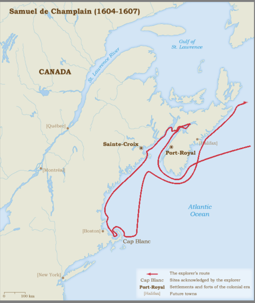
From 1604 to 1607, he helped set up Port Royal in Acadia, which was the first lasting European settlement north of Florida.
In 1608, Champlain established Quebec City on the St. Lawrence River, creating the first permanent French settlement in Canada. This strategic location became the foundation of New France and served as a crucial trading post and administrative center.
• Indigenous Relations and Alliances:
Champlain built important alliances with the local Innu (Montagnais), Algonquin, and Wendat (Huron) peoples, which were vital for the survival and development of New France. He learned their languages, participated in their diplomatic councils, and formed military alliances.
He took part in their battles against the Iroquois confederacy and lived for long stretches within Indigenous communities, where he made thorough ethnographic notes that became the foundation of his published writings.
• Promoting French Colonization:
As Lieutenant General of New France, Champlain worked tirelessly to attract French settlers and establish a viable colony. He promoted agriculture, trade, and the development of infrastructure while governing the growing settlement.
He is recognized as the "Father of New France."
• His detailed writings and maps provided Europeans with their most comprehensive understanding of northeastern North America, and his colonial efforts laid the groundwork for French influence in the region that would last for over 150 years.
Note *: Before the end of December 1610, neither anyone nor even Samuel Champlain associates the particle "de" with this family name — as seen in the titles of his works. It is in his marriage contract that this particle first appears. He and his family did not own a fief and did not derive income from fiefs. However, "this particle is accepted for notable individuals," especially "if they are admitted to the king's court," which is true for Champlain.
| | |
Historical Context
Early French explorations of
North America
1524 - 1604
| | |
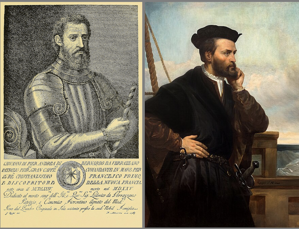
• Giovanni da Verrazano, (who signed his name Jean de Verrazane), sailing for France, was the first to systematically explore the North American Atlantic coast in 1524. He was sent by King Francis I to find a route to Asia and traveled along the coast from what is now North Carolina to Newfoundland. Verrazano examined many harbors and bays, including what would later be known as New York Harbor, which he described thoroughly. He interacted with various Indigenous groups along the coast and provided the first detailed European accounts of the North American shoreline, although he did not discover the desired passage to the Pacific.
• A decade later, Jacques Cartier made three voyages between 1534 and 1542, concentrating on the northern areas that Verrazano had only briefly visited. Cartier's first journey in 1534 took him through the Strait of Belle Isle and around the Gaspé Peninsula, where he claimed the land for France and met the St. Lawrence Iroquoians. His most notable accomplishment occurred during his second voyage in 1535, when he navigated up the St. Lawrence River to present-day Montreal. Cartier thoroughly explored and mapped the river system, visiting the Iroquoian communities of Stadacona (Quebec City) and Hochelaga (Montreal).
The voyages of both explorers established France's early claims to North American land and provided essential geographical insights that would influence future French colonial activities. Their detailed observations of the coastline, river systems, and Indigenous peoples laid the foundation for France's later establishment of New France. Cartier's exploration of the St. Lawrence River system was especially important, as it became the main route for French expansion into the North American interior and the basis for French colonial settlements in what would later be Quebec and the Great Lakes region.
Initially, the French crown gave exclusive trading rights and colonization privileges to different individuals and companies, but these efforts were not successful. Early colonization attempts, like those by Sieur de Roberval, failed because of poor planning and lack of resources. During this time, the French government was more concerned with conflicts in Europe and religious wars than with far-off American lands.
By the late 16th century, the French presence in Canada was mostly limited to seasonal fishing and fur trading, rather than any formal governance. The few French who stayed year-round were mainly traders who mingled with Indigenous communities instead of setting up European-style administrative systems.
• It was only after Samuel de Champlain established Quebec in 1608 and the Company of One Hundred Associates was formed in 1627 that France started to create a more organized colonial governance in what would later be known as New France.
| | |
Samuel de Champlain
Early years
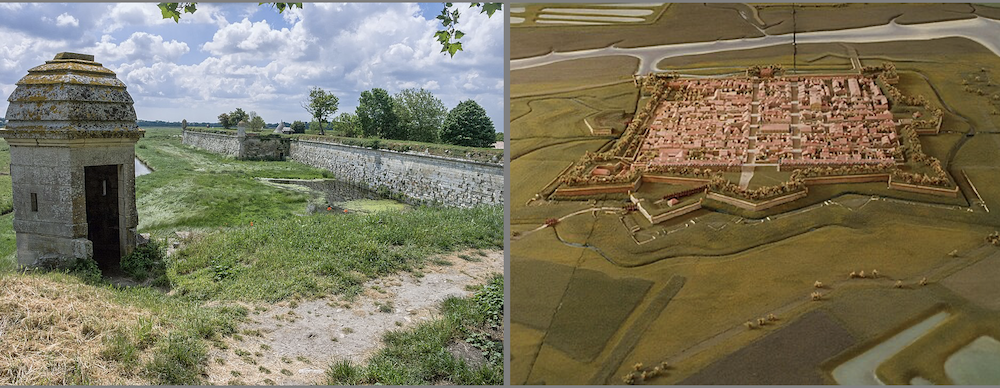
Brouage, Charente-Maritime
near La Rochelle
| | |
Above:
Top Left: Left: Citadel of Brouage, in today Charente-Maritime, (once part of the Province of Saintonge), which was a harbor in the 16th Century. By Jean-Christophe BENOIST - Own work, CC BY 2.5, https://commons.wikimedia.org/w/index.php?curid=2098407
Top Right: Citadel of Brouage - reproduction of a 17th-century scale model By Myrabella - Own work, CC BY-SA 3.0, https://commons.wikimedia.org/w/index.php?curid=6645636
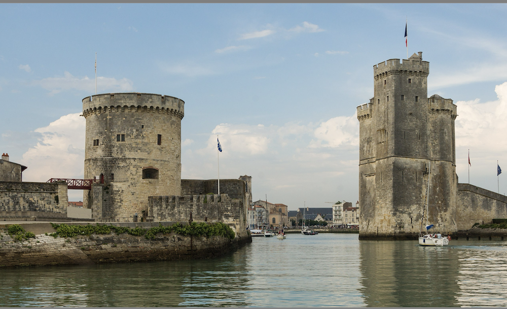
Bottom: The Tour de la chaîne and Tour Saint Nicolas, built in the 14th Century, protect the entrance to La Rochelle harbor. By Jebulon - Own work, CC0, https://commons.wikimedia.org/w/index.php?curid=46279660
| | |
• The exact date and place of Samuel de Champlain's birth are still debated by scholars. He was the child of Antoine Champlain (sometimes noted as "Anthoine Chappelain" in various records) and Marguerite Le Roy, and he was probably born in the French region of Aunis, either in Hiers-Brouage or the coastal city of La Rochelle.
• Champlain came from a Roman Catholic family, but his Old Testament first name hints at possible Protestant roots, which matches a baptismal record from 1574 found in a Protestant church. The family seems to have owned land in both Brouage and nearby La Rochelle, which explains the historical uncertainty regarding his birthplace.
• Brouage was a fortified port town that played a key role in the salt trade and often changed control between Catholic and Protestant groups during the French Wars of Religion. From 1627 until his death in 1635, Cardinal Richelieu was the governor of this royal fortress. At the time of Champlain's birth, his parents lived in Brouage, where they had significant property that Samuel would eventually inherit.
At the service of King Henry IV
| | |
Above:
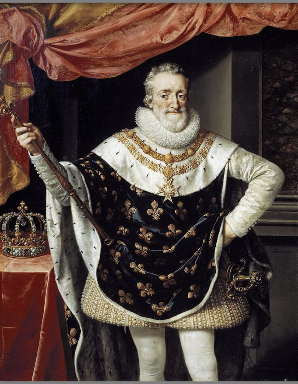
Top: French King Henry IV (1589-1610), founder of the Bourbon dynasty, in his coronation robes, by Frans Pourbus the Younger, Public Domain,
https://commons.wikimedia.org/w/index.php?curid=115558243
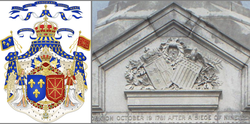
Bottom Left: Grand Royal Coat of Arms of Henry and the House of Bourbon (1589–1789), By Sodacan, CC BY-SA 3.0,
https://commons.wikimedia.org/w/index.php?curid=8072931
Bottom Right: you can see the same French royal coat-of-arms next to the shield of the United States of America on the Monument to the Alliance and Victory column at Yorktown, Virginia (1881) .
Photo by Cbaile19 - Own work, CC0,
https://commons.wikimedia.org/w/index.php?curid=96803816
| | |
• Born into a family of sailors*—his father and uncle-in-law were both navigators—Champlain received hands-on maritime training from a young age. He learned navigation, map-making, drafting, and how to write practical reports. Unlike many educated individuals of his time, he did not study Ancient Greek or Latin, which shows that his education was more practical, focusing on seamanship and trade.
He himself says that he has loved the art of navigation and the ocean since a young age.
• Since French ships had to defend themselves, Champlain also learned military skills with firearms. He gained combat experience while serving in King Henry IV's army during the last phases of the French Wars of Religion in Brittany from 1594 or 1595 to 1598 that devastated the kingdom of France in the latter half of the 16th century, where Catholics and Protestants, also known as Huguenots, were in conflict. Henry IV fought against the Catholics of the League, but in 1593, he renounced his Protestant faith and was crowned king in February 1594.
Starting as a quartermaster in charge of supplies and horse care, he rose to the rank of "capitaine d'une compagnie" by 1597, leading a garrison near Quimper.
• In April 1598, Henry IV signed the Edict of Nantes, granting Protestants the freedom of conscience. Samuel Champlain served in this army for three years, until the Peace of Vervins (May 2, 1598).
• During his military service, Champlain claimed to have undertaken a "certain secret voyage" for the king and likely took part in combat, possibly during the Siege of Fort Crozon in late 1594. This military experience would later be beneficial in his colonial efforts, equipping him with leadership abilities and knowledge of defensive strategies crucial for establishing settlements in disputed areas.
Note*: Some believe that Champlain was the illegitimate son of the king, based on Champlain's cryptic assertion: “His Majesty, to whom I was bound as much by birth as by the pension with which he honoured me.” - Les Voyage faits au Grand Fleuve Sainct Laurens par le sieur de Champlain Capitaine ordinaire pour le Roy en la marine, depuis l'année 1608 iusques en 1612". Paris: 1613.
Early travels in Latin America:
| | |
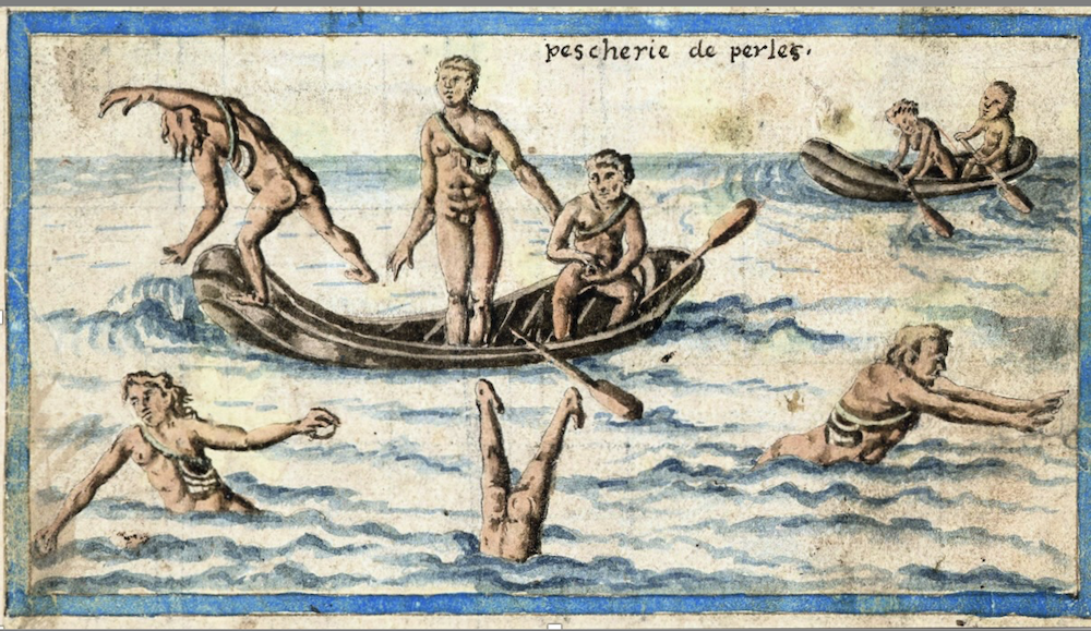
• After the peace of Vervins was signed between France and Spain on May 2, 1598, Champlain accompanied his uncle, Guillaume Allène, who was tasked with bringing back the Spanish troops stationed at Blavet. They arrived in Cadiz aboard the Saint-Julien on September 14, 1598, and their ship was quickly requisitioned by the Spanish government to join the fleet sent to Iberian America to bring back gold and silver. Since Allène had to stay in Spain, Champlain became the 'ordinary master' of the Saint-Julien, meaning he was responsible for leading the French crew under the orders of the Spanish captain of the ship.
• This journey was very educational: 'His treatise on navigation published in 1632, the 'Traitté de la marine', also emphasizes learning through observation of practice rather than academic study. He shows little knowledge of the mathematical principles of navigation and topometry, but he uses basic navigation and surveying procedures. Since he only cites Spanish texts and uses the Spanish marine league, it is likely that he gained his knowledge of navigation and cartography aboard his uncle's ship.
• Upon his return to France, he presented his observations compiled in the 'Brief Discours' to the king's court. He did not keep a travel diary, which would have included a day-to-day journal and sketched maps, as such a document could have easily been discovered by his Spanish companions, putting him at risk of arrest for espionage. Instead, he relied on his memories, which were more or less accurate, supplemented by information gathered from conversations, readings, and visits to cabinets of curiosities.
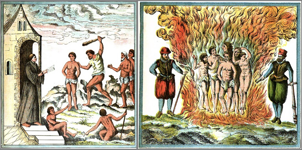
• He was particularly repulsed by the harsh treatment that the Spanish inflicted to the Natives and depicted some of the scenes he observed. As we will see, this profoundly influenced his conduct towards the American Indians he would interact with in North America, one of respect, trust and humanity, given the standards of the times.
• In 1601, Champlain returned to France and met Aymar de Chaste, the governor of Dieppe, who greatly appreciated the Brief Discours, for which he had a beautiful copy made by a Dieppe illumination workshop. De Chaste introduced Champlain to King Henry IV, who kept him at court starting in early 1602 and granted him a pension.
| | |
Onwards to North America
• Aymar de Chaste (1514–1603) was a French Catholic admiral during the Franco-Spanish Wars from 1582 to 1598.
• Champlain assisted Aymar de Chaste in developing a colonization plan for Northeast America. He planned to establish a French settlement in the Chesapeake Bay, at the entrance of Long Island Sound, in Saco Bay, or at the mouth of the Penobscot River, but the kingdom's financial situation did not allow for this project to proceed.
Aymar de Chaste was then persuaded by François Gravé, a wealthy merchant from Saint-Malo living in Honfleur, to focus instead on the Saint Lawrence Valley, which he had been visiting since the late 1570s and knew to be rich in furs. He tasked him with leading an expedition to explore all its possibilities.
• Chaste was appointed Viceroy of Canada by King Henry IV on February 6, 1602, after he agreed to lead this expedition with former officers Samuel Champlain, Pierre Dugua, Sieur de Mons, François Gravé Du Pont, and others, whom we will all introduce further.
• Before accepting to join the expedition, Champlain first requested permission from Henry IV, who granted it on the condition that he provide a "faithful report" upon his return.
It is impossible to retrace in detail all of Champlain's voyages in the scope of this Bulletin. Furthermore, as much as possible we focus on Champlain's footsteps in what is today the United States.
| | |
First trip to Canada, on the Saint Lawrence River (March 15, 1603)
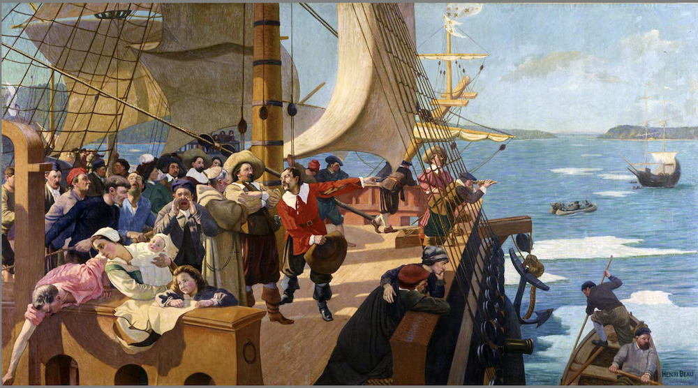
His first journey to North America begins in March 1603 under the command of François Gravé, on a mission from Aymar de Chaste, aboard La Bonne Renommée, the Françoise and another ship are also part of the fleet.
Champlain and Gravé meet the Indians and take part in the peace pipe ritual. This initial agreement shapes the entire French Indian policy for the following century, particularly the involvement of the French in wars against the Iroquois, who were enemies of the Montagnais and other nations along the river. Champlain observes and describes this smoking ceremony as well as the customs and beliefs of his hosts.
Champlain has no other official assignment for this trip than to accurately sketch a map of "the Great River of Canadas," from its mouth to the "Great Sault Saint-Louis."
Upon his return to France on September 20, 1603, he reports to the king and publishes an account of the expedition titled "Des Sauvages, or Voyage of Samuel Champlain, of Brouage, made in New France, in the year sixteen hundred three". He signs the work as Samuel Champlain, without the particle "de."
| | |
2nd voyage. Establishment of a colony on Saint Croix Island, in present-day Maine
• On November 8, 1603, King Henry IV grants a commission to Pierre Dugua, Sieur de Mons, to establish a settlement in Acadia, as the "lieutenant general in North America." The main reason for choosing Acadia, already noted by Jean de Verrazano, was the search for precious metals like copper and silver.
In March 1604, the king allows Champlain to join this new expedition, and he must report on his findings. Led by Pierre Dugua de Mons, this expedition (without women or children) is still directed by François Gravé Sieur Dupont. • Departing from Havre-de-Grâce on April 7, 1604, the expedition consists of two ships, the Bonne Renommée and the Don de Dieu (and a third smaller one, whose name has not been recorded) . Gravé Du Pont sails on the Bonne Renommée, while Pierre Dugua de Mons, Jean de Biencourt, Seigneur de Poutrincourt, Sieur d’Orville (an architect, whose first name is not known), and Champlain travel on the Don de Dieu.
• By early May 1604, they land at Port-au-Mouton (now in Nova Scotia), then at Saint Croix Island (now in Maine) where they settle. They build structures using materials brought from France.
• The winter of 1604 to 1605 is harsh: scurvy claims 35 or 36 French lives out of the 79 inhabitants of the island, where river ice isolates them from coastal resources. On June 15, Gravé Du Pont arrives with about forty men, supplies, and equipment.
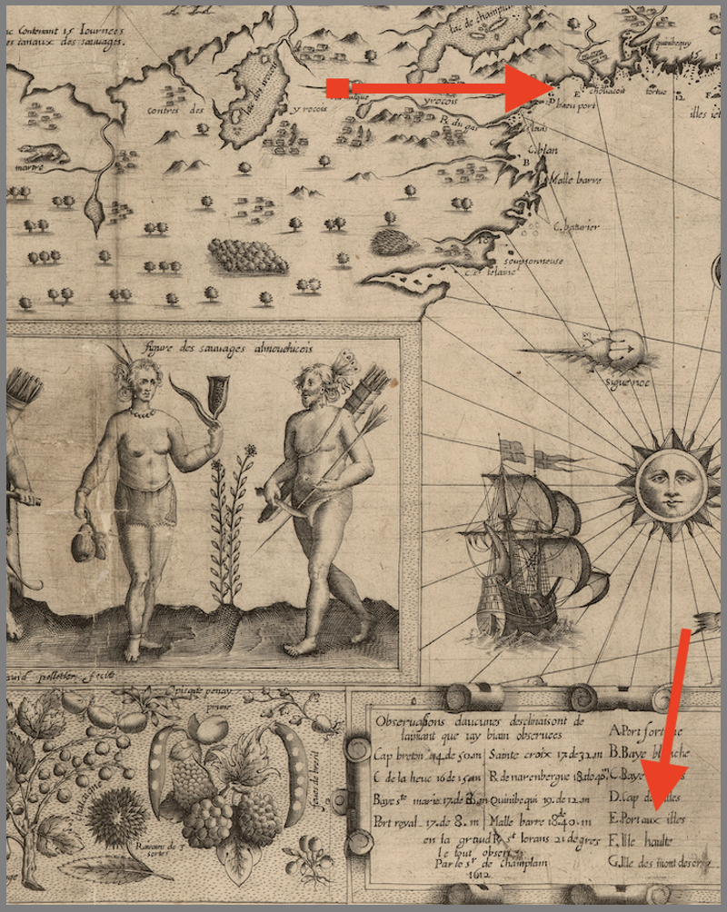
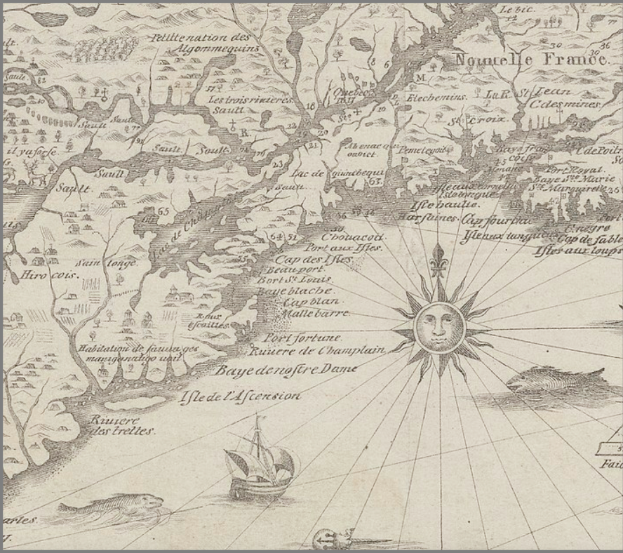
• Throughout the summer of 1605, de Mons and Champlain search for a more hospitable location. Starting from the Kennebec River, they explore southward, visiting the Bay of Seven Islands (Casco Bay), the Bay of Chouacouët (Saco Bay), Cape-aux-Îles (Cape Ann), the Bay of Islands (Boston Harbor), Port Saint-Louis (Plymouth Bay), Cape Blanc (Cape Cod), and Mallebarre (Nauset Harbour). They return to Saint Croix on September 3, 1605.
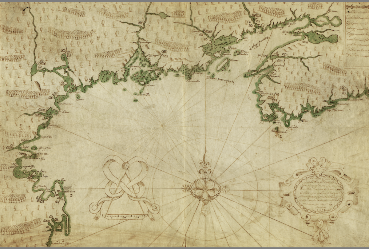
Champlain creates a very detailed map of this journey:
| | |
Above:
This portulan-style map on vellum was drawn by Champlain in 1607 for presentation to the King of France. It establishes the first thorough delineation of what would become New England and the Atlantic coast of Canada, from Cap-Sable to Cap Blanc (Cape Cod). It depicts Port Royal, Baye Blanche (Cape Cod Bay), Baye Françoise, and the St. John, St. Croix, and Penobscot rivers. It also shows Kennebec River Bay and the island of Monts Deserts. Champlain began his survey in 1604 at La Have and finished it in 1606 at Nantucket Sound. In August of that year he completed the chart. The following year he altered the date to 1607. Size of the original: 37 54.5 cm. Photograph courtesy of the Geography and Map Division, Library of Congress, https://press.uchicago.edu/books/hoc/HOC_V3_Pt2/HOC_VOLUME3_Part2_chapter51.pdf
| | |
• On September 21, 1605, the group moved the colony to Port Royal (now in Nova Scotia) to build the "Habitation". The buildings from Sainte-Croix were taken apart and then reassembled.
• In the fall of 1606, over a period of more than two months, Champlain and Jean de Poutrincourt searched from southern Acadia to Cap Blanc (Cape Cod) for another place to settle permanently. At Fortuné port (Chatham, Cape Cod), he planted crosses and attempted to establish a settlement. An altercation with the Nauset tribe resulted in the death of four Frenchmen.
• The expedition members noticed beautiful bays and named several places, including the Champlain River (Mashpee River), but the presence of the English nearby and the hostility of the natives made them give up on settling on this coast. They did not go beyond Martha's Vineyard.
Champlain would soon turn his attention into an other axis of penetration of the continent: the Saint Laurence river:
| | |
3rd voyage: The founding of Québec...
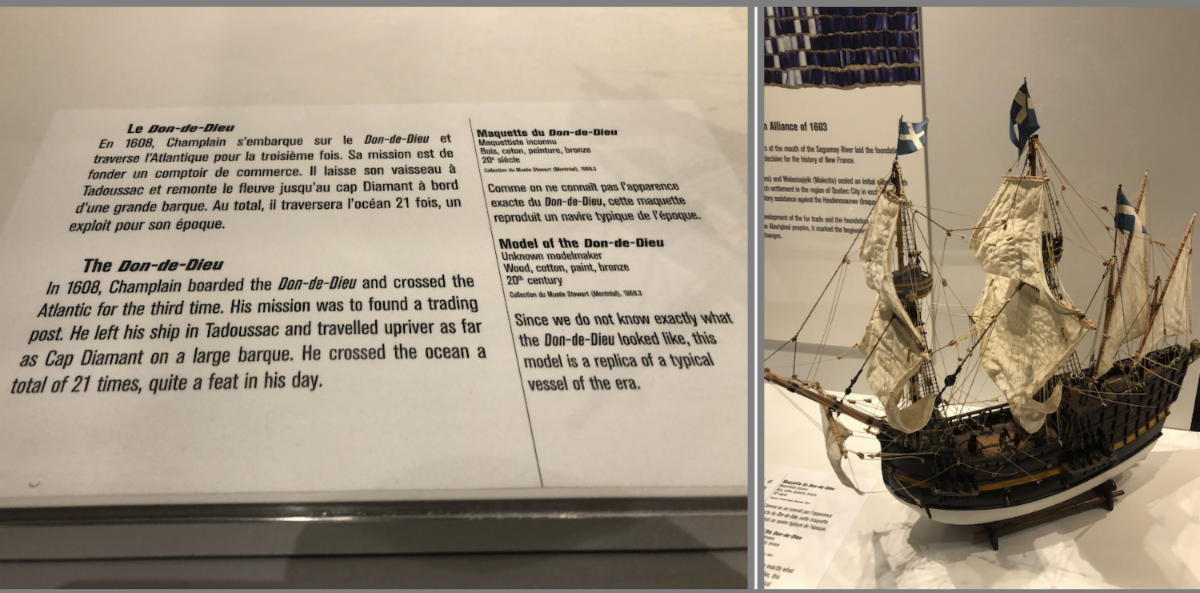
• After a brief return to France, Samuel de Champlain departed again for New France on April 18, 1608, aboard the Don de Dieu as expedition lieutenant. His mission was to establish a permanent trading post along the Saint Lawrence River with his 28 men. On July 3, they reached the "point of Quebec" at the foot of Cap aux Diamants, a strategic location Champlain had previously scouted near the water.
• Champlain immediately set his workers to clear the walnut trees and vines to build "L'Abitation de Quebecq" - a fortified complex serving as fortress, trading post, and residence. The settlement consisted of three two-story buildings surrounded by a wide ditch and wooden palisade, becoming the foundation of the first lasting French colony along the Saint Lawrence. However, the inaugural winter proved catastrophic, with scurvy and dysentery claiming most of the colonists' lives, leaving only eight survivors from the original 28 men.
... and the battle at Lake Champlain:
| | |
Above:
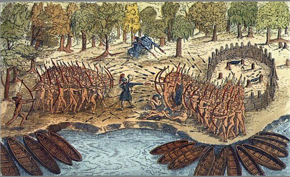
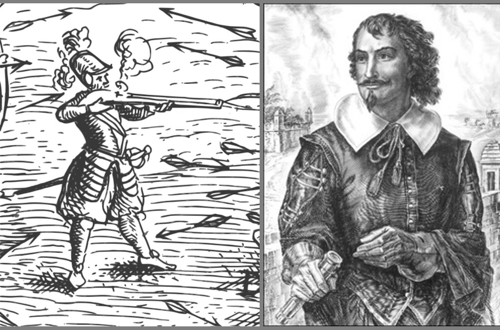
Champlain's own illustration of his encounter with the Iroquois in July 1609. In a battle thought to have taken place somewhere near the Crown Point peninsula, the explorer and his men used their powerful weapons to change the course of a battle between native peoples. The man with the arquebuse in the middle is a self-portrait. It is the only surviving contemporary likeness of the explorer (a close up is shown further down this bulletin at the Ticonderoga memorial) . By Samuel de Champlain - In Champlain, S. de, "Les voyages du sieur de Champlain..." à Paris: chez Jean Berjon..., 1613) facing p. 232), United States Library of Congress's Serials and Government Publications, Public Domain,
https://commons.wikimedia.org/w/index.php?curid=7542745
| | |
• Champlain set out on June 18, 1609 for a journey of discovery in the land of the Iroquois.
• On July 12, he discovered a large lake which he named after himself (Lake Champlain).
• On July 29, at the site of what would become Fort Carillon, just south of Crown Point (New York State), Champlain and his team encountered a group of Iroquois. The next day, two hundred Iroquois advanced on their position. An indigenous guide pointed out the three Iroquois chiefs; immediately, Champlain shot and killed two of them with a single gunshot, causing all the Iroquois to flee and creating panic.
This event marked the beginning of a long period of hostile relations between the Iroquois Confederacy of the Five Nations and the French settlers.
In the ensuing years, Champlain will pursue his explorations deep inland and towards the Great Lakes:
| | |
Champlain also continues his back-and-forth transatlantic crossings: During his stay in Paris, on December 27, 1610, he signed a marriage contract with a 10-year-old girl named Hélène Boullé. The actual marriage took place 3 years later, however the terms of the contract called for the marriage to be consummated two years later, when she turned 15. This was not so uncommon at the time.
• 4th voyage, 1611: Returned to Quebec to continue developing the colony and strengthen trade relationships with Indigenous peoples. During this period, he worked to establish more permanent structures and expand French influence. In honor of his young wife, he names a large island at the foot of the "Grand Sault Saint-Louis" as "Île Sainte-Hélène." This is still the name of the island that the Jacques-Cartier Bridge has been built on since the 20th century.
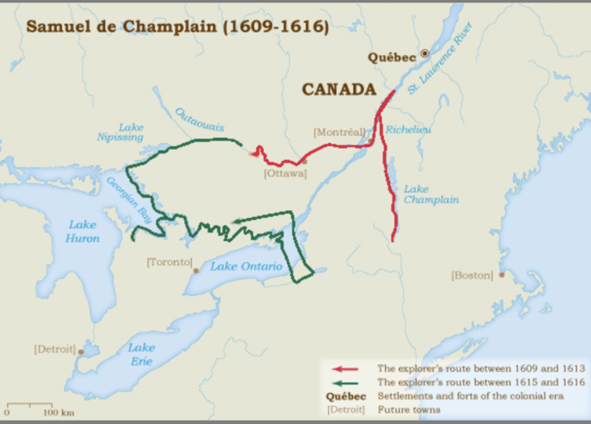
• 5th voyage, 1613: Made significant explorations up the Ottawa River, seeking a passage to the "Northern Sea" (Hudson Bay). This voyage extended French knowledge of the interior waterways and established important trade routes.
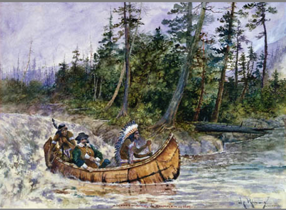
• 1615-1616: Champlain undertook his most ambitious inland expedition, traveling via the Ottawa River to Lake Nipissing, then following the French River to reach Lake Huron. He accompanied Huron allies in an attack against the Iroquois, was wounded in the knee during the battle, and spent the winter of 1615-1616 among the Hurons.
• 1620-1624: Champlain continued administrative and exploratory work, focusing on consolidating French colonial presence and managing relationships with various Indigenous nations.
• 1629-1632: Samuel de Champlain was forced to surrender Quebec to the British Kirke brothers on July 19-20, 1629, after facing starvation with only 16-18 armed men to defend the settlement, and was taken prisoner along with other French colonists until Quebec was returned to France by the Treaty of Saint-Germain-en-Laye in 1632.
• 1633: Made his final voyage across the Atlantic to Quebec and died on Chstmas Day, 1635.
| | Relationships with Natives | | |
“Champlain learned that in order to be accepted and taken on exploring trips, close personal relations and trust had to be built with Native leaders.” – Conrad Heidenreich, “The Beginnings of French Exploration out of the St. Lawrence Valley: Motives, Methods, and Changing Attitudes towards Native People,” 2001
• Samuel de Champlain had a complicated and evolving relationship with Native Americans, characterized by both cooperation and conflict.
Early Cooperation and Alliance Building (1603-1615)
1603: Champlain embarked on his first journey to New France, starting to build connections with various Indigenous groups.
1608: He established Quebec and quickly sought partnerships with local Algonquian-speaking peoples and the Huron (Wendat) confederation.
1609: He fought alongside Algonquin and Huron warriors against the Iroquois at Lake Champlain, using firearms that helped achieve victory but also created lasting hostility with the Iroquois League.
Military Conflicts
Champlain, however, was not a pacifist. When needed, he would resort to military force.
1615: He was involved in a failed Huron-Algonquin attack on an Iroquois village in what is now New York, as we will see further below.
The French-Indigenous alliance against the Iroquois established a pattern of warfare that would continue for many years.
Strategic Partnerships
Champlain understood that the success of French colonization relied on alliances with Indigenous peoples. He formed particularly strong ties with:
The Huron confederation, who became essential trading partners in the fur trade, various Algonquian groups along the St. Lawrence River and The Montagnais (Innu) people.
Cultural Exchange and Diplomacy
1615-1616: He spent a winter living with the Huron, gaining insight into their customs and language. He encouraged young Frenchmen to stay with Indigenous groups to act as interpreters and cultural mediators. He took part in numerous Indigenous diplomatic practices and ceremonies.
| | |
Above:
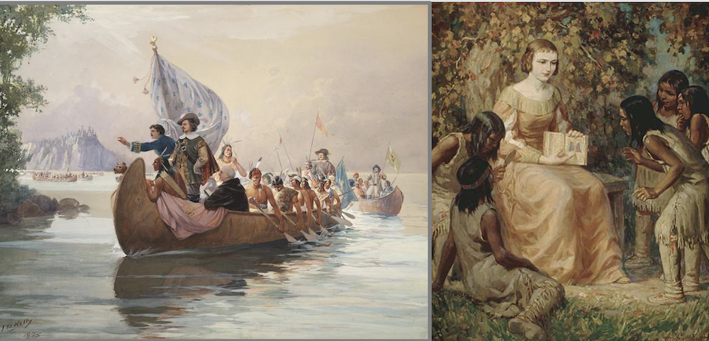
Left: Champlain in Georgian Bay (Lake Huron, Ontario), c. 1615 by Kelly, John David, 1862-1958, Public Domain Toronto Public Library
https://digitalarchive.tpl.ca/objects/353350
Right: Madame Champlain teaching Indian children, 1620. Crédit : Bibliothèque et Archives Canada, no d'acc 1991-36-1. Par Scott, Adam Sherriff, 1887-1980. Domaine public, https://commons.wikimedia.org/w/index.php?curid=51591551
| | |
• The Tadoussac "tabagie" (tobacco) refers to a solemn feast held at Tadoussac on May 27, 1603, that "reunited the Frenchmen Gravé du Pont and Champlain with the Montagnais, the Algonquins, and the Etchimins," marking a pivotal moment in French-Indigenous relations in New France. This important diplomatic meeting took place during an expedition led by François Gravé du Pont, who was serving Aymar de Chaste (the new holder of the Canadian monopoly), with Samuel de Champlain accompanying him on what was essentially a trading and exploration mission.
• Champlain's wife, Hélène, was known to be especially attentive to the education of the Natives. She lived in Quebec for several years, but returned to Paris and eventually decided to enter a convent.
• The couple had no children, but adopted three Montagnais Indian girls named Faith, Hope, and Charity in the winter of 1627–28.
• Champlain's approach was practical rather than solely exploitative; he recognized that French survival in North America depended on Indigenous knowledge, trade routes, and military assistance. However, his alliances also pulled the French into ongoing Indigenous conflicts and created territorial disputes that would have long-term effects on both French colonial goals and Indigenous communities in the area.
As we will see below, an example of this cultural overture is L'Ordre du Bon Temps ("The Order of Good Cheer"), which strengthened ties with First Nations Natives, who were invited to take part in feasts and entertainment, fostering cultural exchange and collaboration.
| | |
"L' Ordre du Bon Temps"
(The Order of Good Cheer)
The first "social club" in America
| | |
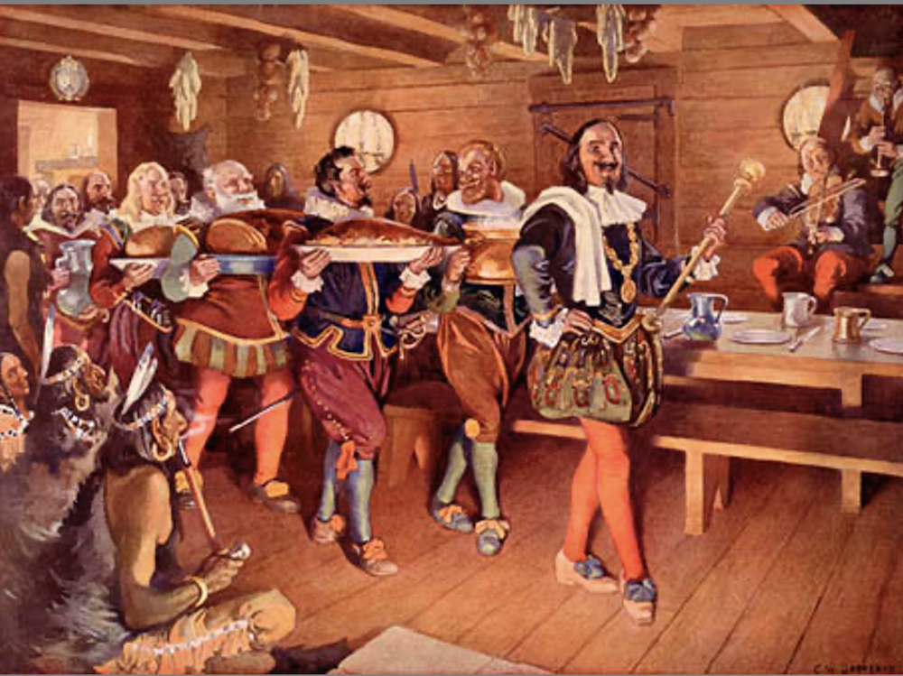
Above: Natives were invited to partake in French "banquets" and plays.
Credit: Library and Archives Canada/National Archives of Canada fonds/e002414812The Order of Good Cheer, 1606, L'Ordre de Bon Temps, painting by C.W. Jefferys
https://www.thecajuns.com/books.htm#1stacadia
| | |
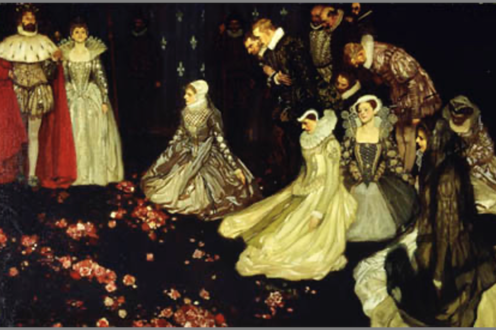
• The Ordre du Bon Temps, founded by Samuel de Champlain in 1606 at Port-Royal, is considered the first social and gastronomic club in North America. Its original aim was to maintain the morale of French colonists during the long winters by organizing feasts and entertainment on a rotating basis.
• Each day, a different member was responsible for organizing meals and entertainment, ensuring a rotation of tasks and a spirit of camaraderie.
• The Order also encouraged cultural exchanges with native peoples, notably the Mi'kmaq, who were often invited to the feasts.
• Murdoch gives a concise description of the working of the "Order of Good Cheer 330 years ago in Acadia" (the book was published in 1936) :
"There were fifteen guests, each of whom in his turn, became steward and caterer of the day. At the weekly dinner, the steward with napkin on shoulder, staff of office in hand and the splendid embroidered collar of the order round his neck, led the van. The other guests in procession followed, each bearing a dish. After grace in the evening, he resigned the insignia to his successor and they drank to each other in a cup of wine. It was the steward's duty to look to supplies, and he would go hunt or fish a day or two before his turn came, to add some dainty to the ordinary fare. During this winter, they had fowl and game in abundance, supplied by the Indians and by their own exertions. The feasts were often attended by Indians of all ages and both sexes, sometimes 20 or 30 being present. The sagamore or chief, Membertou, the greatest sachem of the land, and other chiefs, when there, were treated as guests and equals." Storytelling and music followed.
• The Order had a significant impact on the social and cultural life of the colony, contributing to the survival of the settlers and the establishment of positive relationships with local populations.
• Today, the Order of Good Cheer is celebrated as a symbol of Nova Scotia's history and culture, and continues to be honored through local events and initiatives.
• Still today in Cajun Country in Louisiana, and more popular than ever, the descendants of the Cajuns in Acadia are keeping this heritage with their specific music and food: "Laissez les bons temps rouler"...
"Le théâtre de Neptune"
The first theater play in North America!
| | |
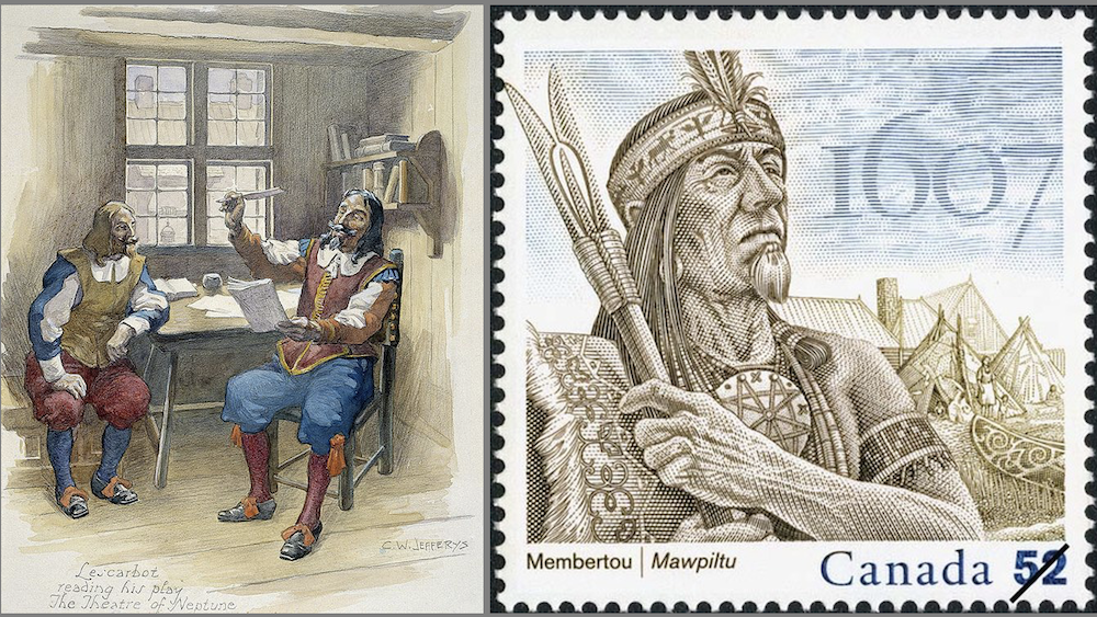
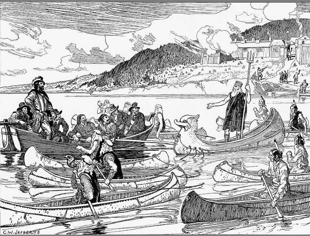
• It was as part of the Ordre du Bon Temps that Marc Lescarbot (also a talented cartographer in his own right) wrote and directed the first European play in North America, “Le Théâtre de Neptune".
• The main character is the god Neptune, on his boat, accompanied by six Tritons and several Micmacs Indians.
A unique feature of this play is the inclusion of Native American roles.
• A frequent guest at Le Bon Temps was the famous and powerful Micmac (Mi’kmaq) chief Membertou (born ? - likely a centenarian when he died in 1611), a strong and clever warrior who likely settled in the Port-Royal area around the mid-16th century. His significant influence, which included religious aspects, grew due to his positive relationships with the French. Membertou is primarily recognized as the first chief of a First Nations community to be baptized, along with 20 members of his family. However, he did not abandon the traditional spiritual practices of his people; he believed that the Micmac and Christian worlds could coexist.
• In 1609, upon returning to Paris, Lescarbot published the text in Les Muses de la Nouvelle-France.
• The play was translated into English in 1927 by the American H.T. Richardson, under the title The Theatre of Neptune in New France.
• In 2006, for the 400th anniversary of the play, a projected performance for that year was canceled due to the perceived "imperialist" ideas expressed in the play.
• The performance eventually took place at the Habitation de Port-Royal in Nova Scotia on November 12, 2006.
• The only difference from the original production is that the performance occurred on solid ground rather than in the water.
| | |
Monuments et Markers
honoring Samuel de Champlain
in the United States
| | |
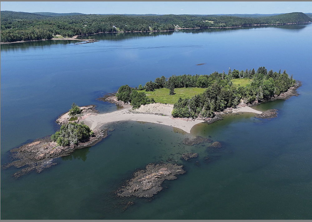
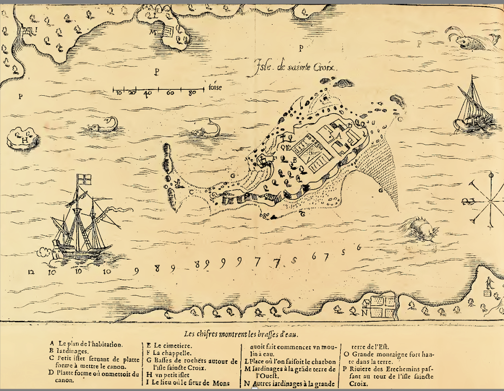
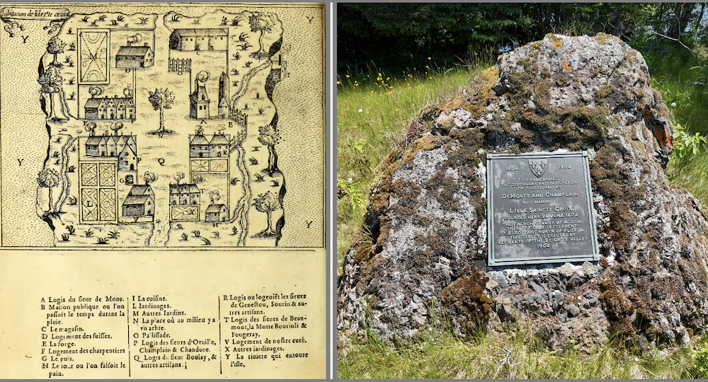
• The settlement in "Isle Saincte Croixwas part of France's early efforts to establish a permanent foothold in North America. However, the colonists faced a brutal winter in 1604-1605, during which nearly half of the 79 men died from scurvy, cold, and other hardships. The harsh conditions included inadequate shelter, insufficient food supplies, and the island's exposure to severe weather.
• On June 25, 1904, the 300th anniversary of the settlement on St. Croix Island was marked with ceremonies held on the island. Three warships from the United States, Great Britain, and France were anchored to the north of the island. A commemorative plaque was revealed on the island. Additional ceremonies took place in Saint John, Port Royal, and Calais in Maine.
• Today, Saint Croix Island is preserved as an International Historic Site, jointly managed by the United States and Canada. The Ste Croix island Visitor Center is on the mainland, in Calais, Maine.
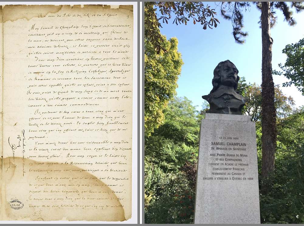
Plaque, “Ste Croix Island”
Saint Croix Island International Historic Site, Calais ME 04619
GPS: 45.128409, -67.133319
• Inscription:
1604 – 1904
“To commemorate the history and occupation
of this island by
DeMonts & Champlain
Who naming it
L’isle Saincte Croix
Founded here 26 June 1604
The French Colony of Acadia
Then the only settlement
Of Europeans north of Florida
This tablet is erected by
Residents of the Saint Croix Valley
1904”
| | |
• A series of trails, dotted with interpretative panels from the National Park Service, bronze sculptures, recreated houses, explain the history of the island and the severe hardship of these first French settlers, 15 years before the Mayflower Pilgrims.
• In reality, this attempt during this first winter was not so much to establish a colony (no women were part of the expedition...), but more to establish an "advance post", a base to explore the entire region all the way south to Cape Cod, and find a future suitable site: which they did, at Port Royal in today's Nova Scotia.
Marker, “Building A Community / Tout à bâtir”
Saint Croix Island International Historic Site grounds,
84 St Croix Dr, Calais, ME 04619
GPS: 45.123967, -67.146500
• Inscription (excerpts):
“...all set to clear the island, to fetch wood, to cut timber, to carry earth & other things necessary for the construction of the buildings."
Samuel Champlain Journal, 1604 (translation)
•Pierre Dugua's settlement plans were ambitious. On the island, the colonists built a French-style community with a central square surrounded by houses and service buildings. Here on the mainland, they planted gardens and erected a water-powered mill. As best they could, they prepared for life in the "New World."
At the end of August, the ships returned to France [...]
The French brought many building materials with them. Archeological excavations on the island have uncovered yellow bricks from Normandy.
Erected by National Park Service.”
Marker, “Exploring the Coast / Exploration de la côte”
Saint Croix Island International Historic Site grounds,
84 St Croix Dr, Calais, ME 04619
GPS: 45.123933, -67.146183
• Inscription (excerpts):
"...I set out from Ste. Croix on September 2...with twelve sailors and two Indians to serve us as guides to the places with which they were acquainted."
Samuel Champlain Journal, 1604 (translation)
“In late summer Pierre Dugua sent a crew, led by Samuel Champlain, to explore the coast. Champlain traveled along the coast of Maine, meeting native peoples, producing detailed maps, and naming places such as Mount Desert Island. Within a month, bad weather and a lack of food forced the crew to turn back.
The French always traveled with native people who served as guides and translators.
Samuel Champlain (later honored as de Champlain) was 34 years old in 1604. It is thanks to his journals that we know the story of Saint Croix Island."
Erected by National Park Service.”
Marker, “Trapped For The Winter / Prisonniers de l'hiver”
Saint Croix Island International Historic Site grounds,
84 St Croix Dr, Calais, ME 04619
GPS: 45.123967, -67.146500
• Inscription:
"During the winter a certain malady attacked many of our people...We could find no remedy..."
Samuel Champlain Journal, 1604 (translation)
“When winter came, treacherous ice made crossing to the mainland impossible. The French were trapped on the island without fresh water or game. They survived on preserved food, wine, and melted snow. But then sickness struck. by spring, thirty-five men—nearly half their number—were dead.”
“The French were not only unprepared for the North American climate, but they were also unlucky. In 1604-05, winter temperatures were colder than they usually are today.”
In his journals, Champlain suggests that the settlers were killed by scurvy. Unfortunately, it would be another 150 years before Europeans learned that fresh fruit prevents scurvy.”
Erected by National Park Service.”
| | Exploration of the Maine coastline | | |
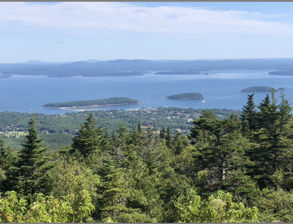
Above:
View of Frenchman Bay, and Bar Harbor, Maine, photographed from Acadia National Park summit.
Photo: TC © ASSFI 2020
| | |
• The best source of information is, of course, "Voyages of Samuel de Champlain 1604-1618". Alternatively, one can learn a lot just by reading these bronze plaques, and of course the illustrated interpretative markers:
Memorial & Plaque, “Samuel de Champlain”
Acadia National Park
Start of Day Mountain Trail, located off Maine Route 3, Bar Harbor ME 04609
GPS: 44.299404, -68.227762
• Inscription:
“In honor of Samuel de Champlain
Born in France, 1567
Died at Quebec 1635
A soldier, sailor, explorer
And administrator
Who gave this
Land its name “
This memorial was erected by the Seal Harbor village Improvement Society
In 1904 – the 300th anniversary of champlain’s voyage“
Marker, “The French Connection”
Acadia National Park
Paradise Hill Road, on the left when traveling south, Bar Harbor ME 04609
GPS: 44.405383, -68.237032
• Inscription:
“Frenchman Bay, in front of you, and other prominent names commemorate the region’s rich French heritage, “Acadia” stems from “Arcadia,” a term used by Giovanni Verrazano’s expedition to describe the Atlantic coast in 1524. The name “Mount Desert Island” was given by French explorer and cartographer Samuel Champlain during his 1604 visit. “Cadillac Mountain” honors Antoine de la Mothe-Cadillac, a self-proclaimed French noble who received a large land grant, including all of Mount Desert Island, from King Louis in 1688. The French, however, ultimately lost the struggle to control northeastern North America in the mid-1770s (sic), when British troops defeated the French at Quebec. As you travel around Acadia today, look for other place names that signal Acadia’s French connection.
Samuel Champlain mapped the coastline from Cape Cod to Canada and westward to the Great Lakes in the 1613 “Map of New France.” His 1604-1618 expeditions laid the groundwork for French colonization of the New World.
The island is high and notched in places so that from the sea it gives the appearance of a range of seven or eight mountains. The summits are all bare and rocky . . . I named it “L’ Ile des Monts-deserts.” Samuel Champlain, 1604 “
Marker, “Frenchman Bay”
Acadia National Park
Paradise Hill Road, on the left when traveling south, Bar Harbor ME 04609
GPS: 44.405383, -68.237032
• Inscription (excerpts):
“[...] In 1604, the explorer Samuel Champlain charted the bay and named this island "Mount Desert" for its bare-topped mountains. From 1613 to 1760 the French battled the English for possession of North America. French frigates hid behind the Porcupine Islands to prey on English warships passing beyond Schoodic Point [...]"
| | |
Other markers can be found along the coastline in Maine:
Marker, “Kennebunk, Maine”
Rotary Park, Main St, Kennebunk, ME 04043
GPS: 43.385233, -70.541933
• Inscription (excerpts):
[...] “In 1604, Samuel de Champlain explored the coast of Maine and visited Cape Porpoise harbor, naming it “Le Port aux Isles” (Island Harbor). A map drawn in 1610 for London’s Virginia Company clearly shows Cape Porpoise. [...]
Erected by the Museum in the Streets.”
Marker, “Samuel de Champlain”
Kenduskeag Stream Park, Bangor ME 04401
GPS: 44.802050, -68.770300
• Inscription:
“Near this spot
in the year 1604
Samuel de Champlain
Gallant pioneer
and intrepid explorer
made a landing on his voyage
up the Penobscot River”.
Erected 1922 by Pine Cone Council, Knights of Columbus.”
Marker, “Pemtegwacook”
711 Fort Knox Road (Maine Route 174), Stockton Springs ME 04981
GPS: 44.567083, -68.803300
• Inscription (excerpts):
“In 1604, French explorer Samuel de Champlain sailed up the Penobscot River, past the future site of Fort Knox. Champlain was not the first or only explorer to travel this far upriver, but his voyage established a sustained French foothold in the area. Champlain ended his upriver journey near present-day Bangor. There, he met Bashabes, a leader of the coastal Etchemins (ancestors of the Penobscot, Passamquoddy [sic], and Malecite Indians), who told him much about the interior lands. Since at least the 1530s, Etchemins had traveled the interior network of rivers and lakes to obtain furs to trade for European goods.
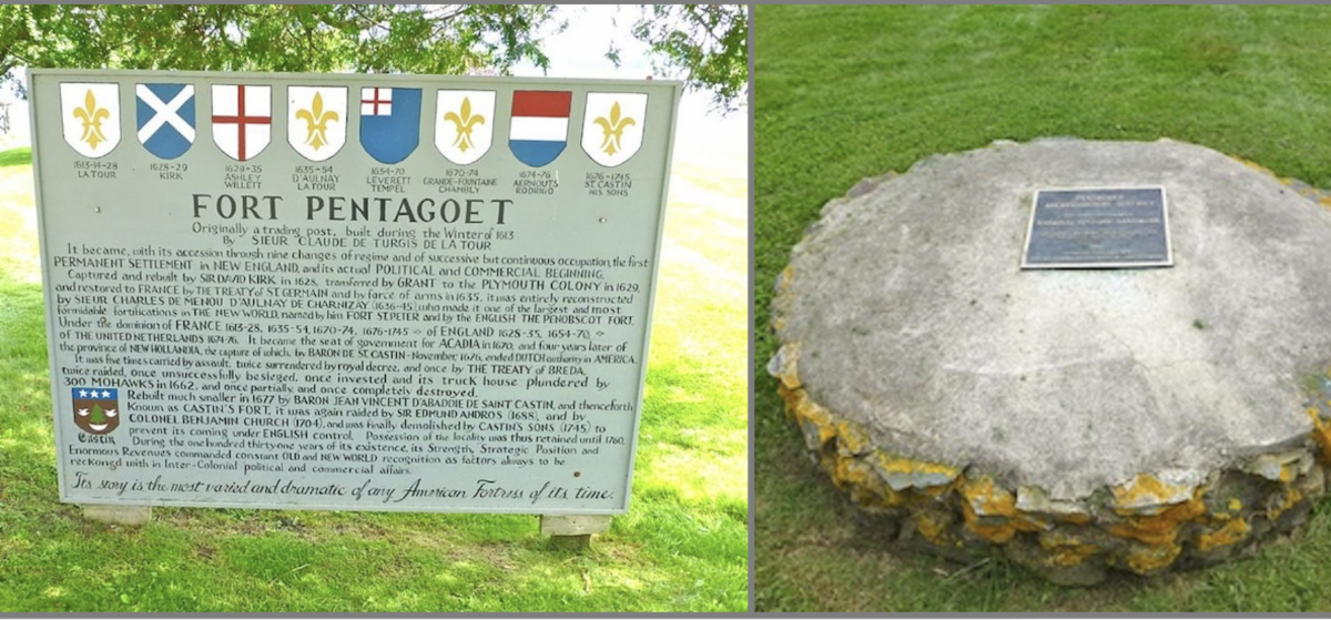
Contact with European newcomers brought some trade advantages to Maine's Native people. But this contact also brought great destruction, first by European diseases and then by wars, in a complex web of events that would change Native American culture forever. Generally, in the conflicts of the 1600s and 1700s, Native American people along the Penobscot and further east allied with the French. In fact, from 1635 to 1759, the Penobscot River and its lands to the east were widely seen, even by the English, as part of French Acadia. Central to this control was a post, Fort Pentagoet, established downriver at Castine in 1635, which served for four years as Acadia's capital.
Erected by Maine Department of Conservation.”
| | |
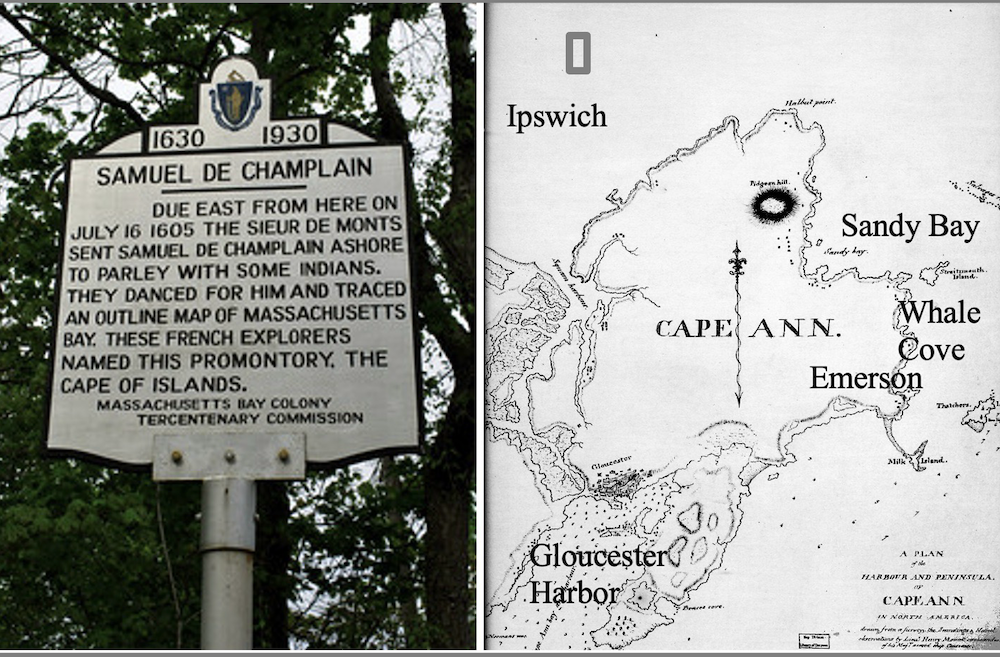
• Champlain sailed along the northern New England coast to Cape Ann in 1604 and came ashore here in 1605 and 1606. His accounts of meeting the Pawtucket in Whale Cove and Gloucester Harbor indicate friendly, though increasingly wary, encounters.
Marker, “Samuel De Champlain”
89-85 MA-127A, Rockport, MA 01966
GPS: 42.650283, -70.599167
• Inscription:
“Due east from here on July 16 1605 the Sieur De Monts sent Samuel De Champlain ashore to parley with some Indians. They danced for him and traced an outline map of Massachusetts Bay. These French explorers named this promontory, The Cape of Islands.
Erected 1930 by Massachusetts Bay Tercentenary Commission.”
| | |
Marker, “Port de Mallebarre”
200 Hemenway Rd, Eastham, MA 02642
GPS: 41.822267, -69.963300
• Inscription:
“Fifteen years before the Pilgrims landed on Cape Cod, French explorer Samuel de Champlain sailed down the Atlantic coast from Canada in search of new lands. On July 20, 1605, he entered here what was then a shallow bay. He named it Port de Mallebarre, “port of dangerous shoals.”
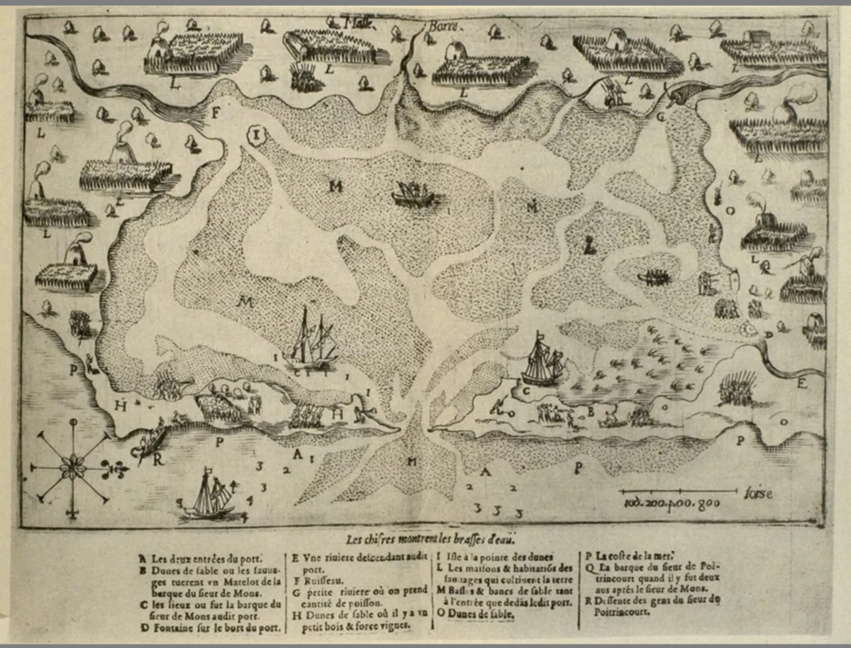
Surrounding the bay the explorers found the thatched houses of the Nauset Indians. Besides each house were fields planted with Indian corn, beans, squash, and tobacco. Unfortunately, an Indian stole one of the explorers’ copper water kettles, and a sailor was killed in an ensuing skirmish.
The French did not settle here, but Champlain left us the first written descriptions of the land and people, and the first detailed map. The bay he called Mallebarre has since been transformed by the tides into today’s Nauset Marsh and Harbor.
Erected by Cape Cod National Seashore.”
| | |
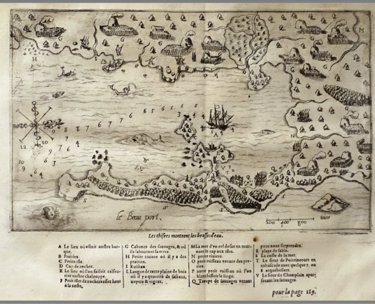
• Champlain's drawings are astonishingly precise. His annotations in French (illustration above) and their English translation below tell the whole story:
A. "Place where our barque was" (Gloucester’s Western Harbor to the lee of Rocky Neck)
B. "Meadows" (Salt marshes)
C. "Small island" (Ten Pound Island)
D. "Rocky cape" (Brace Rock and Bemo Ledge)
E. "Place where we had our shallop caulked". (Rocky Neck, with Native-made causeway)
F. "Little rocky islet, very high on the coast". (Salt Island)
G. "Cabins of the savages and where they till the soil" (Wigwams of the Pawtucket)
H. "Little river where there are meadows" (Brook with marsh flowing into Fresh-Water Cove beside Dolliver Neck)
I. "Brook" (Emptying beside Cressey Beach)
L. "Tongue of land covered with trees, including a large number of sassafras, walnut-trees, and vines"
M. "Arm of the sea on the other side of the Island Cape" (The creek in the drowned marsh at Little Good Harbor Beach)
N. "Small River" (Brook near Clay Cove on the eastern branch of the inner harbor, today identified as Wonson’s Cove)
O. "Small brook coming from the meadows" (Branch of the Little River, running through the Cherry Hill Marsh and the Train Bridge Marsh, joining the Annisquam near Gloucester Harbor above the Blynman Canal)
P. "Another little brook where we did our washing" (At Oakes’ Cove in the southwestern tip of Rocky Neck)
Q. "Troop of savages coming to surprise us" (On the eastern bank of Smith’s Cove, but Champlain probably misread their intentions.)
R. "Sandy strand" (Niles Beach; Interestingly, Champlain omitted Niles Pond and possibly did not see it or thought it was part of the ocean because of its unique proximity; the fresh water pond is separated from the sea only by a narrow natural dike that residents have reinforced over the generations.)
S. "Sea-coast" (Bass Rocks and the back shore along Atlantic Ave.)
T. "Sieur de Poutrincourt" in ambuscade with some seven or eight arquebusiers (Champlain’s detachment of marines)
V. "Sieur de Champlain discovering the savages" (Champlain’s caricature of himself freaking out, highlighting his sense of humor).
• Note: Commentaries between brackets are taken from Mary Ellen Lepionka, whose remarkable blog on Champlain's explorations of the Massachusetts shoreline is a must-read.
Marker, “Samuel de Champlain 1630-1930”
10-2 Rocky Neck Ave, Gloucester, MA 01930
GPS: 42.603700, -70.654650
• Inscription:
“In September 1606, Samuel de Champlain landed at Rocky Neck in what is now Gloucester Harbor, to caulk his shallop, and made an accurate chart of the harbor which he called Le Beauport.”
Erected 1930 by Massachusetts Bay Colony Tercentenary Commission.”
Altercation at Fort Fortuné
(Chatham, Cape Cod)
| | |
Above:
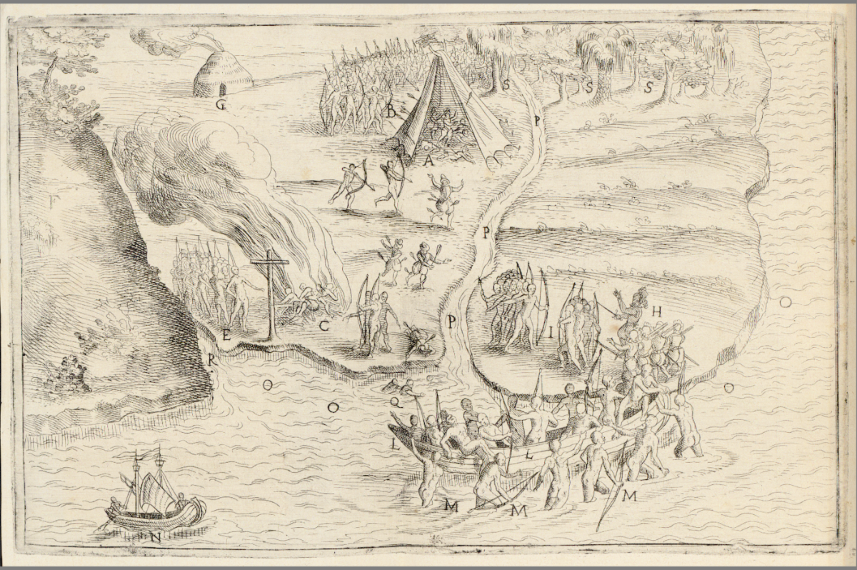
Altercation with Natives at Port Fortuné (Chatham, Cape Cod), 14 years before the Mayflower's Pilgrims. The French try to save themselves by returning to their ships. In the left foreground is a simple cross and next to it a fire consuming the bodies of the French killed earlier by the natives. The English translation of Champlain's captions:
« A Place where the French baked their bread. B Savages surprising the French and shooting arrows at them C Frenchmen burnt by the Savages D Frenchman escaping on a rowboat injured by arrows E Group of Savages burning Frenchmen F Mountain by the harbor. G Savages' hut. H Frenchmen on land charging the Savages. I Savages killed by the French L rowboat used by the French. M Savages around the rowboat being surprised by ourmens. N Sieur de Poitrincourt's rowboat O Harbor P Small creek. Q Frenchmen killed in the water thinking they could escape R Creek coming from the Meadows » By Samuel de Champlain, Public Domain, https://commons.wikimedia.org/w/index.php?curid=52836205
| | |
• In the fall of 1606, Champlain and Jean de Poutrincourt spent over two months searching from southern Acadia to Cap Blanc (Cape Cod) for another place to settle permanently. The members of the expedition noticed some beautiful bays and named several places, including the Champlain River (Mashpee River), but the presence of the English in the area and the hostility of the natives made them give up on settling on this coast. They didn't go beyond Martha's Vineyard.
• At Port Fortuné (present-day Stage Harbor in Chatham, Cape Cod, Massachusetts), they planted crosses and attempted settlement. Champlain encountered a group of Nausets Indigenous people. An altercation arose, potentially due to misunderstandings or territorial disputes, although the exact details are unclear, resulting in an attack at night and the death of four Frenchmen.
This incident, and the failure to establish positive relations with the region's Indigenous peoples, likely contributed to France focusing its colonization efforts further north, particularly in the St. Lawrence River Valley, where they had established stronger trade relationships with Indigenous groups.
Boulder & Plaque, “Samuel de Champlain”
526-608 Stage Harbor Rd, Chatham, MA 02633
GPS: 41.667383, -69.966083
• Inscription:
“Samuel
de Champlain”
“The First White Man
On these Shores
Landed Here
October
1606.”
| | |
Marker, “Samuel de Champlain”
526-608 Stage Harbor Rd, Chatham, MA 02633
GPS: 41.667383, -69.966083
• Inscription:
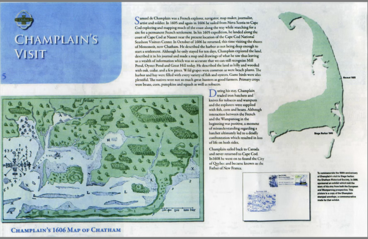
“Samuel de Champlain was a French explorer, navigator, map maker, journalist, artist and soldier. In 1605 and again in 1606 he sailed from Nova Scotia to Cape Cod exploring and mapping much of the coast along the way while searching for a site for a permanent French settlement. In his 1605 expedition, he landed along the coast of Cape Cod at Nauset near the present location of the Cape Cod National Seashore Visitors Center. In October of 1606 he returned, this time visiting the shores of Monomoit, now Chatham. He described the harbor as not being deep enough to start a settlement. Although he stayed for only ten days, Champlain explored the land, described it in his journal and made a map and drawings of what he saw thus leaving us a wealth of information which was so accurate that we can still recognize Mill Pond, Oyster Pond and Great Hill today. He described the land as hilly and wooded with oak, cedar, and a few pines. Wild grapes were common as were beach plums. The harbor and bay were filled with every variety of fish and oysters. Game birds were also plentiful. The natives were not so much great hunters as good farmers. Primary crops were beans, corn, pumpkins and squash as well as tobacco.
During his stay, Champlain traded iron hatchets and knives for tobacco and wampum and the explorers were supplied with fish, corn and beans. Although interaction between the French and the Wampanoag in the beginning was positive, a moment of misunderstanding regarding a hatchet ultimately led to a deadly confrontation which resulted in loss of life on both sides.
Champlain sailed back to Canada and never returned to Cape Cod. In 1608 he went on to found the City of Quebec and became known as the Father of New France.”
| | |
Above:
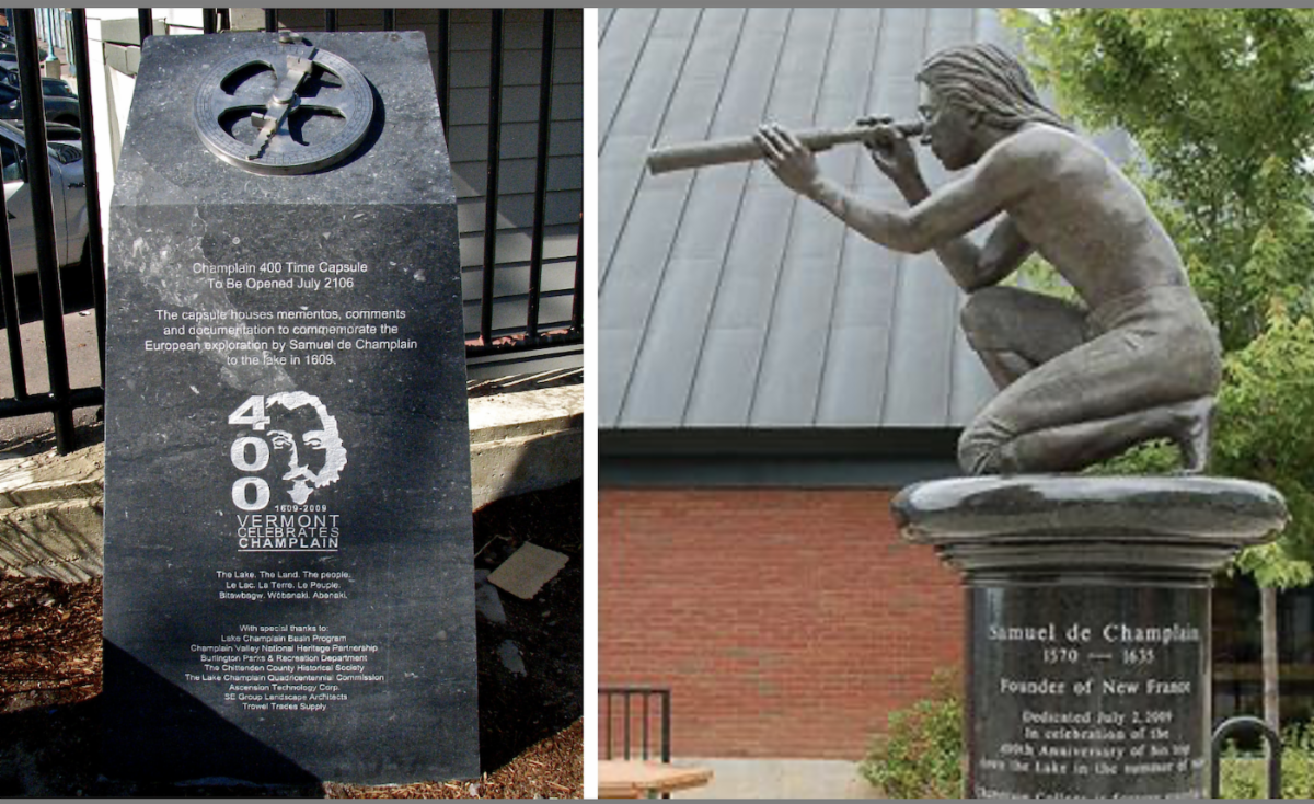
Memorial statue to Samuel de Champlain on Isle La Motte, one of the Lake Champlain Islands chain in Vermont waters of Lake Champlain, separating Vermont and New York State.
Left: Samuel de Champlain (13 August 1574 - 25 December 1635) and guide in Isle La Motte, Vermont, at the site Champlain is said to have first set foot in Vermont (and encamped) in 1609. Lake Champlain is in the background. (Sculptor E.L.Weber, 1967; Photo by Matt Wills, 2009), By Mfwills - Own work, Public Domain, https://commons.wikimedia.org/w/index.php?curid=6624139
Right: Carol M. Highsmith Photography, Inc.; 2017, Carol M. Highsmith's America Project in the Carol M. Highsmith Archive, Library of Congress, Prints and Photographs Division, https://lccn.loc.gov/2017882693
| | |
Statue, “Samuel de Champlain”
958 Shrine Rd, Isle La Motte, VT 05463
GPS: 44.900850, -73.348500
• Inscription:
“Created in the Vermont Pavilion during the Universal and International Exposition of 1967 at Montreal, Canada. Presented to the Town of Isle La Motte by the State of Vermont. Dedicated on July 7, 1968.”
| | |
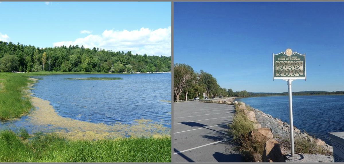
Marker, “Samuel de Champlain, Historic Lake Islands”
Roosevelt Highway, before the entrance of Sand Bar State Park, Milton VT 05468
GPS: 44.628917, -73.248333
• Inscription:
“These islands were first seen by a European in 1609, when Samuel De Champlain explored the Lake which bears his name and claimed them for the King of France. Ceded in 1763 to Britain, they became part of the Royal Colony of New York. After 1776, several American Revolutionary heroes received Land Grants here, and two islands were so named. In 1783 this area joined the Free and Independent Republic of Vermont. Here is history and legend of the famous Allen family, the Green Mountain Boys, Rogers’ Rangers and many others.
Erected 1965 by Vermont Board of Historic Sites.”
Note: another identical marker is located 30 miles away in Alburgh, VT
GPS: 44.986300, -73.296000
• One would think all these markers, statues and plaques were inaugurated long ago. It is remarkable that Champlain is still remembered and honored, even in our times were everything from the past (especially the colonial past) can be a subject of controversy.
Below is a recent sculpture and memorial tribute (complete with a time capsule) dedicated in 2009:
| | |
• The statue by sculptor Jim Sardonis is in bronze and granite and located at the campus of Champlain College. It portrays the French explorer, Champlain, as he would have appeared in July 1609 upon his arrival in the region via canoe, albeit clean-shaven, shirtless and barefoot.
• Resting on a column of polished black granite from Quebec, the statue features a kneeling Champlain, gazing out onto the lake through a spyglass. In recent times, the sculpture has faced criticism from the student body for overlooking the negative impact of colonization on indigenous populations.
• Chief Don Stevens, the leader of the Nulhegan band of the Coosuc Abenaki nation, has proposed the inclusion of an equally prominent statue representing the Abenaki people, rather than dismantling the existing Champlain statue. Champlain had actually favored friendly relations with the Natives.
Statue, “Samuel de Champlain , 1570-1635”
Champlain College, South End, Burlington, VT 05401
GPS: 44.473167, -73.204183
• Inscription on pedestal:
“Samuel de Champlain 1570-1635”
“Founder of New France”
“Dedicated July 2, 2009 in celebration of the 400th anniversary of his trip down the lake in the summer of 1609. Champlain College is forever grateful to Trustee Emeritus and friend John W. Heisse Jr., M.D. for commissioning this statue.”
Erected 2009 by Champlain College.”
Marker, “Celebrating Champlain”
Champlain 400 Time Capsule (to be opened July 2106)
14 College St, Burlington, VT 05401
GPS: 44.476917, -73.219900
• Inscription (excerpts):
“In July 1609, Samuel de Champlain became the first European to set eyes on Lake Champlain. Three hundred years later, in July of 1909, communities around Lake Champlain celebrated the tercentenial of Champlain's expedition. Burlington marked the event in grand style. President Taft arrived on the steamship Ticonderoga and spoke to a crowd of tens of thousands at City Hall Park. Weeklong festivities included a parade, semi-pro baseball game, sailing regatta, motorboat race, fireworks, and Burlington's first marathon [...] more than 175 Iroquois descendants reenacted the formation of the Iroquois confederacy and the battle with some sixty of their native opponents with whom Champlain and his two men were allied.
In 1959, a dramatic "canoecade" formed the centerpiece of the 350th anniversary celebrations. Traveling in hand-crafted birch bark canoes, performers reenacted Champlain's historic voyage with his two compatriots and some 60 Huron, Algonquin, and Montagnais Indian allies.
Each anniversary celebration has offered its own interpretation of Champlain's legacy. The 1909 events highlighted heroism and battle conquests. In 2009, festivities celebrated the Lake Champlain region's natural and cultural diversity’. [...]"
| | |
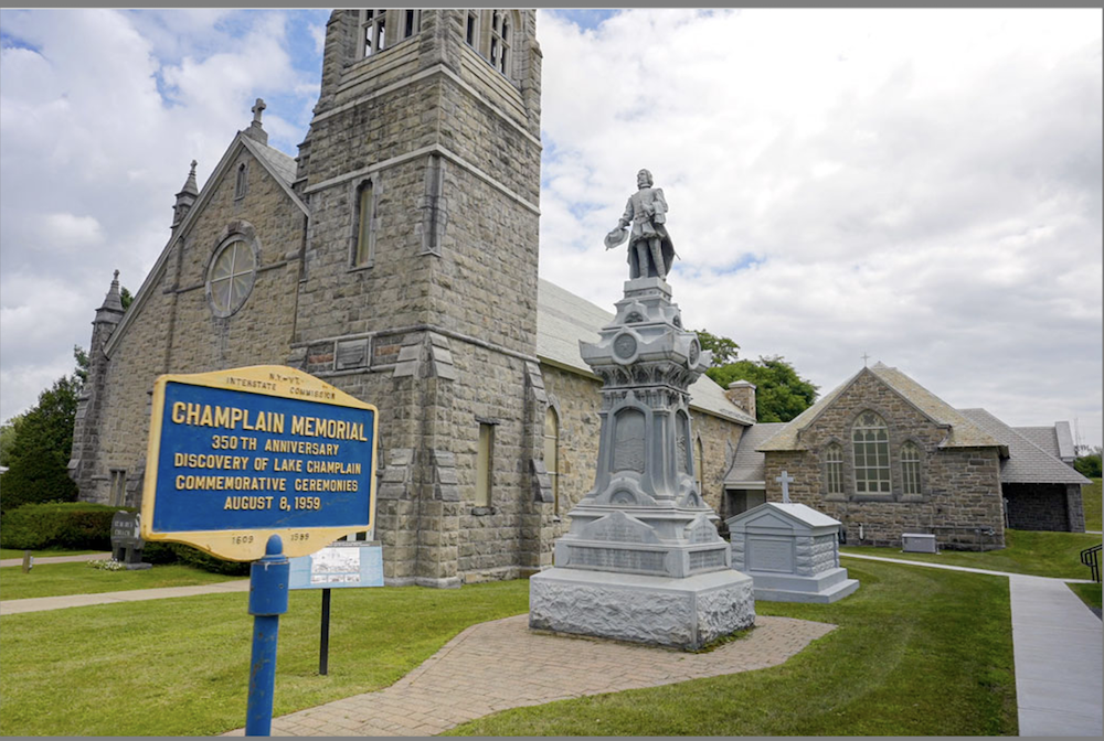
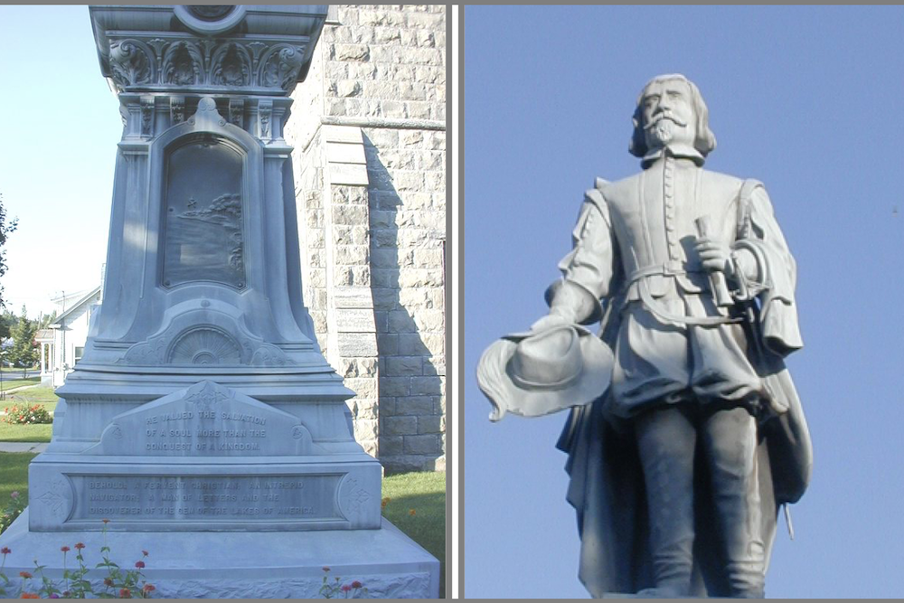
• St. Mary's Church was founded in 1860 under the direction of Father Francis Van Compenhondt, serving a Catholic population that was "entirely French of nearly two thousand souls" in what was described as "an old gathering-place for Canadians." The statue was dedicated on July 4, 1907, by Franco-Americans (French-Americans) in memory of Samuel de Champlain.
• The bilingual inscription (French and English) demonstrates the community's effort to honor both their French heritage and their American identity.
• The fact that it's still well-maintained and serving as a site for historical commemorations shows the lasting impact of that 1907 Franco-American initiative.
• This piece of regional history bridges French colonial heritage, Franco-American immigrant culture, and ongoing American historical commemoration.
Statue, “Champlain”
St Mary’s Church, 526 Point Au Fer Rd, Champlain, NY 12919
GPS: 44.944150, -73.352483
• Inscription (mostly in French):
“Le 4 Juillet 1907.
A la Mémoire de Samuel De Champlain
Par Les Franco-américains.
Samuel De Champlain
Né à Brouage, France, en 1567, Fondateur De Québec, en 1608.
Découvreur Du Lac Champlain, 6 Juillet 1609.
Mort à Quebec An 1635.
He Valued The Salvation Of A Soul More Than The
Conquest Of A Kingdom.
Behold: A Fervent Christian; An Intrepid Navigator;
A Man Of Letters And The Discoverer Of The Gem Of The Lakes Of America.
Le Salut d’une Âme Vaut Plus Que La Conquêe D’un Royaume.
Sa Mémoire Est Une Inspiration Qui Nous Porte Vers Le Vrai,
Le Bien Et Le Beau!
Comme Notre Patron, St. Jean Baptiste;
Il Prépara Les Voies Sur Ce Continent.
Il Fut Un Fervent Chrétien: Un Intrépide Navigateur:
Un Savant, Et Le Découvreur Du Plus Beau Lac De L’Amérique.”
English translation:
"4th July 1907.
In Memory of Samuel De Champlain
By the Franco-Americans.
Samuel De Champlain
Born at Brouage, France, in 1567, Founder Of Quebec, in 1608.
Discoverer of Lake Champlain, July 6, 1609.
Died in Quebec City in 1635.”
The Salvation of a Soul Is Worth More than the Conquest of a Kingdom.
His Memory Is An Inspiration That Carries Us Towards The True,
The Good And The Beautiful!
Like Our Patron, St. John the Baptist;
He Prepared The Way On This Continent.
He Was A Fervent Christian: An Intrepid Navigator:
A Scientist, And The Discoverer Of America's Finest Lake."
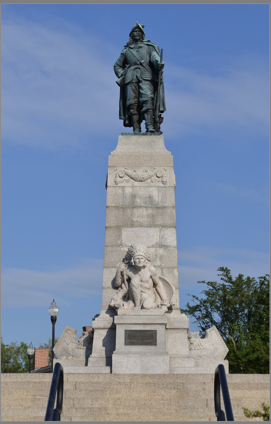
• While this first statue of Champlain in the United States is quite touching and charming, there is another majestic of the statue in Plattsburgh, NY:
| | |
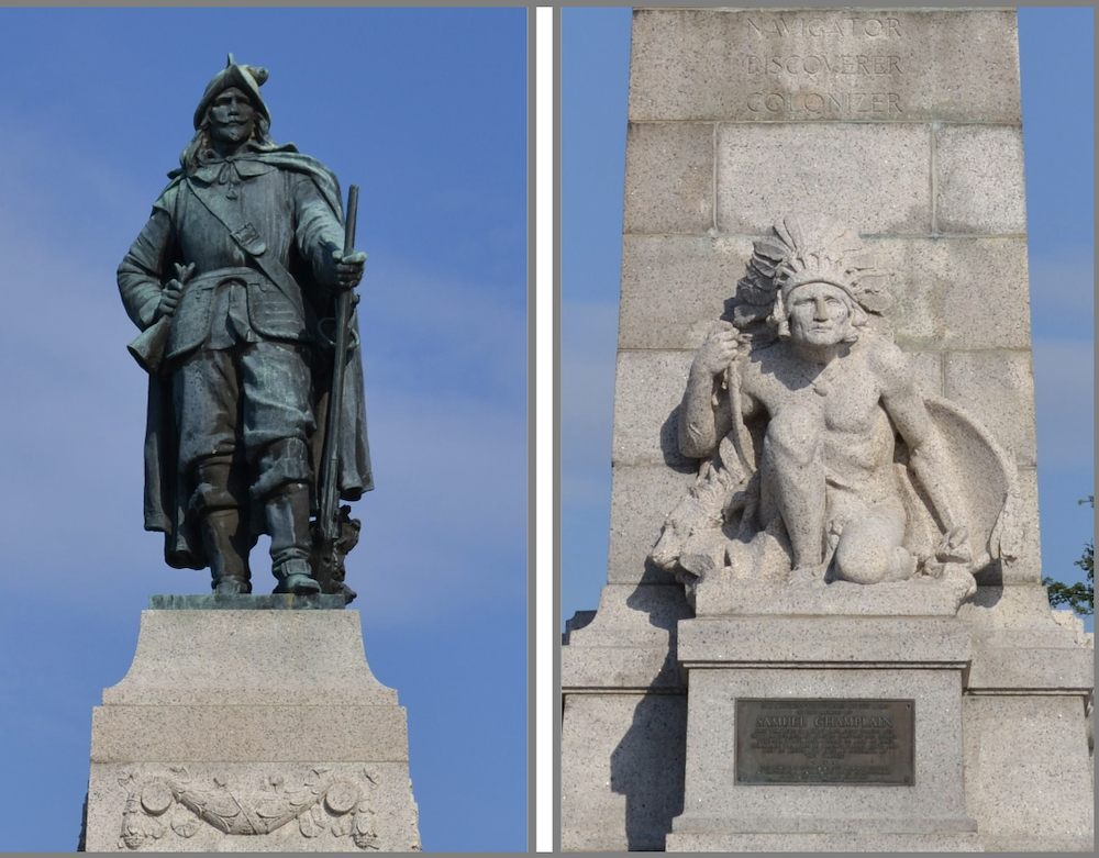
Statue & plaque, “Samuel Champlain”
Samuel Champlain Monument Park,
30 Cumberland Ave, Plattsburgh, NY 12901
GPS: 44.700300, -73.447283
• Inscription:
• Pedestal:
“Samuel
Champlain
1567-1635
Navigator
Discoverer
Colonizer”
• Plaque:
“This monument was dedicated on July 6, 1912 to the memory of Samuel Champlain first European to behold our great forests and lofty mountains, and first to traverse this inland waterway, which later became so rich in fame.
Champlain was born in Brouage, France (1567) and died in Quebec City (1635) as Governor of "New France."
This plaque was unveiled on July 19, 1959, by the citizens of Plattsburgh, to commemorate the 350th Anniversary of the discovery of Lake Champlain
Erected 1959 by Lake Champlain Tercentenary Commission State of New York.”
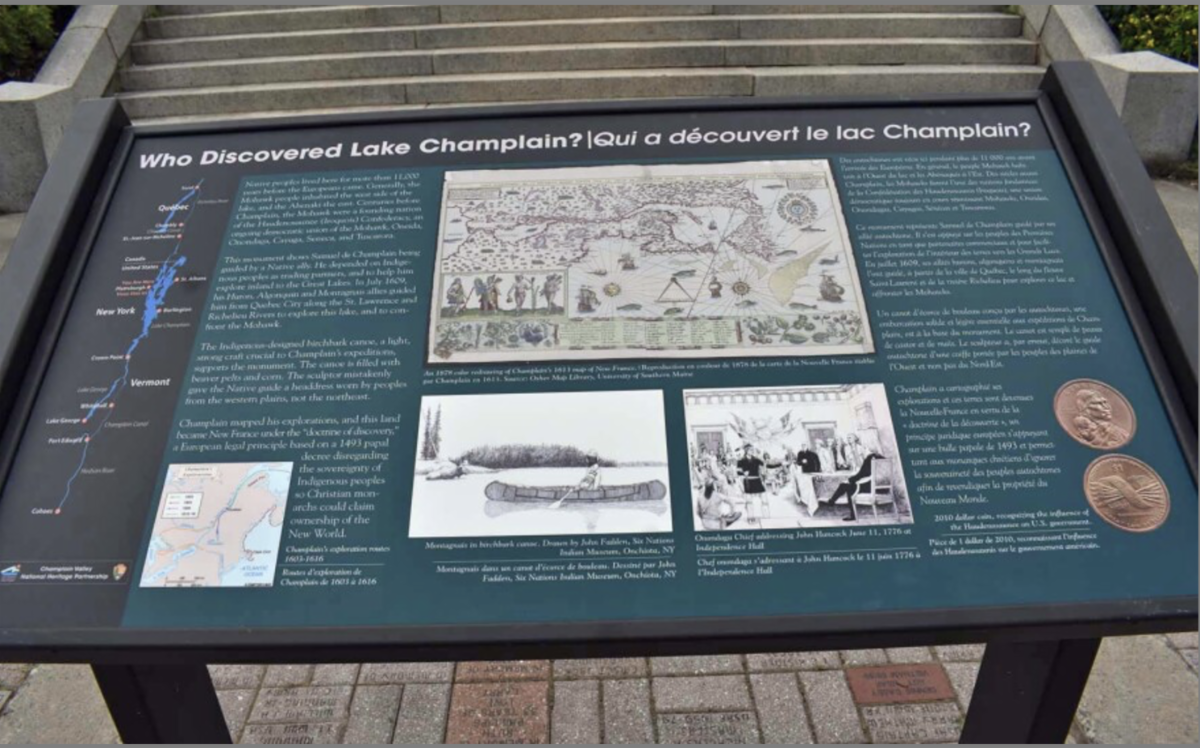
• New interpretive marker placed in front of the statue:
In recent years, the monument has been reexamined historically. A small group of local residents, historians, and Native Americans have collaborated to develop an interpretive panel to be installed near the Samuel De Champlain statue. After two years of research and discussions, a team of volunteers has approved an explanatory panel that clarifies Champlain should not be credited with "discovering" the lake, recognizing that there were people living here, not merely a few hunters, and that communities existed long before Champlain arrived.
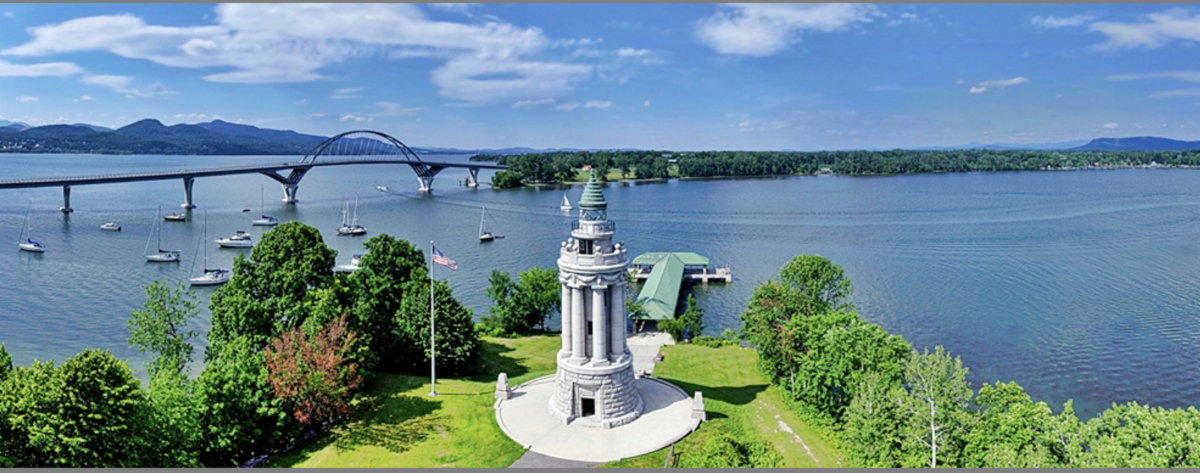
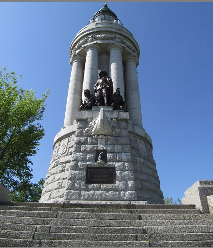
• The Champlain Memorial lighthouse, in Crown Point, NY is another beautiful structure that honors the explorer:
| | |
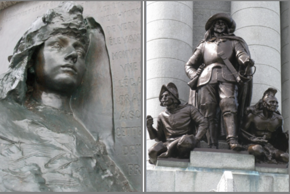
• On the side of the memorial facing the water is a sculpture, crafted by American Carl Heber, depicting Champlain flanked by a crouching Huron Indian and a French soldier. This sculpture stands above the prow of a canoe that was built into the base of the memorial. Roman Bronze Works in Brooklyn cast the sculpture, while Dillon, McClellan, and Beadel designed the monument.
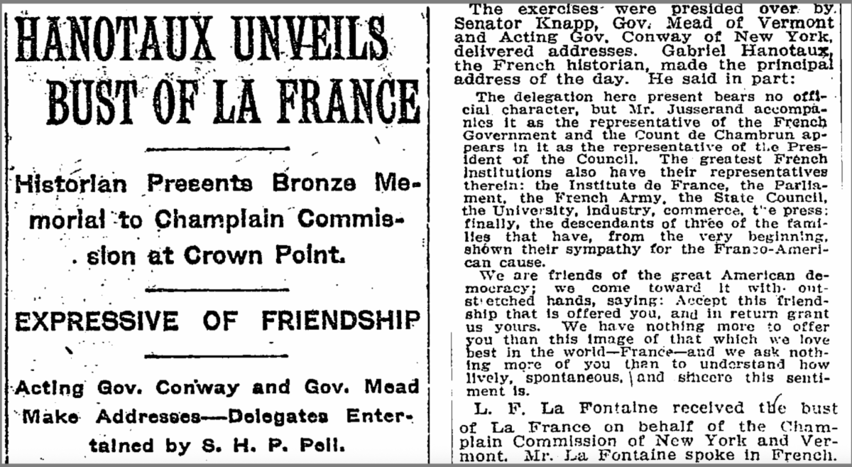
• As a contribution to the memorial, the government of France donated to the people of Vermont and New York a bronze bas-relief called La France, to be embedded in the lighthouse's exterior wall. It was created by Auguste Rodin, who sculpted the head of a woman to personify France. Camille Claudel, his muse and fellow sculptor, was his model. The Rodin is mounted on the memorial below the sculpture of Champlain.
• When the Rodin was dedicated on May 3, 1912, the president of the French delegation, the incomparable Ambassador Jean-Jules Jusserand, remarked in two short sentences:
"The United States is raising a monument to a Frenchman, and France sends you, through us, her tribute of gratitude. Once more, the two great democracies think and act in unison."
• The official dedication of the completed monument, presided over by President William H. Taft, was held on July 5, 1912.
• Another article from The New York times, dated July 5, 1912, notes: "The bronze relief "La France," one of Rodin's characteristic works, was affixed to the lighthouse on May 3 by a French delegation, headed by M. Hanotaux. The relief, which was bought by popular subscriptions, raised in France by M. Jusserand, the French Ambassador, represents France with a headdress resembling a liberty cap and half indicated as the comb of a cock. It has been placed on the front of the pedestal that carries the statue of Champlain, and is, as M. Hanotaux expressed it, the stamp of French appreciation on American works of art."
Memorial Lighthouse & Plaque, “Samuel Champlain”
Champlain Memorial Lighthouse, Crown Point State Historic Park
Crown Point, NY 12928
GPS: 44.029800, -73.421550
• Inscription:
“To the memory of
Samuel Champlain
Intrepid navigator
Scholarly explorer
Christian pioneer
Erected by the State of New York and
the State of Vermont
in commemoration of his discovery of the lake
which bears his name.”
| | |
Monument to Champlain
and the
Battle of Ticonderoga, NY
July 30, 1609
| | |
Above:
Top and Center: Monument Samuel de Champlain, Ticonderoga, NY
Photos: courtesy Richard & Babeth Santander, members of our Society and of the association Hermione-LaFayette, France
Bottom Left: Detail from "Défaite des Iroquois au Lac de Champlain", which we showed above in its entirety, taken from Champlain Voyages (1613). This self-portrait is the only surviving contemporary likeness of the explorer and is reproduced on the memorial by the sculptor. By Samuel de Champlain - Public Domain, https://commons.wikimedia.org/w/index.php?curid=7665017
Bottom Right: Another portrait, done at a much later date, decades after his death, Illustration: http://samuel.johnfishersr.net/
| |
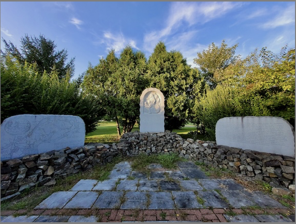
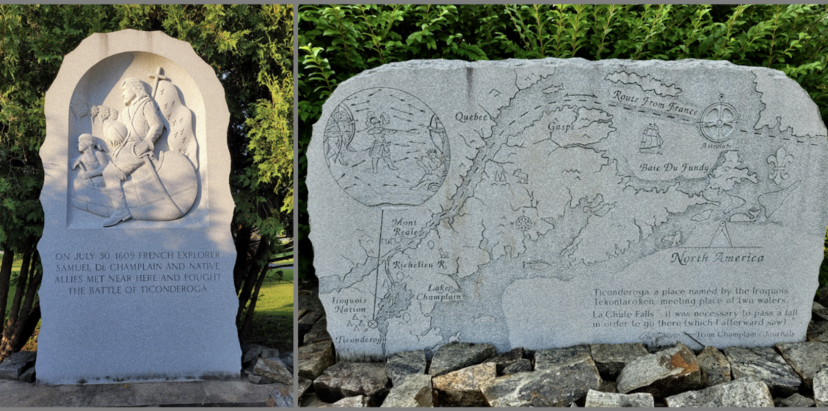
The memorial to Champlain in Ticonderoga is a three-part granite monument sculpted by George Kurjanowicz at Champlain Legacy Park, with a central monument erected for the 400th Samuel de Champlain Celebration in July 2009 by the Ticonderoga Historical Society, and two "wings" added later. The monument complex tells the Champlain story and commemorates the "Battle of Ticonderoga" in July 1609 between Champlain and his French Indian allies against the Iroquois near what is now Fort Ticonderoga.
Monument, “Samuel De Champlain”
Champlain Legacy Park
Rogers Street and Canal Heights, Ticonderoga NY 12883
GPS: 43.850250, -73.419267
• Inscription:
(Center tablet):
“On July 30, 1609 French Explorer Samuel de Champlain and native allies met near here and fought the Battle of Ticonderoga”
(Right tablet):
“Born around 1567 in the coastal town of Brouage, France, young Samuel de Champlain grew into a remarkable man expert in many fields. He was a Soldier by profession, a Mariner in passion, yet known best as an Explorer, the first to step foot in our area.
As a Mapmaker, he set new standards with his precision and detail.
As a Naturalist, he planted experimental gardens and introduced roses into the New France.
Champlain was a Humanist with an intense interest in and a sympathetic respect for other peoples’ differences. He befriended the Algonquin speaking Indians enjoying peaceful cohabitation.
As a Visionary, he found Lake Champlain to be a special place, beautiful and peaceful, full of hope and promise, and named it after himself. In fostering of good relationships, he was unique in encouraging new cultural understanding and stood stalwart for Peace though Diplomacy.
Samuel de Champlain, a extraordinary man is celebrated for his principles as a Leader, his unequaled honesty with Native Americans and Europeans alike, and is remembered as the father of New France.”
(Left tablet ): Ticonderoga, a place named by the Iroquois "Tekontaró:ken", a meeting place of two waters. La Chute Falls "it was necessary to pass a fall in order to go there (which I afterward saw) -- from Champlain Journals”
Marker, “Colonial Battles Fought in this Vicinity”
Sandy Redoubt, Ticonderoga, NY 12883
GPS: 43.848717, -73.401083
• Inscription:
A.D. 1900
“The Society of Colonial Wars in the State of New York erected this tablet to commemorate the colonial battles fought in this vicinity.
Champlain with Hurons and Algonquins defeated the Iroquois July 30, 1609 near the shore.
Montcalm defeated Abercrombie July 8, 1758 at the Assault of Fort Carillon or Ticonderoga.
Amherst captured the fort July 27, 1759.
Erected 1900 by Society of Colonial Wars in the State of New York.”
| |
Markers
Discovery of Lake Oneida, NY
October 8, 1615
| |
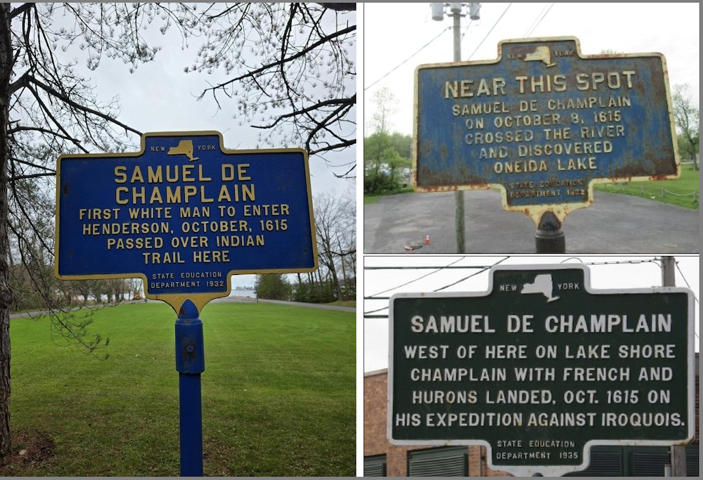
Above:
Left: Photo by Tasha Molnar, April 27, 2025, https://www.hmdb.org/m.asp?m=70476
Top Right: Photo by Anton Schwarzmueller, May 16, 2015, https://www.hmdb.org/m.asp?m=84162
Bottom Right: Photo by Bryan Olson, circa 2008, https://www.hmdb.org/m.asp?m=16051
| |
Marker, “Near This Spot, Samuel de Champlain”
Brewerton Road (U.S. 11 at milepost 0.1) and East River Road, Brewerton NY 13029,
GPS: 43.241233, -76.140833
• Inscription:
“Near this spot
Samuel de Champlain
on October 8, 1615
crossed the river
and discovered
Oneida Lake
Erected 1932 by New York State Education Department.”
Marker, “Samuel de Champlain”
NY State Route 178, Henderson NY 13650
GPS: 43.848200, -76.212167
• Inscription:
“First white man to enter Henderson, October, 1615
Passed over Indian trail here.
Erected 1932 by New York State Education Department.”
Marker, “Samuel de Champlain”
Pulaski town square, North Jefferson Street, Pulaski NY 13142
GPS: 43.566883, -76.127567
• Inscription:
“West of here on lake shore
Champlain with French and
Hurons landed, Oct. 1615 on
his expedition against Iroquois.
Erected 1935 by State Education Department.”
| |
Markers
Site of "Champlain Battle"
Canastota, NY
October 10-13, 1615
| |
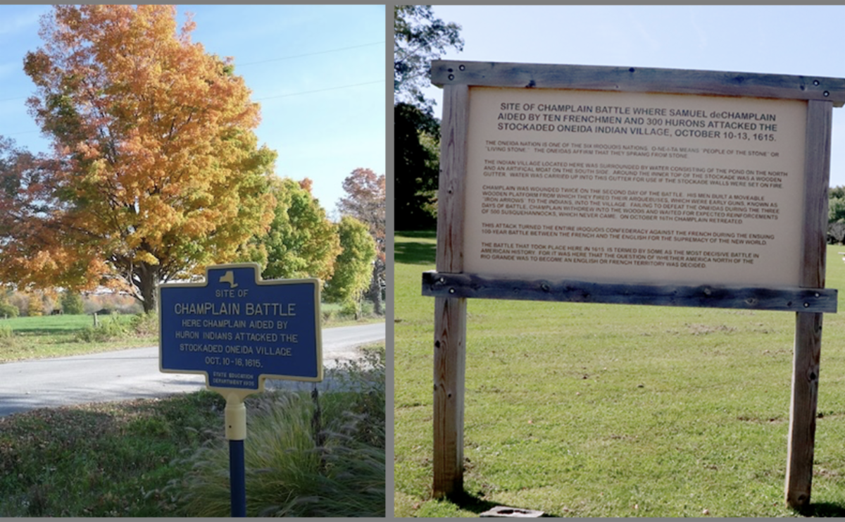
Above:
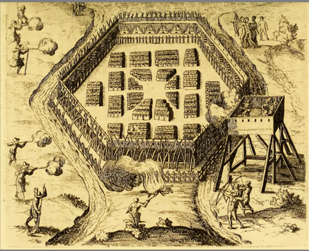
Top:: In 1615, Champlain attacked the Onontagués on the shores of Lake Onondaga, drawing by Samuel de Champlain from Les Voyages, op. cit. - Public domain, https://commons.wikimedia.org/w/index.php?curid=899873
Bottom Left: Marker, "Champlain Battle" Photo by Edward Henry, https://medium.com/@khp3655/forgotten-history-the-battle-of-nichols-pond-1e7ae6fb0fb7
Bottom Right: Sign, Site of Champlain Battle", photo https://www.oneidaindiannation.com/nichols-pond-remains-little-known-site-of-ancient-oneida-village/
| |
• On September 1, 1615, Champlain and northern tribes launched a campaign against the Iroquois from Cahiagué. They crossed Lake Ontario, traveled on foot via the Oneida River, and reached the main Onondaga fort on October 10. Champlain led 10 Frenchmen and 300 Wendat warriors in attacking the fortified village, but the assault failed under pressure for an early attack. Champlain was wounded in both legs by arrows, including his knee. The French-Wendat force retreated on October 16.
• The Wendat insisted Champlain winter with them. During a deer hunt, he became lost for three days before encountering other First Nations people.
He spent the winter learning their customs and way of life, then departed Wendat territory on May 22, 1616, returning to Quebec before sailing to France on July 2.
Marker, "Nicholas Pond Park"
5797 Nichols Pond Road, Canastota NY 13032
• Inscription (excerpts):
" [...] There is also substantial evidence that Nichols Pond was the site of a decisive battle where Samuel de Champlain aided by 10 Frenchmen and 300 Hurons attacked the stockaded Oneida Indian village October 10-16, 1615 [...] "
• In their official website, the Oneida Nation disputes this assertion. "Many historians claim that Nichols Pond is the site of Samuel de Champlain’s infamous 1615 battle with the Onondaga, but there is strong evidence against this conclusion. Despite having found no metal fragments from bullets or any evidence along those lines, many cling to the idea that this could have been his battle site. Unfortunately, many stories and artifacts have been fabricated or manipulated to align or support this idea, sometimes leading to frustrating attempts by some scholars to put this “story” to rest once and for all."
• The significance of this action, in military parlance - one would hesitate to call it a battle - is somewhat overstated in the marker below.
Battle sign, “Site of Champlain Battle”
5901-5753 Nichols Pond Rd, Canastota, NY 13032
GPS: 43.002700, -75.741700
• Inscription:
“Site of Champlain Battle where Samuel de Champlain aided by ten Frenchmen and 300 Hurons attacked the stockaded Oneida Indian Village, October 10-13, 1615.
The Oneida Nation is one of the six Iroquois Nations. O-NE-I-TA means "People of the Stone" or "Living Stone." The Oneidas affirm that they sprang from stone.
The Indian village located here was surrounded by water consisting of the pond on the north and an artificial moat on the south side. Around the inner top of the stockade was a wooden gutter. Water was carried up into this gutter for use if the stockade walls were set on fire.
Champlain was wounded twice on the second day of the battle. His men built a moveable wooden platform from which they fired their arquebuses, which were early guns, known as "iron arrows" to the Indians, into the village. Failing to defeat the Oneidas during the three days of battle, Champlain withdrew into the woods and waited for expected reinforcements of 500 Susquehannocks, which never came. On October 16th, Champlain retreated. This attack turned the entire Iroquois Confederacy against the French during the ensuing 100-year battle between the French and the English for the supremacy of the New World.
The battle that took place here in 1615 is termed by some as the most decisive battle in American history. For it was here that the question of whether America north of the Rio Grande was to become an English or French territory was decided.”
Marker, “Site of Champlain Battle”
5901-5753 Nichols Pond Rd, Canastota, NY 13032
GPS: 43.002700, -75.741700
• Inscription:
“Here Champlain aided by Huron Indians attacked
the stockaded Oneida Village Oct. 10-16, 1615
Erected 1935 by State Education Department.”
There are dozens of additional statues and markers in today's Canada, of course, which fall outside the scope of this Bulletin.
In the United States, there are also several markers that mention Champlain, often in conjunction with his companions. We will therefore introduce them in the pages below.
But before we do, we are including this marker in the State of MIchigan, showing the extent of his explorations deep inland around the Great Lakes.
| Exploration of Lake Huron, Michigan | |
Above:
Illustration: Carte des Cinq Grands Lacs du Canada by Jacques-Nicolas Bellin - Michigan State University, Public Domain, https://commons.wikimedia.org/w/index.php?curid=43449302
| |
• Lake Huron was originally called “La Mer Douce”, or “the freshwater sea,” by French explorers.
• It later got its name from the Huron people who lived along its shores. It forms the eastern outline of Michigan's "Mitten," including the distinctive "Thumb" which is dotted with port towns and shelters Saginaw Bay.
Marker “Lake Huron”
Huron Dunes Roadside Park, Millersburg MI 49759
GPS: 45.589750, -84.163500
• Inscription:
“This, the fifth largest lake in the world, was the first of the Great Lakes seen by white men. By following the Ottawa River route, Samuel de Champlain in 1615 came to the “Freshwater Sea.” It was half a century before the French fully understood the lake’s size. Lake shipping has swelled immensely since the Griffin’s solitary voyage in 1679. Much of the shore is still as wild as when the Huron Indians were the only travelers on the lake.”
“Michigan Historical Commission Registered Site No. 119”
Erected 1957 by Michigan Historical Commission. (Marker Number 119.).”
| |
Some of Champlain's companions
during the first expedition
Pierre Dugua de Mons
| | |
• At the beginning, Champlain was "only" a cartographer. The actual leader of the expedition of 1604 was Pierre Dugua de Mons (also known as Du Gua de Monts; around 1558 – 1628) was a French Calvinist merchant, explorer, and colonizer who established the first permanent French settlement in Canada. He served as Lieutenant General of New France from 1603-1610.
• Born in Royan, Province of Saintonge, France, de Mons supported Henri IV during the religious wars and was rewarded with a pension and governorship of Pons. In 1603, the king granted him exclusive colonization rights for North America between 40° and 60° North latitude, plus a fur trade monopoly.
• In 1604, de Mons led 79 settlers to establish a colony on St. Croix Island in the Bay of Fundy. After a disastrous winter with many deaths from scurvy, the colony relocated to Port-Royal in 1605. The settlement survived until 1607, when merchants' objections led to the revocation of de Mons' monopoly, forcing the colonists to return to France.
• De Mons then focused on the St. Lawrence valley, sending Champlain to establish Quebec in 1608. He never returned to the New World but significantly contributed to creating France's first permanent North American colony. He later served as Governor of Pons until retiring in 1617 and died in 1628 at the Château d'Ardenne in Fléac-sur-Seugne.
| | |
• François Gravé Du Pont (Saint-Malo, November 1560 – 1629 or shortly after), known as Du Pont (or Le Pont, or Pontgravé...) was Champlain's mentor. He was a French navigator, fur trader, and explorer in New France. A former military man turned merchant, he began trading furs in Canada possibly as early as 1580. In 1599, he established a trading post at Tadoussac with Pierre de Chauvin.
• In 1603, Du Pont returned with Samuel de Champlain, forming important alliances with the Montagnais Innu people and exploring the Saint Lawrence River. In 1608, while attempting to enforce a trade monopoly, he was severely injured in a conflict with Basque and Spanish traders, though Champlain later brokered peace.
• Du Pont continued trading expeditions to the Saint Lawrence from 1608 to 1629. His son notably deserted his duties to live among indigenous tribes, leading to various conflicts and reconciliations with colonial authorities between 1610-1611.
| | |
Jean de Biencourt, baron de Poutrincourt
&
Claude de Saint-Étienne de la Tour
| | |
• Jean de Biencourt, baron de Poutrincourt et de Saint Just (1557-1615) was a French nobleman who played a key role in establishing early French settlements in North America. He participated in Pierre Dugua de Mons' 1604 expedition that founded the first colony on Saint Croix Island, later moved to Port-Royal in Acadia in 1605.
• Appointed governor of Port-Royal in 1606 with fur trading and fishing rights granted by King Henri IV, Poutrincourt oversaw the colony until French support was withdrawn in 1607.
• Poutrincourt made another trip to Acadia in 1610, accompanied by his son Charles de Biencourt de Saint-Just, Claude de Saint-Étienne de la Tour, and his son Charles de Saint-Étienne de la Tour.
Port-Royal was re-established and thrived until it was destroyed by a British raid in 1613.
After the destruction of Port-Royal, Poutrincourt returned to military service in France, where he became embroiled in a dynastic conflict involving Henri IV's widow, Marie de Medici, and Henri de Bourbon, Prince de Condé. In 1615, Poutrincourt lost his life in a battle for control of the town of Méry in the Champagne region.
• Fort Pentagoët was a French fort established in present-day Castine, Maine, which was the capital of Acadia. It is the oldest permanent settlement in New England. Fort Pentagoët is also known as Fort Pentagoet, Fort Pentagouet, Fort Castine, Fort Penobscot, Fort Saint-Pierre.
Marker, “Fort Pentagoet”
Pentagoet Park, 131 Perkins St, ME 04421
GPS: 44.384627, -68.803350
• Inscription (excerpts):
“Originally a trading post, built during the winter of 1613 by Sieur Claude de Turgis de la Tour. It became [...] the first permanent settlement of New England [...]. restored to France by the Treaty of Saint-Germain and by force of arms in 1635. It was entirely reconstructed by Sieur Charles de Menou d’Aulnay de Charnizay (1636-45) who made it one of the largest and most formidable fortifications in the New World, named by him Fort St. Peter [...] Under the dominion of France 1613-28, 1635-54, 1670-74, 1676-1745 [...] It became the seat of government of Acadia in 1670 and four years later the province of New Hollandia, the capture of which by baron de St Castin, November 1676, ended the Dutch authority in America [...] rebuilt much smaller in 1677 by baron Jean-Vincent d’Abbadie de Saint Castin, and thenceforth known as Castin’s Fort [...] finally demolished by Castin’s sons (1745) to prevent its coming under English. control. Possession of the locality was thus retained until 1760 [...]”
| | |
Mathieu de Coste
The first free Black man in New France
&
Rev. Nicolas Aubry
A Catholic priest in wilderness
| | |
The first free black man in Canada:
• Mathieu da Costa (also known as de Coste in French documents, or d'Acosta) (fl. 1589–1619) was an Afro-French member of the exploration team led by Pierre Dugua, the Sieur de Monts, and Samuel de Champlain. They traveled from France to the New World in the early 17th century. He is recognized as the first recorded free black individual to set foot in what is now Canada.
• There is limited information available about Mathieu da Costa. He is believed to have partial African ancestry and was a freeman who was valued by explorers for his ability to speak multiple languages. Many mixed-race African-Portuguese individuals were part of the Atlantic Creole generation, often serving as sailors or interpreters.
• It is thought that he spoke several languages, including Dutch, English, French, Portuguese, Mi'kmaq, and pidgin Basque, which was commonly used by Indigenous peoples for trade.
• In February 1607, Mathieu da Costa was in Amsterdam, Holland. It appears that the Dutch had taken Pierre Du Gua de Monts's ships near Tadoussac on the St. Lawrence River during a trade conflict, and they also took Mathieu. His capture suggests that his skills were crucial in connecting Europeans with the First Nations of Canada. It is believed that he was kidnapped.
• French records show that da Costa worked for the leaders of Port Royal in 1608. That same year, he was contracted for three years by Pierre Du Gua de Monts. It is likely that Da Costa joined Du Gua de Monts and Samuel de Champlain on some of their journeys to Acadia and the St. Lawrence region. However, in 1609, he is noted to have been in Rouen, France, and later in a jail in Le Havre, France, in December. It remains uncertain whether he traveled to Canada that year. Du Gua's endeavors in Canada continued until 1617.
Da Costa's free status and professional role as an interpreter made him quite different from the typical experience of many Africans in the Americas during that period. His story represents an important but often overlooked aspect of early North American colonial history, showing that not all Black individuals in the early colonial period were enslaved.
• Streets in Montreal, Quebec City and Halifax have been named after Mathieu da Costa. And a francophone primary school in Toronto. But best of all, Canada Post created a stamp with his picture.
There were also two Catholic priests and a Protestant minister among the first settlers:
• Father Nicolas Aubry was a French Catholic priest who served as one of three clergy members accompanying Pierre Dugua, Sieur de Monts on his colonizing expedition to Acadia in 1604. The religious contingent also included another Catholic priest designated to minister to the planned parish at Port Royal, and a Protestant minister—a reflection of the religious tensions of early 17th-century France. The expedition, which included the renowned cartographer Samuel de Champlain and 77 other settlers, was among the earliest sustained European attempts to establish a permanent settlement in what would become the Maritime provinces of Canada.
• Aubry's most remarkable experience in Acadia was a harrowing survival ordeal when he became lost in the dense forests around Baie Sainte-Marie (Saint Mary's Bay) in present-day Nova Scotia. For sixteen grueling days, he survived alone in the wilderness, likely subsisting on berries and roots while battling exposure and wild animals, until a fisherman rescued him from the shores of the Bay of Fundy.
• Following his recovery from this traumatic experience, Aubry returned to France, presumably having had enough of colonial life in the challenging New World. The historical record of his life becomes sparse thereafter, with the last documented reference to Nicolas Aubry appearing in 1611, leaving his ultimate fate unknown to history.
• History has not recorded the name of the other Catholic priest, nor the Protestant clergyman, except for frequent altercations between them during the Atlantic crossing...
| | |
Etienne Brulé
"The Columbus of the Great Lakes"
| | |
Above:
Left: Interpretative marker, “The Great Cataract" Niagara Falls, NY
Photo: TC © ASSFI 2024
Right: Étienne Brûlé at the mouth of the Humber River, by F. S. Challener
Oil on canvas 166.4 cm x 135.9 cm, Government of Ontario Art Collection, 619849, https://www.archives.gov.on.ca/en/access/franco-ontarian.aspx
| | |
• The French explorer Etienne Brûlé (often written Brulé, or Brule, c.1592 – c.June 1633) was the first European to go beyond the St. Lawrence River. He has been dubbed the “Columbus of the Great Lakes”. Brûlé became an interpreter and guide for Samuel de Champlain, who later sent Brûlé on a number of exploratory missions. Brûlé probably visited four of the five Great Lakes — Lake Huron, Lake Superior, Lake Erie, Lake Ontario — and may have also seen Lake Michigan. He lived 20 years with the Hurons and was the first white European to complete these expeditions across North America. He died massacred by a Huron tribe who had initially welcomed him in their midst.
• Here is a selection of markers that memorialize this intrepid scout at Champlain's service:
Marker, “The Village of Charlotte”
366-384 River St, Rochester, NY 14612
GPS: 43.249389, -77.611944
• Inscription (excerpts):
[...] “Although the Port of the Genesee has become the Port of Rochester, lakeside Charlotte maintains its "village" atmosphere.
1000-1800 Native Americans hunt and fish along the banks of the Genesee.
1612 Champlain's scout, Etienne Brule, is the first white man to visit Genesee Country.
1669 Explorer Robert de la Salle comes to Irondequoit Bay seeking a route to the Ohio River Valley.. [...]
1816 Lesueur sketches the port and hamlet of Charlotte.” [...]
Marker, “The Great Cataract of Niagara”
Niagara Scenic Parkway, Niagara Falls, NY 14304
GPS: 43.077650, -79.016300
• Inscription (excerpts):
Early European Visitors
The Niagara River, with its mighty falls and rapids, was well known by Native Americans. Word of its majesty reached European explorers and soldiers who came to North America. Despite their mission, explorers and soldiers alike took time to see the watery spectacles for themselves.
1615 Etienne Brule, a French explorer may have been the first European to actually view the Falls and gorge.. [...]
Erected by Seaway Trail, Inc
Marker “Lake Superior”
Sand Dunes Dr, Mohawk, MI 49950
GPS: 47.444133, -88.216850
• Inscription (excerpts):
“Lake Superior was discovered in 1629 by the French explorer Brule. Largest expanse of fresh water in the world. The water of Lake Superior is chemically pure. Area 31,800 sq. miles; 1500 miles of coast; greatest length, 350 miles; greatest breadth, 160 miles; greatest depth, 1333 feet; 602 feet above sea level; about 21 feet above Lake Huron...[...]
...The freighters you see passing this point carry more tonnage each season than the combined tonnage of the Panama, Kiel and Suez canals.”
“Erected 2012 by Keweenaw County Road Commission
| | |
Champlain's last will
and resting place mystery
| | |
Above:
Top Left: Last will of Samuel Champlain done in Québec on November 17, 1635, first page. This file was provided to Wikimedia Commons by the Archives Nationales as part of a cooperation project with Wikimédia France., Public Domain, https://commons.wikimedia.org/w/index.php?curid=35203007
Top Right: Buste de Samuel de Champlain, Place du Canada, 75008 Paris, near the Grand-Palais
48.865100, 2.310700. Photo: TC © ASSFI 2017
Bottom: Panel at Basilique-Cathédrale Notre Dame de Québec. Photos: TC © ASSFI 2020
| | |
• Inscription:
"During the English occupation by the Kirke brothers from 1629 to 1632, Champlain promised to build a chapel “if the country were recovered”. Upon his return to Québec, he ordred the construction of a wooden chapel. In 1635, his body may have been laid to rest here before being movedto another chapel named “Chapelle de Champlain”, built in 1636. In 1640, a fire destroyed the two chapels and the rectory. Since the 19th century and until only recently, amateur and professional researchers and archeologists have searched in vain for Champlain’s tomb.”
| | Champlain's work as Founder of New France | | |
As noted above, the numerous sites in Canada memorializing Champlain fall outside the scope of our Bulletin. Still, we cannot leave this great man without summarizing the immense work done by him up North, up to his passing on Christmas Day 1635 in Québec.
• After Samuel de Champlain became administrator of New France around 1612, he dedicated himself to establishing a permanent French presence in North America through systematic colonization and exploration. He founded Quebec City in 1608, which became the capital and cornerstone of New France, and worked tirelessly to develop trade relationships with Indigenous peoples, particularly focusing on the lucrative fur trade. Champlain led numerous expeditions into the interior, mapping vast territories including the Great Lakes region, and establishing alliances with various Indigenous groups such as the Huron, Algonquin, and Montagnais, though these alliances also drew the French into conflicts with the Iroquois Confederacy.
• Throughout his tenure until his death in 1635, Champlain faced constant challenges including limited financial support from France, harsh winters, disease outbreaks, and ongoing warfare. He worked to attract settlers and establish sustainable agricultural communities, though New France's population remained small compared to English colonies to the south. Champlain also promoted Catholic missionary work among Indigenous peoples and attempted to create a society that blended French and Indigenous cultures. His detailed maps, journals, and ethnographic observations of Indigenous peoples became invaluable historical records. When he died on Christmas Day 1635 in Quebec, Champlain left behind the foundation of what would become the French colonial empire in North America, having transformed New France from a precarious trading outpost into a more established colonial presence.
| | |
“Samuel de Champlain was one of the greatest pioneers, explorers and colonists of all time.....the most versatile of colonial founders in North America; at once sailor and soldier, writer and man of action, artist and explorer, ruler and administrator.” – Historian Samuel Eliot Morison, "Samuel de Champlain: Father of New France", Little, Brown & Company, 1972
Champlain's lasting legacy
• Numerous sites and landmarks are named in honor of Champlain, a key figure in various regions of Acadia, Ontario, Quebec, New York, and Vermont. Known as the "Father of New France" and "Father of Acadia", his historical importance remains relevant today.
There are too many places and monuments to list in Canada. Just in the United States:
Geographical sites:
- Lake Champlain, Champlain Valley, the Champlain Trail Lakes, NY State
- Champlain Mountain, Acadia National Park, Maine
Streets & Urban Features:
- Lake Champlain Bridge, NY-VT
- Champlain Avenue Patchogue, NY, USA
- Champlain Avenue West Hempstead, NY, USA
- Champlain Square Teaneck, NJ, USA
- Champlain Drive Hopewell Junction, NY, USA
- Champlain Road Carmel Hamlet, NY, US
Administrative/Political Divisions:
- Champlain in New York State
Educational Institutions:
- Champlain College, Burlington, Vermont
US Navy ships:
- USS Lake Champlain (1917): A cargo ship in service from 1918 to 1919.
- USS Lake Champlain (CV-39): An Essex-class aircraft carrier that served from 1945 to 1966.
- USS Lake Champlain (CG-57): A Ticonderoga-class guided-missile cruiser in service from 1988 until its decommissioning in September 2023.
Commercial/Hospitality:
- Hotel Champlain Burlington, Curio Collection by Hilton in Burlington, Vermont
Monuments & Statues:
- Memorial statues in Plattsburgh NY, Isle La Motte VT, Burlington, VT, Ticonderoga NY, Burlington, NY
- Lighthouse statue at Crown Point, NY
Organizations & Societies:
- The Champlain Society (historical publication society)
Commemorative Items:
- Joint US-Canada commemorative stamp (2006)
• The memorials span a wide geographic range and represent various ways communities have chosen to honor Samuel de Champlain's legacy, from natural landmarks to educational institutions to public monuments.
Ah, and these maps!... The amount of details and the hours of labor they represent are simply astonishing. We invite you to click on all our selected illustrations to access them in large format.
| | |
Above:
Geographical Map of New France Made by Mr. de Champlain of Saintonge, Ordinary Captain for the King's Navy, Champlain, Samuel de, 1567-1635 Creator, Pelletier, David Engraver, Paris, 1612, Library of Congress online catalog, https://lccn.loc.gov/2021668652
| | |
Excerpts from the Library of Congress commentary notice:
"Presented here is the magnificent map of the country that Champlain showed to the king. [...] In 1612 Champlain had the map engraved for inclusion in his account of his travels, which was published by Jean Berjon the following year. Oriented to the magnetic north (that of the compass) rather than the geographical north (indicated by the oblique line across the map), the map highlights the places Champlain visited, including the coasts of Newfoundland and Acadia (present-day Nova Scotia) and the Saint Lawrence River and its main tributaries.[...]
The map also indicates the areas inhabited by different Native American tribes at the time: the Iroquois south of Lake Champlain, the Montagnais on the south bank of the Saint Lawrence River, the Algonquins on the Ottawa River, the Etchemin and Souriquois on the Atlantic coast, and the Hurons in the Great Lakes region. On the bottom border, as well as elsewhere on the map, are depictions of plants, fruit, vegetables and sea animals showing the untapped riches of this land that the French were claiming. Two Native American couples also are portrayed in poses typical of the time."
| | |
PART TWO
Tribute to the American Volunteers
who joined the Lafayette Flying Corps:
We continue our series started in October 2023 with individual tributes to members of the Escadrille Lafayette, later part of the Lafayette Flying Corps. To access our Bulletin dedicated to the Escadrille Lafayette, visit:
https://conta.cc/3Qz0Xjl (original version in English)
https://conta.cc/3QCRqYM (version en français)
This month we are paying tribute to another volunteer who fought for freedom and democracy:
Sergent Edward J. Loughran
"Mort Pour la France"
18 Feb 1918 (aged 24)
Minaucourt-le-Mesnil-les-Hurlus,
Departement de la Marne, Champagne-Ardenne, France
Note*: "Mort pour la France" meaning "Died for France," is a legal term in France. It is an honor given to those who lost their lives in conflicts while serving the country. This phrase appears on their death certificates. Both French citizens and foreign volunteers can receive this recognition.
| | |
Above:
Top Left: Left: Source: "The Lafayette Flying Corps: The American Volunteers in the French Air Service in World War One," by Dennis Gordon. Schiffer Military History, Atglen, PA: 2000. Page 284,
Top Right: Livret Militaire, https://www.memoiredeshommes.sga.defense.gouv.fr/fr/ark:/40699/m005239f4b618961/5242befe312ceMiddle Left: Passport photo 1916 Added by Rachel Reeves Wilson, https://www.findagrave.com/memorial/175355703/edward-james-loughran
Middle Right: From the Daily Arkansas Gazette newspaper, 24 Feb 1918.
Bottom Left: The National Necropolis of Minaucourt-le-Mesnil-lès-Hurlus, Marne, Photo by Lomita - Own work, CC BY-SA 4.0, https://commons.wikimedia.org/w/index.php?curid=61537647
Bottom Right: “Found on the reverse of a Food Administration news clipping for Randolph County, Arkansas and shared here for this pilot's surviving family descendancy. Thank you for your service Edward.” Commen and photo added by Eric Jelle on 13 Jun 2017, https://www.findagrave.com/memorial/175355703/edward-james-loughran
| | |
• Edward J. Loughran was born in 1893 in Harlem, New York City, to James Patrick Loughran, a saloon keeper. Growing up in a large family, Loughran had limited opportunities for education. He and his brothers began working at a young age. When World War One started, he was employed as a railroad section hand alongside his brother, Edward, in Desoto, Kansas.
• Loughran left Kansas to join the Great War. He served with the American Red Cross in France for six months before enlisting in France's Service Aeronautique on 20 March 1917. From 27 March to 26 October 1917, he attended aviation school at Avord, Pau, and the G.D.E. He earned his brevet on the Caudron airplane on 31 August 1917.
• On 29 October 1917, Caporal Loughran was assigned to the Front with Escadrille Spad 84. He flew with that squadron diligently, even skipping leave, until he was killed in combat on 18 February 1918, southeast of Minaucourt.
• On that day, while returning from a morning reconnaissance patrol, Sergent Loughran's SPAD was attacked by three enemy fighters. During the fight, Loughran was wounded but managed to reach Allied territory and began a normal descent. However, just 500 meters from the ground, his aircraft suddenly nose-dived and crashed violently just behind the French defenses south of Minaucourt.
• Sergent Loughran's body was retrieved from his plane and he was buried in the war cemetery at Mont Frenet. He was 24 years old when he died.
• In 1928, his remains were moved to the Lafayette Flying Corps monument at Marnes-la-Coquette near Paris.
| | |
PART THREE
NEWS, ANNOUNCEMENTS & SAVE THE DATES
Photo Album
Bicentennial Lafayette's Farewell Tour
A selection of July 2025 Events
General Lafayette in
New Jersey, Maryland, Pennsylvania
All photos and captions from https://www.facebook.com/AmericanFriendsofLafayette
| | |
Lafayette, Human Rights Champion
Symposium at Morris County Library
Whippany, N.J.
July 14, 2025
| | |
The Lafayette 200 Symposium…
and what the human rights champion might say in 2025
"Part 1 features Alan R. Hoffman, president of the American Friends of Lafayette (AFL), nonprofit organizers of a 13-month re-creation of Lafayette’s 1824-25 farewell tour.
Lafayette successfully lobbied for the manumission of his own slave, James, a double-agent in the American Revolution, and publicly embraced him, a highly unusual gesture at the time, Hoffman says.
https://youtu.be/56-kBo-NZq0
Part 2 begins with “A Sanctuary for the Rights of Mankind”: Lafayette and Human Rights, a talk by Diane Windham Shaw, curator emerita of the Lafayette Collections at Lafayette College.
Shaw notes how a Native American tribe in Alabama welcomed Lafayette as “White Father” and “Envoy of the Great Spirit.” He was a “proto-feminist,” too, Shaw says, and he pushed Catholic France to expand the rights of Protestants and Jews.
https://youtu.be/kdKNjUl1MbI
“I shall ask for abolition of the penalty of death,” Lafayette wrote in 1830, “until I have the infallibility of human judgment demonstrated to me.”
Shaw is followed on the video by a lively panel discussion and audience Q & A. Panelist Leslie Bramlett, portraying enslaved cook Hannah Till, says Washington promised to free Till at the war’s conclusion, as insurance that he would not be poisoned.
Speaker Diane Shaw is followed by a panel discussion around the 33-minute mark, when Wendy York introduces emcee Chuck Schwam, executive director of the AFL. "
Complete article: https://morristowngreen.com/.../video-the-lafayette-200.../
Text: The American Friends of Lafayette
Note : James Armistead was an enslaved African American who served as a double agent for the Continental Army during the Revolutionary War, providing crucial intelligence while pretending to spy for the British. He was not owned as a slave by Lafayette.
Lafayette Visits Chadds Ford, PA
July 26, 2025
| | |
"Historic Rock Ford observed Lafayette Day on Monday in remembrance of Lafayette’s July 1825 visit to the daughter of Gen. Edward Hand. Hand, a physician who also became a brigadier general in the U.S. military, commanded a light-infantry brigade under Lafayette in the war. Monday’s event included the arrival of a historical interpreter portraying Lafayette — being greeted in his carriage under a recreation of an 1825 triumphal arch — along with fife-and-drum performances, historical presentations, reenactors, music, children’s activities and more.
The Lafayette200 tour of 24 U.S. states, mirroring Lafayette’s 1825 visit, moves on to Maryland after today’s Lancaster County sendoff ceremony at Drumore Estate in Pequea."
Full article and source: https://lancasteronline.com/.../collection_7db9beaf-9025...
See the reel at : https://www.facebook.com/reel/1265729658398137
Photos by Denise Tuft - Text: The American Friends of Lafayette
Lafayette at Brandywine Battlefield
July 26, 2025
| | |
"On Saturday, we commemorated Lafayette’s July 26, 1825 return to the Brandywine Battlefield, where he was wounded during the Battle of Brandywine on September 11, 1777.
The day began at 11:00 a.m. with a special program—including an appearance by Lafayette himself—followed by a heritage walk to the very site where he was injured while fighting alongside American troops.
Later in the day, just as in 1825, we honored his visit to West Chester, where Lafayette was once welcomed with a grand dinner. It was a powerful day of remembrance, reflection, and Revolutionary War history brought to life.
Photos by Morgaine Mary Beck and Missy Smith
See the reel at: https://www.facebook.com/reel/1101622738566781
THORNBURY—On the exact day, Saturday July 26, 200 years later after a grand 1824-25 tour, Gen. Marquis de Lafayette triumphantly returned to Chester County and visited where he was wounded during the Revolutionary War at the Battle of Brandywine and later in the day visited, West Chester.
Revolutionary War landowner of Thornbury Farm and reenactor Randell Spackman led a tour of where 19-year old French General Lafayette was likely shot in the left calf but still managed to lead the troops to safety during a successful retreat in a losing effort for Washington’s Army in the longest and largest land battle in American Revolution.
Michael Halbert portrayed Lafayette at Thornbury Farm where British Troops had met on September 11, 1777, for an audience of about 350 history lovers."
Text: The American Friends of Lafayette
| | |
"Honoring the past at Brandywine!
A powerful moment as Lafayette was awarded the Pennsylvania Distinguished Service Medal, with an official citation from Governor Josh Shapiro and Adjutant General Pippy recognizing his enduring legacy and service during the American Revolution.
Brigadier General McGovern presented the medal alongside Chuck and our tireless Lafayette interpreter. The ceremony opened with the Pledge of Allegiance, grounding us in the values Lafayette helped fight for."
Text: The American Friends of Lafayette
Lafayette in Parkesburg, PA..
July 27, 2025
| | |
"On Sunday, July 27, the streets of Parkesburg, PA came alive with Revolutionary spirit during the Lafayette Bicentennial Parade!
From Valley Road to Main Street, spectators gathered to witness Lafayette’s triumphant arrival by horse and carriage, retracing his historic 1825 journey through the town once known as Fountain Inn.
Crowds lined the streets as Lafayette greeted the public, delivered a brief speech, and was warmly welcomed by local 1825 figures Col. Joseph McClellan and his wife, Keziah Parke McClellan.
Guests gathered at Historic White Chimneys in Gap, PA for a refined and memorable Lafayette Tea, honoring the Marquis and his 1825 visit to the region.
Attendees enjoyed a delightful afternoon of tea sandwiches, scones, pastries, and the signature Lafayette Spritzer, all served alongside period music and living history.
Lafayette arrived to warm applause, followed by remarks from both the Marquis and his wife, Adrienne. Guests also met 1825 host Amos Slaymaker and explored a historical display presented by Salisbury Township.
The event concluded with a ceremonial cane presentation and a processional as Lafayette departed for Lancaster—just as he did 200 years ago.
Photos by Morgaine Mary Beck"
Text: The American Friends of Lafayette
Lafayette in Lancaster, PA.
July 27, 2025
| | |
"On Sunday, July 27, history came to life at Lafayette Tower Park and the Lafayette Fire Company in Lancaster, PA—on the very grounds where General Lafayette reviewed troops in 1825!
Crowds gathered to witness the grand arrival of Lafayette, followed by stirring speeches, remarks from the Marquis himself, and a ceremonial troop inspection honoring the original event.
Guests then adjourned to the firehouse for historical displays and light refreshments—just as thousands once did to welcome this hero of liberty two centuries ago.
Photos by Morgaine Mary Beck"
Text: The American Friends of Lafayette
| | |
"On Sunday, July 27, guests stepped into the elegance of 1825 at the Bicentennial Candlelight Dinner & Period Ballheld at the beautifully restored Trust46 Building in Lancaster, PA.
The evening began with cocktails, followed by a French-inspired candlelight dinner catered by former White House Chef John Moeller—a fitting tribute to Lafayette’s legacy.
Guests then danced the night away at a graceful period ball, led by English Country Dance Caller Jenna Simpson with music by Mara Shea, Kathy Talvitie, and Bob Pasquarello.
It was a night of history, elegance, and celebration—just as Lancaster honored Lafayette 200 years ago.
Bravo to the amazing volunteers who put this event together! It is outstanding!
Photos by Morgaine Mary Beck"
Text: The American Friends of Lafayette
| | |
"On Monday, July 28, the Steinman Concert Hall at the Ware Center was filled with music, emotion, and Revolutionary spirit during A Summer Evening with Lafayette.
The powerful performance brought Lafayette’s life and legacy to the stage, featuring the Allegro Orchestra, Gospel Choir, MFE Community Choir, Central York Fife & Drum Corps, and special guest performer—Lancaster’s own James Wolpert.
Through story and song, the audience met key figures from Lafayette’s remarkable journey and experienced a heartfelt tribute to his enduring impact on liberty and friendship across nations.
Photos by Morgaine Mary Beck"
text: The American Friends of Lafayette
| | |
Lafayette in Port Deposit, MD.
July 29, 2025
| | |
"On Tuesday, July 29, downtown Port Deposit welcomed the return of General Lafayette—200 years after his historic Farewell Tour passed through the region in 1825.
Portrayed by Ben Goldman, Lafayette arrived in center square just as he did two centuries ago—at age 67! He was escorted from Lancaster by Chuck Schwam, Executive Director of the American Friends of Lafayette.
The afternoon began with a rousing performance by the Maryland Army National Guard Ensemble, setting the stage for this moving reenactment.
“This stop matters,” said Bill Baron, chairman of the Port Deposit event. “Lafayette traveled over 6,000 miles in 1824–25 and made a special point to pass through Cecil County and Havre de Grace after locals requested a visit.”
Lafayette’s legacy was remembered with the awe once reserved for celebrities: “Over 80,000 people came out to see him in New York,” Baron noted. “He was like a rock star of his time.”
Text: The American Friends of Lafayette
Lafayette in Havre de Grace, MD.
July 29, 2025
| | |
"General Marquis de Lafayette returns to Havre de Grace on the 200th anniversary of his original visit, on Tuesday, July 29.
By Brian T. Krista | bkrista@tribpub.com | Baltimore Sun Media
More photos of Lafayette at Concord Point Lighthouse. The American Friends of Lafayette
Thank you Pat Venturino Photography - Venture Photos"
Text: The American Friends of Lafayette
| | |
SAVE THE DATE
Lafayette's Farewell Tour
Bicentennial
River Edge, N.J.
August 24, 2025
| | |
Bergen County Historical Society:
The Nation’s Guest: General Lafayette’s Return Visit, 1824-1825
Celebration & Remembrance of Lafayette's Return Visit to the States when he toured all 24 states at the invitation of President Monroe including a visit to Gen. Enoch Poor's gravesite in Hackensack.
The event takes place at Historic New Bridge Landing August 24, 2025, 1-4:30 pm.
Story and Song with the Enslows and new exhibits, cooks in the kitchen.
1201 Main Street, River Edge, NJ
Visit our website for more info: www.bergencountyhistory.org
La Grange, Georgia,
September 5, 2025
| | |
The Final Lafayette Bicentennial weekend
Washington. D.C.
September 5-7, 2025
| | |
"There are two significant patriotic events that are free and open to the public and....
There is one (spectacular) event that still has plenty of room for more registrants due to the large capacity the venue has.
Saturday, September 6th at 2:00pm:
A ceremony at the brand new WWI Memorial in Washington D.C. It is here that we will partake in a ceremony at this spectacular new monument in our nations capital. Dignitaries from the French and American Military will be present and will address the gathered. Descendants of pilots from the Lafayette Escadrille will be on hand. We again will celebrate Lafayette's birthday as well as the ongoing friendship between France and the United States. The memorial is located at 1449-1455 Pennsylvania Ave NW
This event is free and open to the public.
Sunday, September 7th at 9:15am:
American Friends of Lafayette have been afforded a Public Wreath Laying at the Tomb of the Unknown Soldier at Arlington Cemetery.
This event is free and open to the public.
Sunday, September 7th at 1:30pm:
At Woodlawn Pope-Leighey House, 9000 Richmond Hwy, Alexandria, VA 22309 a panel discussion with three Lafayette's!!! Out of costume, you will listen to (and interact with) the three Lafayette interpreters that did a bulk of our work during the Bicentennial. Ben Goldman, Michael Halbert and Mark Schneider will all be there discussing the past thirteen months as they followed Lafayette's footsteps (as Lafayette !!). This should be a fun, educational and very interesting discussion as we have three Lafayettes in one room.
- General Admission: $20 per adult, $10 per student (K-12)
-
Tickets can be purchased by clicking: HERE
Text: Chuck Schwam, Executive Director and Chair, Lafayette Bicentennial, AFL
All other events are for AFL Members and many are sold-out. For more info, visit: Lafayette200.org
| | News from the "Merci Train" | | |
"Merci train" story: click above or: https://vimeo.com/18495973
• Our November 2022 Bulletin narrated the incredible story and ongoing legacy of the "Train de la Reconnaissance Française", affectionately called "The Merci Train" (November 2022: "The Merci Train, 49 boxcars of French gifts"
https://conta.cc/3OLtgJ3 (original version in English)
https://conta.cc/3VpKzRP (version en français)
• The Merci Train, the 40&8 National Box Car Association and many other local organizations, custodians of the various "Merci train" boxcars in several States are planning various events throughout the year. We invite you to check their respective websites and follow them on social networks. We express our admiration for the fantastic work they are doing and we are honored to help get the word out.
| | |
Above:
A very interesting exchange took place recently on the Facebook group. A group member shared these diagrams showing how military authorities planned transportation of troops and horses to the frontlines.
"As the journeys between the barracks and the front could be long, one might think that the general staff preferred that the soldiers travel seated. However, they were only wooden benches."
We invite you to check regularly the news posted on Facebook at:
https://www.facebook.com/groups/TheMerciTrain
and the 40&8 National Box Car Association at:
https://www.facebook.com/groups/natlboxcarassn
Administered by Merci Train expert historians and Veterans, these FB groups are very informative. Not only do they report on the progress of restorations such as the one in Utah, they post rare photos that are progressively turning up, from the U.S. as well as France, from descendants of SNCF rail engineers who participated in the Merci Train project. We are impressed by their meticulous attention to historical details. Nothing escapes their sharp eyes, and their knowledge is encyclopedic!
Congratulations to Alexis Kim and David Knutson for sharing your expert knowledge with volunteers and restorers around the nation.
| | |
ANNOUNCEMENTS
Exciting news from
Odell Rochambeau Museum
Greenburgh, NY
| | |
State funding being used to construct historic Revolutionary War exhibits; Nonprofit plans museum opening for 2026:
The nonprofit Friends of Odell House Rochambeau Headquarters will turn the historic house, long in disrepair, into a museum of Westchester's revolutionary war efforts with help from a $250,000 state grant secured by Senate Majority Leader Andrea Stewart-Cousins.
The museum, tentatively set to open in the spring of 2026, in time for nationwide observances of America's 250th birthday, will feature exhibits throughout the house's ten rooms, providing guests with an immersive and educational experience, telling the story of the house and its pivotal role in the Revolutionary War.
“It was my pleasure to deliver the funds needed to see this visionary museum project to completion,” said Majority Leader Andrea Stewart-Cousin. “Here in the Town of Greenburgh, we have a site as deeply rooted in our nation's founding as any in the country, and our community is blessed to have dedicated organizations like the Friends of Odell House Rochambeau Headquarters to serve as stewards of this remarkable historical resource. I look forward to seeing these exhibits completed when the museum opens to the public.”
Friends of Odell House Rochambeau Headquarters President Susan Seal said "I am so grateful to the Majority Leader for providing the key funding for the museum exhibits. The Senator has been our enthusiastic supporter from the very beginning and this major grant allows us to build modern, interactive and informative exhibits that will engage and excite visitors."
The Odell House dates to 1732 and served as headquarters for Gen. George Washington's French ally, Gen. Count de Rochambeau during the Revolutionary War. It was there, in 1781, that Rochambeau and Washington hatched the plan to march the Continental and French armies south from New York to Virginia to confront the British. Just a few weeks later, the pair led their forces to victory over British troops at Yorktown, effectively ending the war and securing American independence.
The house is named for Revolutionary soldier Col. John Odell, a key guide to Gen. Washington during the War. Odell purchased the property after the war ended and five generations of his descendants lived in the Hartsdale home. When the Town of Greenburgh took ownership in 2020 the work to transform it into a museum began.
Restoration of the house has been underway since 2021 and is nearly complete thanks in part to more than $2 million in funding from the New York State Department of Parks, Recreation and Historic Preservation and supported with a $500,000 grant from Majority Leader Stewart-Cousins. The museum will contain the many relics and historic artifacts which the Friends are meticulously cataloging for themed exhibits, with a goal to open to the public next spring.
Friends of Odell House Rochambeau Headquarters representatives who joined Majority Leader Stewart-Cousins are: President Susan Seal, Vice President Tom Hay, Secretary Vaneska Pasqua, Co-Treasurer David Seal, Communications Director Marc Cheshire, Sandy Morrissey, Ken Jones, Rob Pellegrino, Peter Marcus, Amelia Bucarelli and Bob Hermann.
Text & Photos: Odell House Rochambeau Headquarters
We Need Your Support!
The funding for our exhibits is not included in the restoration budget, so we need to raise funds to create a compelling, interactive museum within the house. The more we raise, the more exciting and informative the exhibits will be.
Please give what you can—and let us know if you have connections to organizations or individuals who could make major donations.
Click here to donate
If you want to donate by check, make it payable to Odell House Rochambeau Headquarters and mail it to OHRH, c/o Seal, 14 Rochambeau Drive, Hartsdale, NY 10530.
Thank you for your support!
| | |
Update on our restoration of
the Lapérouse Memorial
in Maui, Hawaii
Phase Two
| | |
La Pérouse Memorial, Maui, Hawaii
Off Makena Road, Kihei, HI 96753
GPS: 20.600745, -156.419877
Photo: Image capture Google maps
| | |
• After a couple of years, finally, the restoration of the Lapérouse Memorial is complete! Thanks to the generous support of Marc Onetto, Regional Delegate of Le Souvenir Français in the West Coast and keen admirer of this great explorer, the support of the Consulate General of France in San Francisco, as well as the support of Mr. Sumner Erdman, owner of Ulupalakua Ranch on which the monument is erected, our Society has completed the restoration on June 1st.
• The structure made of lava rocks was crumbling, and the bronze plaque had become illegible over the years.
Phase Two now underway: Interpretative marker
We are now working with a local signage manufacturer to install an illustrated interpretive marker explaining to the tourists who was Lapérouse, the scientific and peaceful purpose of his 1786 circumnavigation exploring the Pacific, Alaska and California, and notably his friendly relations with the natives of Maui. This signage is made possible by the generosity of Marc Onetto, Regional Delegate of our Society for the West Coast, and board member Jean-Hugues Monier.
A rededication in the presence of Mr. Laurent Bili, ambassador of France to the United States, and, we hope, the participation of the French and U.S. Navy, is in the planning stages.
| | |
The Hermione, "the Freedom Frigate",
A Call to Arms
| |
Photo: © Valerie Toebat, 2015
Why the Hermione Matters to America
The Hermione isn’t just any ship. Known as the “Freedom Frigate,” this vessel carried the young Marquis de Lafayette across the Atlantic in 1780 with news that would change the course of American history: France was officially joining our fight for independence.
Without Lafayette’s mission aboard the Hermione, the outcome at Yorktown—and American independence itself—might have been very different
A Living Monument to Freedom
Today’s Hermione is an exact replica of the original 18th-century frigate, rebuilt from 1997 to 2014 using traditional methods at the historic Rochefort shipyard in France. Over 5 million people witnessed this incredible reconstruction—the most complex wooden structure ever built in modern France. Since 2014, the Hermione has sailed over 22,000 miles, including a triumphant voyage to America in 2015 that celebrated the enduring bond between our nations.
The Crisis Is Real—And Urgent
Since September 2021, the Hermione has been in dry dock in France, undergoing critical hull restoration. The damage is severe due to a fungus infection of the solid wood in the hull, but fixable—if we act now.
The Numbers:
- Total restoration cost: $10 million
- Already secured: $5 million
- Still needed: $5 million
- CRITICAL DEADLINE: $1.5 million needed by September 2025 to resume work
- Goal: Return to sea by 2027
Without this funding, restoration stops, the Hermione dies. The ship that helped create America needs America’s help.
Our Call to Action
We call on:
- Elected officials to recognize the Hermione’s importance to American history
- American and French private citizens who value our common heritage
- Major donors and foundations committed to preserving history
- Veterans’ organizations that honor those who fought for our freedom
- Educational institutions that teach the story of American independence
Time Is Running Out
The Hermione carried Lafayette to America when we needed France most. Now America must answer the call to help preserve this symbol of our shared fight for liberty.
The time to act is NOW. Our heritage depends on it.
We Need $1.5 Million by September!
The Bottom Line
Join Americans, French citizens, and freedom-lovers worldwide in supporting the Hermione restoration. Together, we can ensure that future generations will see this magnificent vessel and remember the alliance that made American independence possible.
How to Help:
The Hermione saved American independence. Now we must save the Hermione.
- Corporations: Contact the Hermione-La Fayette organization for partnership opportunities.
- Individuals: Every contribution matters—from $10 to any amount you can afford.
- Politicians: Advocate for grants and official support
- Organizations: Rally your members around this historic cause
Don’t let the ship that helped win American independence sink on our watch.
A similar call for action was published in France and signed by hundreds of personalities and major sponsors. Sign this petition. Contact your representatives. Donate if you can. Share this message!
For more information, please contact: domitille@friendsoffdf.org
DONATE NOW
We thank all the leaders of American civic and patriotic organizations who accepted to add their names to the petition:
Richard A. Azzaro, Co-founder & President, Tomb of the Unknown Soldier Foundation • Thierry Chaunu, President, The American Society of Le Souvenir Français, Inc. • Lynn Briggs, Chairman, Washington Rochambeau Revolutionary Route-New York, Incorporated • Denise Doring VanBuren, Board Chair, The Doughboy Foundation, and Honorary President General, National Society Daughters of the American Revolution • William P. Dunham Jr., past President Mass Lafayette Society • Peter Feinman, Founder & President, the Institute of History, Archaeology, and Education • Daun Frankland, Daughters of the American Revolution, Virginia Chapter • Bonnie Fritz, Treasurer/Secretary, American Friends of Lafayette • Peter C. Hein, Secretary, Lower Manhattan Historical Association • Alan R. Hoffman, President, American Friends of Lafayette • Laura Ingenhuyff, Hawaii • James S. Kaplan, Chairman, Lower Manhattan Historical Association • W. Robert Kelly, Jr., Director, Gloucester (Virginia) Museum of History • Paul Jeffrey Lambert - President Williamsburg-Yorktown American Revolution Round Table • Dr. Patti Maclay, M.D., National Chair, Franco-American Memorial Committee, National Society Daughters of the American Revolution • Terri Mitchell, D.A.R., Franco-American Memorial Committee, National Division Vice-Chair, Northwestern Division • Pierre Oury, Colonel (ret), USAF • Lanny R Patten, Sons of the American Revolution of Pennsylvania, W3R • Michael Wingate Rhodes, Past-president, Richard Henry Lee Chapter, Virginia Society, Sons of the American Revolution • Ambrose M. Richardson, President, Lower Manhattan Historical Association • Mark Francis Schneider, Historian • Chuck Schwam, Executive director, & Bicentennial committee chair, American Friends of Lafayette • Susan & David Seal, Lafayette’65 • Joseph Studlick, Founding Director, Battle of Rhode Island Association • Dr John David Thornley, Alaska • Nicole G. Yancey, Honorary Consul of France in Virginia Emerita
| | |
Update on our
Projected sculpture of
Antoine de Saint Exupéry & The Little Prince
Phillip & Patricia Frost Museum of Science
Downtown Miami, Florida
| | |
Dear Friends of The Little Prince,
Generations of children -- and with them generations of adults -- have fallen under the spell of Antoine de Saint Exupéry’s The Little Prince since its 1943 publication. Appearing in over 600 languages to date, it is the most translated book of fiction in the world. Dozens of plaques and statues commemorate the Little Prince who touches down from his lonely planet to offer a bouquet of wisdoms to this one.
As an international city, very much a crossroads of the Americas, Miami surely deserves a monument to the Little Prince, that most endearing of cultural ambassadors.
The American Society of Le Souvenir Français, Inc., and the France-Florida Foundation for the Arts, both non-profit 501 (c) 3 organizations, are proposing a bronze sculpture of Saint Exupéry and his most beloved creation for the Phillip and Patricia Frost Museum of Science. The statue would be installed on the esplanade near the museum entrance, in the heart of downtown Miami.
The life-size bronze sculpture designed by renowned artist Jean-Marc de Pas will depict the aviation pioneer, WWII hero, poet, and novelist Antoine de Saint Exupéry in his flight suit, holding the hand of his “petit bonhomme”. Another de Pas sculpture currently sits along a wall opposite Central Park on Fifth Avenue in New York City. It has been an overnight success with the public, who have lined up daily for photos since its 2023 inauguration. We expect the same in Miami, especially at a museum and planetarium frequented by so many families and young children.
This project, a gift to one of Miami’s most vibrant cultural institutions, has received the official endorsement of H.E. Mr. Laurent Bili, Ambassador of France to the United States and Mr. Olivier d'Agay, President of the Antoine de Saint Exupéry Youth Foundation and grand-nephew of the author of The Little Prince. On behalf of our Honorary Committee, we are soliciting your tax-deductible assistance in underwriting the sculptures, along with their transportation and installation.
Any donation of $100 or more will be duly recognized. Names of donors above $1,000 will be engraved on a plaque to be installed inside the Museum, according to the following levels:
Bronze $1,000-$5,000 // Silver $5,000-$10,000 // Gold $10,000-$20,000 Platinum: $20,000 or more.
As of today, we have raised close to $70,000, however we still need $80,000 in order to have the sculpture completed and sent to the foundry. Four corporate donations of $20K are actively sought!
Please contribute what you can—and inform us if you know any organizations or individuals who might be able to make significant donations.
Please send your donation (specify: Petit Prince)
by ACH wire to:
The American Society of Le Souvenir Français Inc.
TD BANK - 1031 1st Avenue, New York, NY 10022
Routing # 026013673 - Account# 4326011741
Or by check, made payable to:
The American Society of Le Souvenir Français Inc.
500 East 77th Street #2017, New York, NY 10162
or via PayPal:
https://www.paypal.com/donate/?hosted_button_id=WP5E5SCTBTFMN
| | |
Announcing
The Rochambeau Monument Project
Meadowview Park, Middlebury, CT
2026
| | |
The Rochambeau Memorial Project
in Middlebury, Connecticut
Needs Your Help!
Middlebury’s Role in the American Revolution
The Rochambeau Monument Project is a major initiative of the Middlebury Historical Society, commemorating a pivotal moment in our town’s Revolutionary War history.
Timed to coincide with the 250th anniversary of the Declaration of Independence and the start of the Revolutionary War, the monument honors the French troops who marched through Middlebury in 1781 under the leadership of General Jean-Baptiste de Rochambeau. Their presence was part of the critical French-American alliance that helped turn the tide of the war. More than 2,000 of these soldiers died in the fight for American independence.
The monument will be installed at Meadowview Park in 2026.
This monument will honor the encampment of General Rochambeau’s French army in Middlebury on June 27-30, 1781 during their historic march to join General Washington.
As Ms. Alice DeMartino, Board Secretary of the Middlebury Historical Society wrote:
"What makes this monument especially distinctive is that it does not portray a general or statesman— instead, it honors the French foot soldiers themselves: the men who marched, suffered, and in many cases died for American independence. Their courage and sacrifice are too often overlooked. Our project includes a major fundraising effort, a commissioned sculpture by Tony Falcone, and educational materials for the public".
We invite you to visit our dedicated website to learn more:
https://www.middleburyhistoricalsociety.org/
A more detailed article and updates on this very exciting project will be forthcoming in our next bulletins. Stay tuned!
| | |
Fund-raising Appeal to help
a Memorial site
honoring American G.I.'s who died for
the liberation of Brest, Sept. 1944
To be inaugurated November 16, 2025
| | |
Announcement
from
Elite French Tutoring
| | |
Elite French Tutoring propose des cours de français personnalisés pour adultes et enfants, y compris les professionnels
internationaux, les diplomates et les familles sensibles à la culture.
Notre méthode associe immersion culturelle et expression orale, rendant le français vivant, accessible et enrichissant à tous les
niveaux.
For more information, please visit:
elitefrenchtutoring.com
| |
Announcement
from
The American Friends of Lafayette
Fine reproductions available!
| |
Above: Washington and Lafayette at Mount Vernon, 1784 By Louis Rémy Mignot / Thomas Prichard Rossiter c. 1859. - The Metropolitan Museum of Art, Public Domain, https://commons.wikimedia.org/w/index.php?curid=9526984
Good morning Friend of Lafayette...I have an amazing opportunity to share with you.
Are you looking to commemorate Lafayette's Grand Tour Bicentennial in your very own home? The American Friends of Lafayette are very proud to provide you with an opportunity to do so.
Today, we are pleased to announce the release of Historical Lafayette Giclee Prints. There are 25 different Lafayette-related images that are available in three different framing options (Archival Matte, Rolled Canvas or Gallery-Framed Canvas).
Please see all 25 images and ordering information on this two-page document that can be found by clicking: HERE
Now you can fill your home (or office) with images from the past...images of our hero...doing heroic things !!
Thank you and vive Lafayette !!
Chuck Schwam
Executive Director
Bicentenial Committee Chair
American Friends of Lafayette
| |
SAVE THE DATES
Westfield, N.J.
August 17, 2025
| |
Sixth Annual March to Yorktown Day Commemoration
Sunday, August 17, 2025
12:00 PM 4:00 PM
Mindowaskin Park
385 East Broad Street Westfield, NJ
This event celebrates the anniversary of the day Continental and French troops marched through Westfield, NJ, on Aug. 29, 1781, on their way to Yorktown, Va., where they would fight, lay siege to and force the surrender of Cornwallis. Thousands of troops led by Gens. Washington and Rochambeau crossed New Jersey on their way to Yorktown that August, and several columns passed through Westfield.
We recommend Nicholas Benevento's History Blog. Nicholas is bringing the history to the public using his history blog site. In the last 2 years, he has embraced to importance of the Franco-American friendship.
https://beneventoshistoryblog.com/
https://www.facebook.com/profile.php?id=100094160364324
https://www.instagram.com/beneventos_history_blog/
| |
Butts Hill Fort, Plymouth, R.I.
August 29, 2025
| |
The Butts Hill Fort Restoration Committee (BHFRC) of the Battle of Rhode Island Association (BoRIA) will hold a wreath-laying ceremony with a musket salute on the 247th anniversary of the Battle of Rhode Island on Friday, August 29th at 7:00 PM at Butts Hill Fort in Portsmouth, RI. We take this moment to remember and reflect on the events of that day in 1778. The ceremony will end at 7:30 PM. The public is invited and parking will be available at the Wealth Management lot on the top of Dyer Street off Sprague Street and the Portsmouth High School tennis courts.
The battle was tactically inconclusive, with both sides suffering significant casualties, but it ultimately ended with the British maintaining control of Aquidneck Island. Most historians call it a “stalemate.” Butts Hill Fort was the headquarters of patriot forces under the command of General John Sullivan.
Casualties (approximate): American - 30 killed, 137 wounded, and 44 missing.
British, Hessian and Loyalists - 38 killed, 210 wounded, and 12 missing.
If you're a reenactor and would like to participate please contact Jim Stearns, Director of Public Relations. publicrelations@battleofrhodeisland.org
| |
Yorktown, VA
September 20, 2025
| |
Colonial National Historical Park, along with WHRO Public Media, York County, the Jamestown-Yorktown Foundation, and the VA250 Commission, is hosting a free special screening of Ken Burns's upcoming documentary "The American Revolution" on Saturday, September 20, 2025, at the historic Yorktown Battlefield. The event will feature exclusive, never-before-seen excerpts from the film that focus specifically on the Siege of Yorktown, offering attendees a unique preview of this pivotal moment in American history before the full documentary premieres on PBS on November 16.
Prior to the screening, visitors can enjoy the Revolutionary Festival with engaging activities and live music suitable for all ages. The event is rain or shine and registration is highly recommended. Attendees should bring lawn chairs, water, flashlights, bug spray, and sunscreen, and can take advantage of the free ADA accessible trolley running from 11 a.m. to 9 p.m. Co-directors Sarah Botstein and David Schmidt will participate in the event, which promises to be an educational and celebratory experience at the very location where American independence was secured.
For more information, call (757) 898-2410.
| |
Lecture on Rochambeau
and the French Army in Westchester, NY
1781-1782
Scarsdale Public Library, NY
September 24, 2025 at 7:00PM
| | |
Join Zoom Meeting by clicking HERE
One tap mobile
+16469313860,,81615937075#,,,,*464499# US
+16465588656,,81615937075#,,,,*464499# US (New York)
Meeting ID: 816 1593 7075
Passcode: 464499
| | |
OUR PAST MONTHLY BULLETINS
OUR AIM: To turn the spotlight on a famous, or less famous, episode or historical figure during the long shared history between France and the United States, with illustrations and anecdotes.
You can have access to our past monthly Bulletins
(in English and French) at: www.SouvenirFrancaisUSA.org
Click on each photo for further access to sources and references.
Images available on the Internet and included in accordance with Title 17 U.S.C. Section 107.
| | |
OUR MISSIONS:
• To preserve the memory of the French soldiers, sailors and airmen who gave their lives for freedom, and who are buried in the United States.
• To honor French Citizens who did great deeds in the United States, or with a strong connection with the United States,
• To promote the appreciation for French culture and heritage in the United States, and the ideals that unite our two nations, in order to pass the torch of memory to younger generations.
• To strengthen the long-standing traditional bonds of friendship between the American and French peoples, and to this end: erect or maintain memorials and monuments and encourage historical research, public presentations and publications in the media.
The American Society of Le Souvenir Français, Inc. is an independent American corporation, apolitical, established in 1993 in NY, with 501 (c) 3 non-profit status.
| | |
Board of Directors
2025 - 2028
Directors: Françoise Cestac • Gabriel Chalom • Thierry Chaunu • Yves de Ternay • Patrick du Tertre • Francis Dubois • Alain Dupuis • Daniel Falgerho • Bertrand Jost • Dr. Patti Maclay, MD • Domitille Marchal-Lemoine • Mathias Maisonnier • Clément Mbom • Jean-Hugues Monier • Patrick Pagni • Harriet Saxon • Nicole Yancey
Regional Delegates:
Jacques Besnainou, Great Lakes and Midwest • Bruno Cateni, South
Prof. Norman Desmarais, New England • Alain Leca, Washington D.C. •
Marc Onetto, West Coast • Brigitte Van den Hove – Smith, Southeast • Nicole Yancey, Yorktown & Virginia, former Honorary Consul of France in Virginia
| | |
Join us!
Help us implement several historic commemorative projects!
Your contribution is essential to our activities!
- $ 25 for Veterans and Students
- $ 50 for a membership ($80 for a couple)
- $100 for a Supporting Level membership
- $100 for an civic or patriotic association (US only)
- $150 for a Benefactor Level membership
- We are an IRS-qualified 501(c)3 non-profit organization. Donations are tax deductible.
You can send your donation via PayPal by clicking on:
https://souvenirfrancaisusa.org/donate/
(100% secure - no need to have an account with PayPal - major credit cards accepted)
or
By check, payable to "American Society of Le Souvenir Français, Inc"
Mailing address:
Yves de Ternay, General Secretary
5650 Netherland Avenue #4G Bronx NY 10471
A Membership card and a donation receipt will be adressed
| | |
The American Society of Le Souvenir Français, Inc. is a registered NY State non-profit corporation and has full IRS tax exempt 501(c)3 status. All donations are tax deductible.
Copyright © 2025 The American Society of Le Souvenir Français, Inc.
All Rights Reserved
Merci de nous contacter si vous souhaitez recevoir ce bulletin dans sa version traduite en français.
Contact: Thierry Chaunu, President
Email: tchaunu@SouvenirFrancaisUSA.org
| | | | |