Mission Updates | Upcoming Webinar | Data Set Releases | Community of Practice | Open Altimetry Updates | Outreach Events | Research Highlights | Upcoming Conferences

The Quarterly Pulse Review

Discover the latest developments in ICESat-2 research and Applications.

Mission Metrics


Mission status: Nominal

Days in Orbit: 2963

Shot Count: 2498106520000

Laser is firing at level 6.


Cloud Distribution:

  • 7,893 usernames
  • 122,765,679 files
  • 140 countries

ATL03, ATL06, & ATL08 remain the most-downloaded data products.


Quick Look Products (3-5 day latency):

  • 809 registered users names
  • 297,067 files downloaded


Project Leadership update


The Project Scientist leadership role has been passed to Dr. Nathan Kurtz.


Nathan brings a wealth of experience to the role, dating back to his days as a graduate student working on the original ICESat. He later transitioned to the airborne side of altimetry, serving as Project Scientist for Operation IceBridge before stepping into the ICESat-2 Deputy role just prior to launch. Nathan is very much qualified and able to support the project.


We welcome Nathan to this new role and send much gratitude to Tom Neumann for leading this very successful mission.


Earthdata Webinar


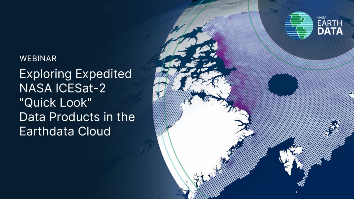
Join us for a short webinar on Exploring Expedited NASA ICESat-2 "Quick Look" Data Products in the Earthdata Cloud.


Date: October 28, 2026

Time: 2:00 p.m. ET


Register here


New Data Set Releases


Untitled Design_p1.png

Community of Practice


The Applications Team will be facilitating thematic discussion groups for ICESat-2 data applications. These groups will promote conversations on how the data are applied, share ideas for future data use, provide feedback on data usability, and receive/offer support.


To stay informed, send an email with 'subscribe' in the subject to icesat2-community-of-practice-join@lists.nasa.gov

Open Altimetry Updates


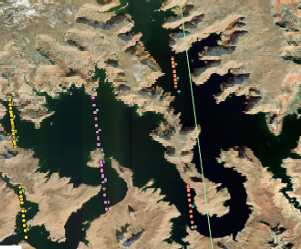
The NASA Snow and ICE Data Center Distributed Active Archive Center is pleased to announce that the Open Altimetry Web application has been updated to include ATLAS/ICESat-2 Nearshore Bathymetry, version 2.


Click the link below to learn more.

Outreach Events

Brian Campbell will be traveling to Hermosillo, Sonora, Mexico next month (November 12-16) for the NASA Space Apps Challenge 2026 at the Technological University of Hermosillo.


Brian will serve as a mentor and NASA Earth Science Mission SME to the students, highlighting the data from multiple missions like ICESat-2, GEDI, NISAR, PACE, others, and connecting citizen science/crowdsourced data with satellite data verification & validation.

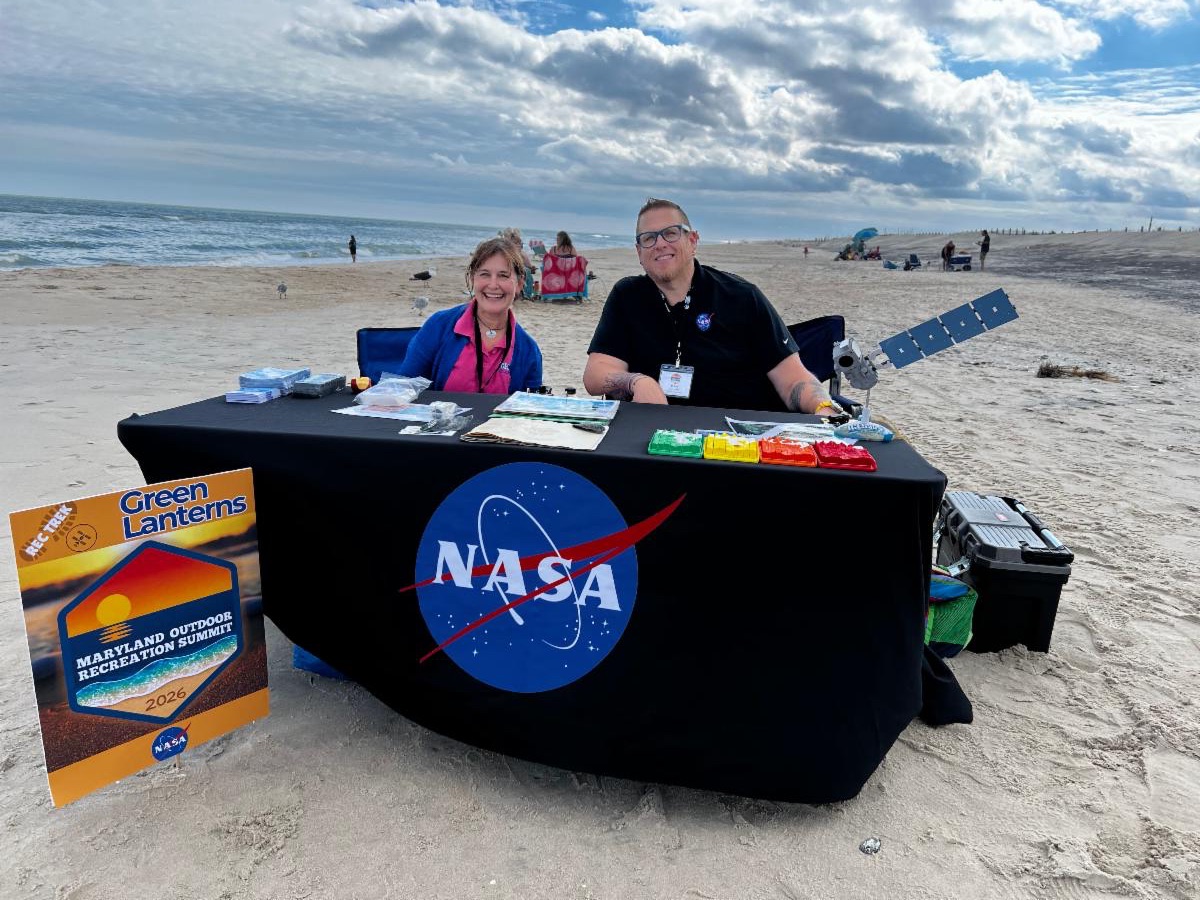
Valerie Casasanto and Brian Campbell attended the 2026 Maryland Outdoor Recreation Summit held in Ocean City and Assateague Island, Maryland.


The three-day event, hosted by the Maryland Department of Natural Resources, brought together recreation enthusiasts, leaders, and business owners to network, collaborate, learn and enjoy the outdoors together.


Research Highlights

(Explore Zotero Library)


New Product Alert: 2025 Texas Canopy Height Map


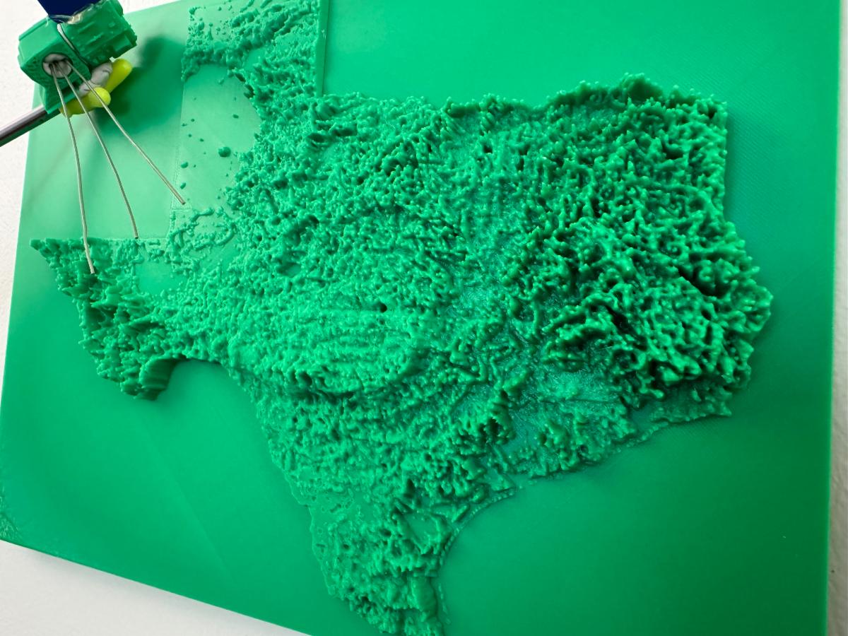
ICESat-2 data and ancillary datasets were used to create a complete 2025 Texas canopy height map at 30-m spatial resolution. This product is available in Cloud Optimized GeoTIFF (COG) format. Click the link below to access.


On a fun note, the Texas canopy data were used to create a 3D printed map along with a model for ICESat-2 seen in the photo above. Credit: Justinn Jones (creator) and Sorin Popescu (photographer).


New R package for ICESat-2 vegetation


rICESat2VegRA is an R Package for NASA's Ice, Cloud, and Elevation Satellite (ICESat-2) Data Processing and Visualization for Terrestrial Applications. It provides tools for downloading, reading, processing, visualizing, and exporting NASA's ICESat-2 ATL03 and ATL08 products. Supports photon- and segment-level analysis, spatial sampling, gridding, statistical and machine-learning modeling, and integration with Google Earth Engine' for wall-to-wall mapping of vegetation structure and other land attributes.


12145_2026_2216_Fig1_HTML image

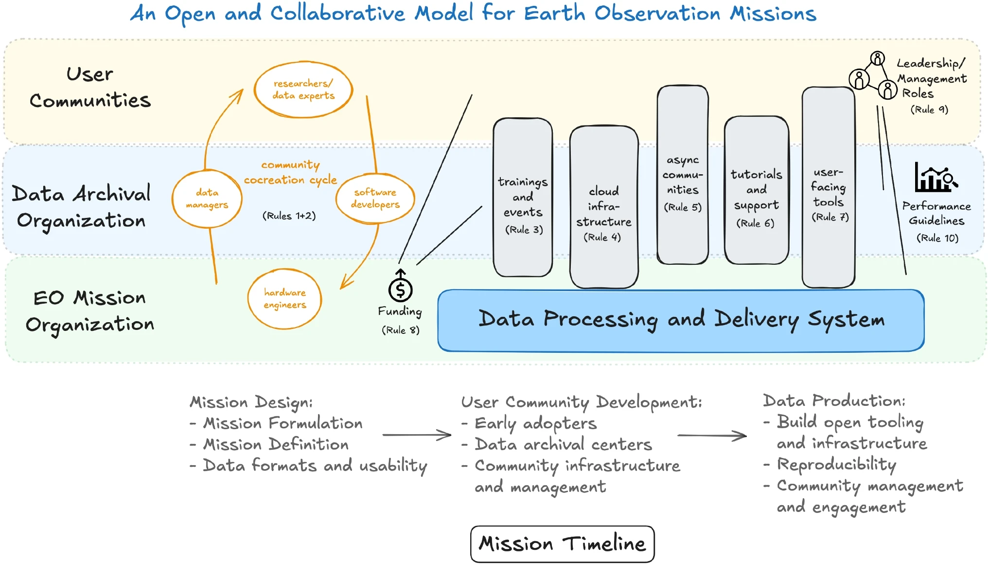
Ten Rules to increase the usability of Earth observation mission datasets. By Scheick et al. 2026 in Earth Science Informatics.


This paper presents ten rules to help mission planners, funders, data archival organizations, software engineers, and data user communities thoughtfully construct and engage with fully open, collaborative communities, technical infrastructure, software tooling, and educational resources to maximize data usage from EO missions. 


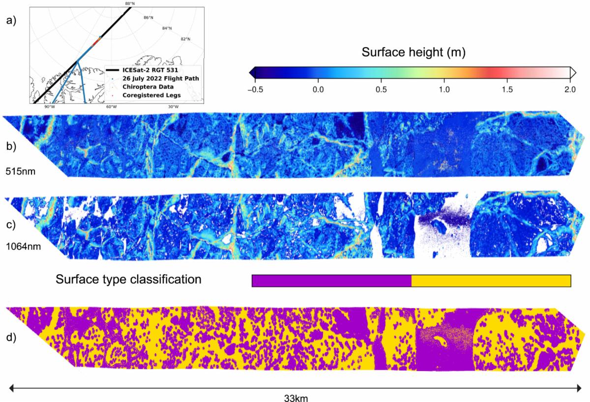
First Assessment of ICESat-2 Summer Sea Ice Freeboard with Airborne Validation. By Buckley et al. 2026 in Geophysical Research Letters.


This paper presents an assessment of ICESat-2 summer sea ice observations using airborne LiDAR and imagery collected along near-coincident ground tracks during a July 2022 calibration and validation campaign.


Upcoming Meetings & Conferences


Tools and Resources

For data downloading, processing and visualization