|
Highlight
Towards Understanding the New Three-dimensional Accuracy of the ASPRS Accuracy Standards
Qassim Abdullah, Ph.D., PLS, CP
| |
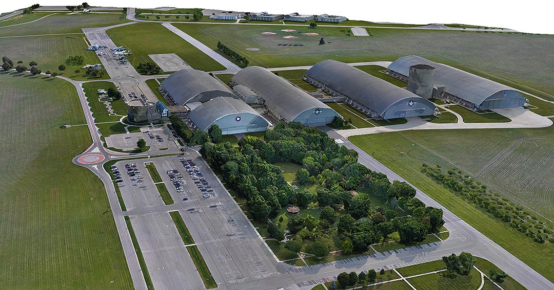
With the industry increasingly moving towards three-dimensional GIS and true three-dimensional representation of terrain and infrastructure, it becomes prudent for the mapping standards to provide a measure to assess the accuracy of such representations. That is exactly what was offered in the latest American Society for Photogrammetry and Remote Sensing (ASPRS) Positional Accuracy Standards for Digital Geospatial Data, which was published last year, as the term “three-dimensional accuracy” was introduced to complement horizontal and vertical accuracy terms. This article provides users of the standards with practical methods for assessing the three-dimensional accuracy of geospatial data and helps them understand this new term of accuracy.
| | |
Columns
GIS Tips & Tricks - Is Your Hydro-network Fully Attached?
Mike Plivelich and Al Karlin, Ph.D., CMS-l, GISP
| |
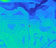
With the recent USGS – 3D Hydrography Program (3DHP) update to the National Hydrography Dataset (NHD), renewed significance has been focused on aligning the hydrography with 3D lidar-derived surfaces that have been produced under the USGS 3D Elevation Program (3DEP). This update to the hydrographic mapping not only uses standard horizontal dimensions (x & y) to capture feature position, but also includes a 3rd vertical dimension (z) that allows us to drape networked hydrography over 3D digital landscapes
| | |
An Interview
Lasithasree (Lasitha) Lakshmanan
| | |
Lasithasree (Lasitha) Lakshmanan is originally from Hosur, India and is presently a Graduate Research Assistant and master’s Student in Civil Engineering (Geomatics), at Florida Atlantic University (FAU) where she focuses on using GIS to support disaster resilience and address environmental and urban challenges. Lasitha currently serves as the President of the FAU ASPRS Student Chapter and is Vice President of the Women’s Transportation Seminar (WTS) FAU Chapter. Outside of academics and research Lasitha enjoys traveling, singing, dancing and photography. She is fluent in English and Tamil, one of the world’s oldest languages and enjoys studying and teaching Tamil to others. Lasitha is committed to continuous learning and mentoring students, supporting their academic and professional growth.
| |
|
Signatures
Oregon State University Geomatics: Where Innovation Meets Education
|
- Brett Murphy receives Dennis Marker Teach of the Year Award
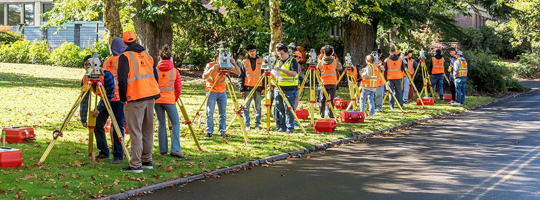
- Brett Murphy’s lab students at Oregon State University engage in hands-on fieldwork with Total Stations
- Professor Chris Parrish’s Kinematic Positioning and Navigation Class at Oregon State University demonstrate orientation concepts
- ASPRS Oregon State University Geo Week Recap from Students
| | |
SPECIAL ISSUE ANNOUNCEMENT
The American Society for Photogrammetry and Remote Sensing (ASPRS) Photogrammetric Engineering & Remote Sensing (PE&RS)
Special Issue on Hyperspectral Remote Sensing (imaging spectroscopy) to make Gigantic Leaps in Land and Water Science
Guest Editors: Dr. Prasad S. Thenkabail, Dr. Itiya Aneece, Dr. Pardhasaradhi Teluguntla
U.S. Geological Survey (USGS)
Email: pthenkabail@usgs.gov, ianeece@usgs.gov, pteluguntla@usgs.gov
Deadline for submission of manuscripts: rolling submission starting now until July 31, 2026
Tentative publication date: Expect multiple issues in 2025 and 2026
Hyperspectral remote sensing or HRS (imaging spectroscopy) changes the very paradigm of remote sensing data acquisition and, as a result, remote sensing science. HRS sensors typically acquire data in hundreds or thousands of near-continuous hyperspectral narrowbands (HNBs). In contrast, multispectral broadbands (MBBs) such as Landsats, Sentinels, and PlanetScope Doves and SuperDoves acquire data in a few broad spectral bands. HNBs are typically ≥15 nanometers in bandwidth whereas multispectral broad bands (MBBs) are typically >15 nm in bandwidth. However, many spectroradiometers have bandwidth as narrow as 1 nm. HRS data have hundreds or thousands of HNBs along the electromagnetic spectrum (e.g., 400-2500 nm) whereas multispectral sensors have around 10 MBBs in 400-2500 nm. Hyperspectral data can be considered as “signatures” whereas multispectral data are acquired in “a few data points along the spectrum”. Currently, we are acquiring remotely sensed data in four distinct modes. These are defined below (defining characteristic for each type is highlighted in italic bold):
-
Hyperspatial broadband (HBB) data: (a) Spectral resolution (band width): >15 nm (typically >30 nm), (b) Number of bands in 400-2500 nm: 4-10, (c) spatial resolution: sub-meter to 5 m, (d) radiometric resolution: 8 to 12 bits, (e) temporal resolution: 1-20 days.
-
Multispectral broadband (MBB) data: (a) Spectral resolution (band width): >15 nm (typically >30 nm), (b) Number of bands in 400-2500 nm: 4-10, (c) spatial resolution: sub-meter to 1000 m (typically 30 m or better), (d) radiometric resolution: 8 to 12 bits, (e) temporal resolution: 5-16 days.
-
Superspectral broadband (SBB) data: (a) Spectral resolution (band width): >15 nm (typically >30 nm), (b) Number of bands in 400-2500 nm: around 20 optimal bands (Landsat Next has 26 bands in 400-12,000 nm with 21 bands in 4000-2500 nm range), (c) spatial resolution: typically 30 m or better, (d) radiometric resolution: 8 to 12 bits, (e) temporal resolution: 5-16 days.
-
Hyperspectral narrowband (HNB) data: (a) Spectral resolution (band width): <15 nm (typically <30 nm), (b) Number of bands in 400-2500 nm: 200+, (c) spatial resolution: 30 m, (d) radiometric resolution: 8 to 12 bits, (e) temporal resolution: 1-20 days.
Great advances are taking place in remote sensing science and in particular hyperspectral remote sensing with a suite of new generation spaceborne hyperspectral sensors such as:
-
Planet Lab’s Tanager-1 acquiring data in 420 hyperspectral narrow bands (HNBs) over 400-2500 nm spectral range in 5 nm bandwidths,
-
German Space Agency’s DESIS (DLR Earth Sensing Imaging Spectrometer) onboard the International Space Station (ISS) acquiring data in 235 hyperspectral narrow bands (HNBs) over 400-1000 nm spectral range in 2.55 to 10 nm bandwidths,
-
German Space Agency’s EnMAP (Environmental Mapping and Analysis Program) acquiring data in 222 HNBs over 400-2500 nm spectral range and 10 nm bandwidth,
-
Italian Space Agency’s PRISMA (PRecursore IperSpettrale della Missione Applicativa, Hyperspectral PRecursor of the Application Mission) acquiring data in 238 HNBs over 400-2500 nm spectral range and 10 to 12 nm bandwidth.
-
NASA’s Earth Surface Mineral Dust Source Investigation (EMIT) acquiring data in 285 HNBs over 380-2500 nm spectral range and 7.4 nm bandwidth.
- Other novel ground-based and drone-borne hyperspectral sensors.
Given the above fact, the overarching goal of the special issue(s) will be to critically evaluate hyperspectral narrowband (HNB) data and establish their challenges, strengths, and limitations relative to other types of remotely sensed data such as the HBB, MBB, and SBB data to advance remote sensing science in the study of Earth’s land and water resources. Specific manuscripts of interest will be as follows:
-
Characterizing, harmonizing, standardizing, calibrating and comparing: Studying distinct remote sensing data types such as hyperspatial broadband (HBB), multispectral broadband (MBB), superspectral broadband (SBB), and hyperspectral narrowband (HNB) in the study of land and water resources. However, there are no restrictions in use of other data types such as SAR or LiDAR to integrate those data as well as other data such as MBB, HBB, SBB data types with HNB data to enhance information.
-
Data redundancy and Hughes’ phenomenon: Addressing issues of data redundancy and overcoming Hughes’ phenomenon in hyperspectral data.
-
Data mining: Exploring data mining methods and approaches to best utilize hyperspectral data.
-
Spectral libraries: Generating hyperspectral spectral libraries of agricultural crops and vegetation.
-
Hyperspectral Vegetation Indices (HVIs): Establishing specific hyperspectral vegetation indices (HVIs) to study specific land and water characteristics.
-
Modeling and mapping: Developing agricultural crop biophysical, biochemical, plant health, plant stress, and plant structural quantity models and maps using HNB and HVI data and comparing the same with HBB, MBB, and SBB data.
-
Data analysis philosophies: Discussing full spectral analysis (FSA) versus optimal hyperspectral narrowbands (OHNBs).
-
ML/AI: Implementing machine learning (ML) and artificial intelligence (AI) methods and approaches, especially on the cloud platforms such as Google Earth Engine (GEE), Amazon Web Services (AWS), Microsoft Azure, and high-power computing (HPC).
-
Other innovations: in methods, techniques, approaches, and a wide array of science applications pertaining to land and water.
All submissions will be peer-reviewed in line with PE&RS policy. Because of page limits, not all submissions recommended for acceptance by the review panel may be included in the special issue. Under this circumstance, the guest editors will select the most relevant papers for inclusion in the special issue. Authors must prepare manuscripts according to the PE&RS Instructions to Authors, published in each issue of PE&RS and also available on the ASPRS website at Instructions to Authors.
Important Dates: Manuscripts due: rolling submissions starting now through July 31, 2026. When we have 5 or more accepted papers, we will publish a special issue. So, if you have a relevant manuscript ready, you can submit right now and submissions with be accepted until July 31, 2026. Please submit your manuscript at https://www.editorialmanager.com/asprs-pers/ and select “Hyperspectral Remote Sensing.”
Guest Editors:
Dr. Prasad S. Thenkabail, PhD
U.S. Geological Survey
Flagstaff, AZ 86001, USA
Email\s: pthenkabail@usgs.gov;
thenkabail@gmail.com
Dr. Itiya Aneece
U.S. Geological Survey
Flagstaff, AZ 86001, USA
Email: ianeece@usgs.gov
Dr. Pardhasaradhi Teluguntla
U.S. Geological Survey
Flagstaff, AZ 86001, USA
Email: pteluguntla@usgs.gov
| | |
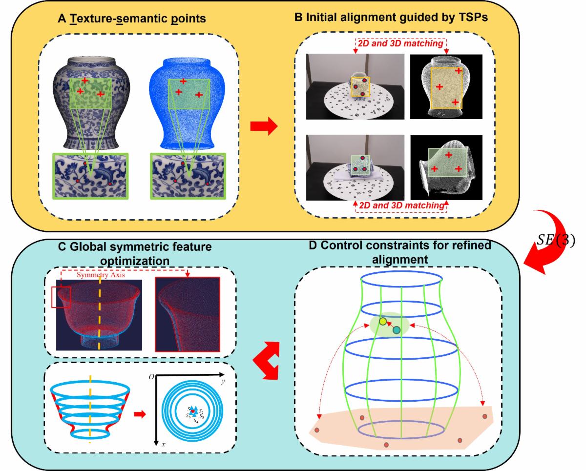
Texture-Semantic Point: Registration for Point Clouds of Porcelain Relics
Xuming Ge, Chengze Wu, Min Chen, Bo Xu, Qing Zhu, and Han Hu
| Point cloud models of porcelain are captured through the multi-registration of point clouds, which presents a challenging task. On the one hand, the smooth surface of porcelain lacks geometric feature variation, making it difficult to establish corresponding points. On the other hand, the overall geometric symmetry of most porcelain relics can easily lead to iterative calculations falling into the local minimum convergence trap. To address the difficulties in feature point selection, we propose a novel approach using texture-semantic points as features for coarse registration. | | |
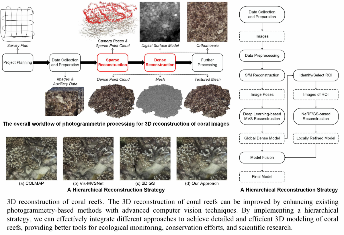
A High-Quality Underwater 3D Reconstruction Solution for Coral Reef Environments Leveraging Advanced Photogrammetric Computer Vision Techniques
Jiageng Zhong, Ming Li, Armin Gruen, Xuan Liao, Jiangying Qin, and Bing Wang
| Coral reefs, with their intricate 3D structures, are vital marine ecosys¬tems increasingly threatened by environmental stressors. Accurate 3D reconstruction of these underwater structures is essential for scientific research and conservation management. While underwater photogram¬metry has emerged as a promising tool for this purpose, technical challenges persist in capturing fine-scale features under underwater conditions, particularly the intricate morphology of coral reefs and the highly complex textures that hinder high-fidelity reconstruction. Recent breakthroughs in computer vision and deep learning have introduced new opportunities for underwater photogrammetry. This study begins by outlining a photogrammetric workflow that can integrate current advanced technologies, followed by summarizing cutting-edge methods used in the key stages, i.e., sparse and dense reconstruction. | | |
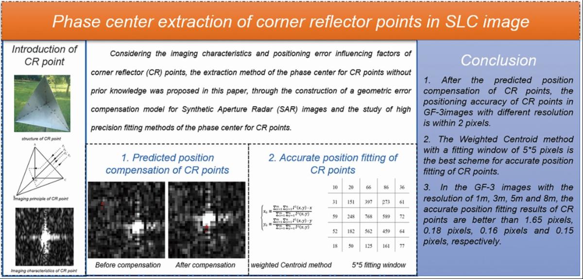
Phase Center Extraction of Corner Reflector Points in Single-Look Complex Image
Ruishan Zhao, Zhi Yu, Libo Wang, Chunsen Chen, Wenchao Huang, and Jiguang Dai
| | The geometric calibration accuracy of the Synthetic Aperture Radar (SAR) system is affected by the extraction accuracy of Corner Reflector (CR) points in a Single-Look Complex (SLC) image. There are some problems in traditional artificial extraction methods for CR points, such as the difficulty of identifying CR points without prior knowledge, low efficiency, and limited extraction accuracy. An extraction method of the phase center for CR points without prior knowledge was proposed in this paper through the construction of a geometric error compensation model for SAR images and the study of high precision fitting methods of the phase center for CR points. The effectiveness of the proposed method was verified by the Gaofen-3 (GF-3) satel¬lite image data. Experimental results demonstrated that the extraction accuracy of CR points could be better than 0.2 pixel for GF-3 images. | | | | |