Wisconsin Coastal Resilience Newsletter | |
|
Greetings from the Wisconsin Coastal Resilience Team!
This month's newsletter contains:
Collaboration Classifieds:
- Opportunity to Collaborate on Coastal Monitoring to Support Adaptive Management
Lake Michigan Water Level Update
Resource Highlight:
- Visual Signs of Erosion Guide
- Federal Flood Standard Support Tool
Around the Great Lakes:
- McKinley Beach Reopened to the Public
- Climate Resiliency Plan for Grant Park, Milwaukee County Parks
Funding Opportunities:
- Bipartisan Infrastructure Law 2024 Competition
- Pre-Disaster Flood Resilience Grant Program
- Federal Funding for Nature-Based Solutions
Trainings:
- NOAA Digital Coast On-Demand Training Opportunities
News:
- Climate Change Threatens Milwaukee’s Coastline
- Climate Change Brings Rising Lake Michigan Water Levels. Art Museum, Summerfest, Others Respond
| |
Collaboration Classifieds | |
Opportunity to Collaborate on Coastal Monitoring to Support Adaptive Management | |
|
Is your community interested in exploring adaptive management to respond to coastal changes?
Proof Projects LLC is looking to actively collaborate with Great Lakes coastal communities to support adaptive management by monitoring coastal processes with new drone-based measurement technologies. This new project Adaptive Management and Remote Sensing (AMARS) is taking an innovative approach to support adaptable, strategic, and culturally integrated coastlines. By collecting regular, comparable datasets, AMARS aims to provide better decision-making tools and foster a deeper understanding of coastal processes among community members.
One example of this approach comes from Port Bay, NY. The Proof Projects team collaborated with the community to modify their annual sediment management routine. Instead of traditional upland placement of dredged material, a nearshore "cobble engine" was used, allowing waves to distribute cobbles downshore to rebuild an eroding barrier bar. This cost-effective modification was specifically tailored to align with the community’s established annual budget. The placement has been monitored annually for the past five years to make adjustments as needed.
The AMARS team is seeking communities that are interested in any of the following: studying natural processes to restore and protect coastal habitat, tracking sediment movement, managing open water habitats, collecting and communicating data on changing coastal landscapes, and addressing sediment-related issues in coastal infrastructure. The gathered information will undergo processing to quickly and consistently depict the shoreline’s evolving physical and environmental conditions. This approach can facilitate adaptive responses to changing conditions while fostering productive ecological and social benefits.
Contact Tess Ruckwick of Proof Projects LLC for more information at tess@proofprojects.com
| |
Summer 2024 Water Level Update | |
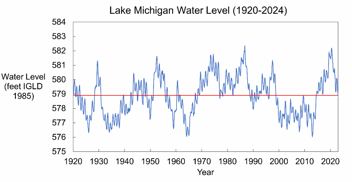
Through the spring months (March, April, May), Lake Michigan water levels began their seasonal rise. Water levels are expected to continue rising through July. Above average precipitation this spring increased water supply to Lake Michigan. Over the next 6-months the USACE predicts that Lake Michigan water levels will be 1 - 2 inches above the long-term average. | |
Visual Signs of Erosion Photo Guide | |
|
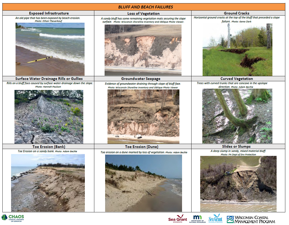
This photo guide was developed by Wisconsin Sea Grant and the Wisconsin Coastal Management Program for local government staff, planning and zoning staff, and coastal professionals to discuss erosion topics with property owners. This tool can help coastal managers and property owners spot signs of erosion such as tilted trees and ground cracks. The guide uses photos to show the different visual signs of erosion on beaches, bluffs, and around coastal infrastructure. This guide can be used to spark conversations with property owners about erosion and documenting change. The visuals this tool provides can be used to identify what is going on at a site or property. Capturing photos of these conditions annually is important for documenting changes to the coast – especially following storm events and changes in water levels.
| |
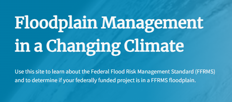
Federal Flood Standard Support Tool | The White House released a blog on flood resilience and launched a beta version of a new website and mapping tool that will help users to search an address to determine if that location is in a high flood risk area. The Federal Flood Standard Support Website and Tool will help users implement the Federal Flood Risk Management Standard (FFRMS). The FFRMS applies to projects where federal funds are used for new construction, substantial improvement, or repairs to address substantial damage. This can include projects such as critical infrastructure, federal facilities, clean energy, transportation, or broadband internet projects. The Tool will help users seeking federal funding for such projects to determine if they will be located within an area with increased risk of flooding. The work to develop freeboard mapping is currently ongoing, and data is being added to the Tool on a regular basis. | |
McKinley Beach Reopened to the Public | |
|
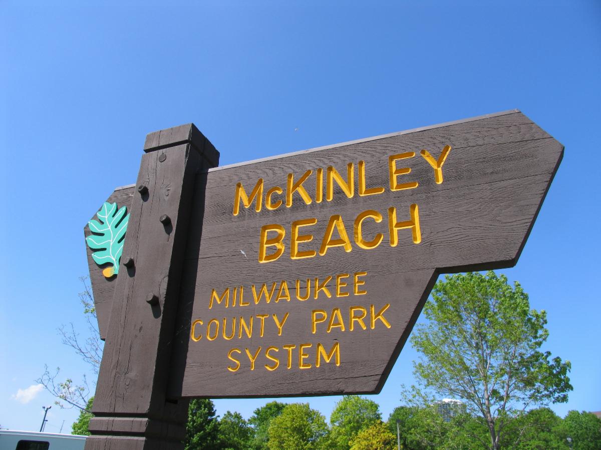
After over three years of construction, Milwaukee’s McKinley Beach has reopened to the public. The beach was closed in 2020 due to riptide hazards, several near drownings, and multiple fatal drowning incidents. Milwaukee County Parks undertook a beach nourishment project to address erosion and riptide concerns by regrading the beach and lowering the depth of the water between the breakwaters.
| |
Climate Resiliency Plan for Grant Park, Milwaukee County Parks | Milwaukee County Parks prepared a Climate Resiliency Plan for Grant Park on the coast of Lake Michigan. This plan provides an overview of environmental risks, impacts, and potential resiliency solutions for Grant Park. Their climate analysis looks at heat, precipitation and flooding, ice coverage, drought, coastal/bluff erosion, forests, and impacts to people and facilities. The Resilience Plan supports Milwaukee County Parks’ mission to “steward a thriving park system that positively impacts every Milwaukee County Park visitor.” | |
Bipartisan Infrastructure Law 2024 Competition | |
|
The Wisconsin Coastal Management Program (WCMP) is seeking projects to competitively apply to the 2024 National Coastal Zone Management Program BIL funding competition. The Bipartisan Infrastructure Law (BIL), also known as the Infrastructure Investment and Jobs Act, is providing funds to the National Oceanic and Atmospheric Administration’s Office for Coastal Management (OCM) to invest in coastal habitat protection and restoration projects. If you have a project idea, contact Lydia Salus (lydia.salus@wisconsin.gov) to begin a conversation.
Project Types:
- Habitat Restoration
- Restoration Planning, Engineering, and Design
- Ecosystem Conservation (Land Acquisitions)
Available Funding:
- $2 to $6 million for Habitat Restoration
- $200 to $500 thousand for Engineering, Design, and Planning
- $1 to $4 million for Ecosystem Conservation
Match Requirement: There is no match requirement.
| |
Pre-Disaster Flood Resilience Grant Program | |
|
Governor Tony Evers recently signed a bill (AB222) that will create a Pre-Disaster Flood Resilience Grant Program administered through the Division of Emergency Management. The grant program will provide funding to assessment and implementation projects aimed at identifying and improving flood vulnerabilities and resilience priorities for local communities. The program grants may cover up to 75 percent of the total anticipated project cost, and the applicant must detail from where it will source the remaining funding.
Available Funding:
- Assessments: up to $300,000 per assessment
- Implementation: up to $250,000 per grant
Eligible Applicants:
- City, village, town governments
- County governments
- Regional planning commissions
- Tribal governments
Eligible Project Sites/Areas must be:
- The site of a presidentially declared disaster for flooding at any time in the 10 years preceding the grant cycle;
-
The site of a governor-declared state of emergency for flooding at any time in the 10 years preceding the grant cycle; OR is for a local governmental unit that has a division-approved hazard mitigation plan that identifies localized exposure to flood risk.
| |
Navigating Federal Funding for Nature-Based Solutions | |
The Environmental Protection Agency (EPA) recently worked with other federal agencies, including NOAA, to update the Navigating Federal Funding for Green Infrastructure and Nature-Based Solutions (pdf) resource. This resource is an inventory of federal funding opportunities available for green infrastructure and nature-based solutions. The inventory has links to each funding source and notes whether the funds can be used for 1) planning and design, 2) implementation or construction, 3) operations and maintenance, and 4) monitoring. | |
|
NOAA's Digital Coast
NOAA’s Digital Coast platform offers on-demand trainings. They offer online, interactive modules on topics such as mapping, nature-based solutions, risk communication, and more! Some modules are eligible for professional credit.
| |
Climate Change Threatens Milwaukee’s Coastline | A new report shows how climate change is affecting weather patterns and local ecology in the Milwaukee area, and how all of it will impact the county’s beloved parks system, including the public’s many treasured, but vulnerable, coastal areas. | |
Climate Change Brings Rising Lake Michigan Water Levels.
Art Museum, Summerfest, Others Respond.
| |
As climate change brings rising levels for Lake Michigan, operators of Milwaukee lakefront attractions such as the Milwaukee Art Museum, Discovery World and Summerfest are working to protect those properties. | |
|
For questions about the CALM Network, or to submit something to the newsletter, contact:
Lydia Salus
lydia.salus@wisconsin.gov
608-266-3687
| |
|
For questions about Lake Michigan coastal hazards or how to address them, contact:
Adam Bechle
bechle@aqua.wisc.edu
608-263-5133
| |
University of Wisconsin Sea Grant Institute | (608) 262-0905 | 1975 Willow Drive, 2nd Floor, Madison, WI 53706 | | | | |