|
Our state highway system is a dependable network of roads connecting Californians to jobs, education, health, and more. It connects rural communities to urban centers and facilitates the transport of goods our state and nation depend on. However, the construction of the state highway system can cut straight through communities and ecosystems; bisecting and separating neighborhoods, people, and habitats. Today, this disconnect can look like elderly adults without secure and timely modes of transportation to access medical facilities, schoolchildren fearing for their safety as they cross a state route on their way to school, or a family of deer testing their luck when they cross a state highway to access their favorite water source.
At Caltrans, we reflect on our history and ask: How can we work with communities to mitigate harm and reconnect ecosystems? How can we strengthen the economy and promote equity?
In observance of Native American Heritage Month, we are particularly mindful of the impacts on Indigenous communities. Many highways were built through lands significant to Native American Tribes. We are committed to collaborating with these communities to ensure their voices are heard and their heritage respected. By acknowledging past injustices and fostering partnerships, we aim to build a transportation network that honors Native American heritage while promoting connectivity and progress for all.
Pictured: Tribal Nation flags lined up on the south lawn of the State Capitol during a California Native American Day celebration in 2013.
Nailah Pope-Harden
Deputy Director, Director’s Office of Equity & Tribal Affairs
| |
| | Land Acknowledgment - In honor of National Native American Heritage Month, we “Acknowledge that the land we now call California is the ancestral lands of the over 109 Nations, Tribes, and Peoples. The Indigenous Peoples of this area have a deep, reciprocal relationship with the land as its original stewards. Their ways, methods, and traditions have contributed to California’s rich biodiversity and have impacted the transportation network for the state...” Read the full Land Acknowledgment statement as developed by the Tribal Affairs Office here. | | | |
| | Join the Tribal Affairs Team - We are actively recruiting for a dynamic individual to serve as a Tribal Policy Manager (Staff Services Manage I). Don't miss this opportunity to make a difference—apply now on Cal Careers (final application date is Monday, November 10th) and share with your network! | | | |
| | NAAC Meeting in November - The Native American Advisory Committee will meet statewide virtually on November 05, 2025. | | | |
| | EAC Subcommittee Meetings in November - The Community Engagement Policies & Practices Subcommittee will meet on November 14. The Data Implementation Subcommittee will meet on November 17. The Transportation Planning & Program Guidance Subcommittee will meet on November 18. All meetings will be virtual via Zoom. Meeting information and agendas will be posted ten days before the meetings. | | | |
On the Road with Caltrans:
Department Highlights
| | |
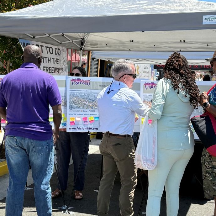
Caltrans District 4 is conducting the Vision 980 Study to hear from the community about ways to reimagine the I-980 corridor. Previous racially discriminatory decision making and redlining policies resulted in the I-980 corridor directly cutting through the West Oakland community. The freeway’s 1.6-mile-long connection between I-880 and I-580 displaced many West Oakland families, divided West Oakland neighborhoods from Downtown, and ultimately contributed to community disinvestment. Today, I-980 represents a painful physical monument to the segregation and discrimination of generations past and acts as a barrier to travel and economic opportunities.
The Vision 980 Study aims to improve the quality of life for impacted residents through a community-led and equitable planning process that seeks to reimagine the freeway with the potential to create new opportunities for land-uses like housing, businesses, open space, recreational, and cultural facilities. The study will be completed in two phases. Phase 1 will identify a new concept and vision for the future of the corridor between Spring 2024 and Fall 2025. Phase 2 will conduct a feasibility analysis of the concept identified in Phase 1 in early 2026 through late 2027.
At the beginning of the study process, community members expressed the importance of reaching out to legacy residents who were displaced by the construction of the freeway, who are aging, and who may have moved to other areas of the region or state. The study consultant outreach lead, RBA Creative, conducted early legacy resident engagement through workshops, interviews, referrals, and newspaper advertisements. Caltrans partnered with the Reconnecting Communities Institute (RCI) to identify and document data sources and strategies to locate and engage legacy residents. The strategies include researching museum archives and Right of Way parcel maps and cultivating knowledgeable contacts via alumni associations and faith-based communities. These strategies, and more, will continue to be employed to locate legacy residents into future planning and potential implementation phases.
For more information about the study, visit www.vision980.org, or contact the study lead, Becky Frank, at vision980@dot.ca.gov.
Pictured: Community members and District 4 staff engaging in conversation during a tabling event in the City of Oakland for the Vision 980 Study.
|
| Caltrans’ Sustainable Communities Planning Grant Program | |
The Sustainable Communities Grant program, funded by Caltrans, supports Tribes, local, and regional multimodal transportation and land use planning projects that strengthen the economy, promote equity, contribute to the State’s greenhouse gas reduction targets, and address the needs of underserved communities through robust engagement.
Tribal Nations are eligible applicants, and to make the program more accessible to Tribes, Caltrans approved a Tribal Set Aside of up to $2 million for this program. In addition, a Limited Waiver of Sovereign Immunity is no longer required to contract with Caltrans directly. These actions were made in response to hearing concerns from Tribal governments on barriers to participation in this grant program. Tribal Nations have been successful applicants to this program in the past, and with these changes, Caltrans hopes to see increased participation by Tribal governments in the future.
Congratulations to all the FY 2025-26 recipients and partnership recipients!
In FY 2026-27, Caltrans will award approximately $22 million for Sustainable Communities Competitive and Strategic Partnerships Transportation Planning Grants. The grant submission deadline for the FY 2026-27 cycle is November 21, 2025, by 5 PM. Visit the program website to learn more and find resources.
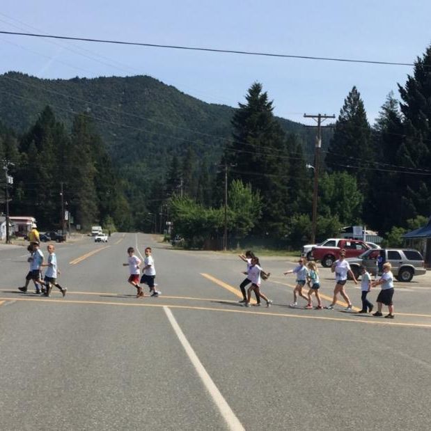
Pictured: Schoolchildren and parents walking within a marked crosswalk along State Route 96 in District 2.
| | Tune into what our team is reading and listening to this month! | | |
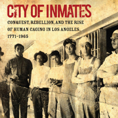
Tribal Liaison, Vivienna Orcutt, is reading City of Inmates: Conquest, Rebellion, and the Rise of Human Caging in Los Angeles, 1771-1965 by historian Kelly Lytle Hernández. She shares, “In the text, Hernández documents how the legal system historically targeted specific populations through a systematic distribution of alcohol and public order charges. In the 1850s, officials classified Indigenous peoples as "vagrants," leading to the rounding up of Tongva and other Native groups. Over time, this practice expanded to include Mexicans, Chinese, and African Americans, many of whom were forced to work on road construction and other public projects in chain gangs or sold to private employers. By 1910, Los Angeles boasted one of the largest jail systems in the country, and convict labor played a significant role in the construction of much of the city's roads and infrastructure.”
| | | |
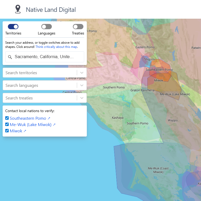
In honor of National Native American Heritage Month, Equity Analyst, Jacq Garcia, shares Native Land Digital resource. She shares, “This a wonderful resource which honors and uplifts the sovereignty of Tribal Nations, their lands, and their waters. It combines modern day geography with ancestral territories. You type in an address and in a few seconds, you can see what territories that address is within.”
| | | | | |