Dear Angelenos:
City Planning’s Geographic Information Systems (GIS) team builds and maintains interactive maps of Los Angeles to support critical planning functions and offer additional opportunities for collaboration. Over the years, the use of GIS desktop and web mapping software has assisted the Department in forecasting trends in population, housing, and employment growth.
GIS technology makes the raw data in a spreadsheet easier for everyone to visualize and digest. Three-dimensional data modeling reveals patterns and relationships that help the City make better-informed decisions. Recently, our GIS team updated our online Cases Filed and Cases Completed Maps to make it easier for the public at large to obtain information on projects filed, approved, or denied by the Department.
The maps now allow users to zoom in on any site by typing in an address or street intersection. To highlight market trends, the maps incorporate new geographic layers that display development interests by Community Plan Area, Council District, and Neighborhood Council boundaries.
Each map marker on the screen indicates the location of a proposed, approved, or denied project. Clicking on the marker displays the project's address, description, type of entitlement, and other information.
Because these maps package information for everyone’s use, not just career professionals in the land use industry, they are great examples of the ways we are using technology to share information and demystify the planning process.
Together, we are #Planning4LA.
Sincerely,
|
|
Vince Bertoni,
Director of Planning
|
|
|
|
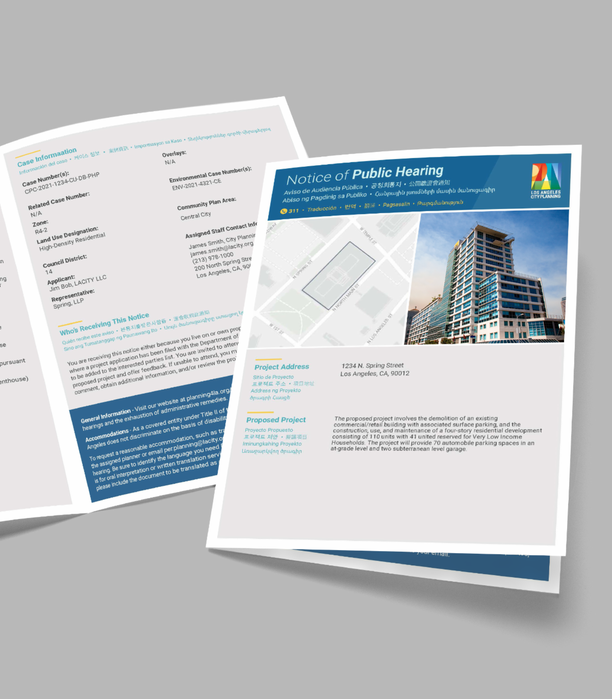
Earlier this month, City Planning unveiled its newly redesigned hearing notice for development projects. To cut through technical language, the Department has adopted an attractive, modern design that standardizes the format of these notices, providing clear and consistent information.
The new design emphasizes important information, ranging from the location of the project to the hearing details, along with a clear and easy-to-understand description to assist the public in making an informed decision about whether to monitor, attend, and/or participate in the public hearing. Within these hearing notices, an image or rendering will now be featured to demonstrate the scale of a project in relation to the surrounding neighborhood.
In order to increase the Department’s reach, City Planning has extended translation services in Spanish and other non-English languages, including Armenian, Korean, Chinese, and Tagalog.
|
|
|
|
Private Detention Center Ban |
On April 15, the Planning and Land Use Management (PLUM) Committee approved the Department’s draft ordinance to ban the local operation and construction of private detention centers. Modeled after Assembly Bill 32, the ordinance would establish new language in the City’s Zoning Code to enforce this prohibition in Los Angeles.
The ordinance would also disallow accessory uses or incidental activity related to “community detention facilities for unaccompanied minors” and “private detention centers.” The Department initially defined “private detention centers” as private institutions that detain individuals awaiting a trial, hearing, or other judicial or administrative proceeding. At its December 10, 2020 meeting, however, the City Planning Commission expanded the definition of “private detention center” to include other private institutions.
The PLUM Committee reverted to the Department’s original language in response to concerns that the new wording might subject privately operated sober living, rehab, and mental health facilities to the ban. The next step is for the City Council to consider the PLUM Committee’s report, prior to instructing the City Attorney’s office to prepare the final version of the ordinance.
|
|
|
|
Mulholland Scenic Parkway Specific Plan: New Implementation Guidance |
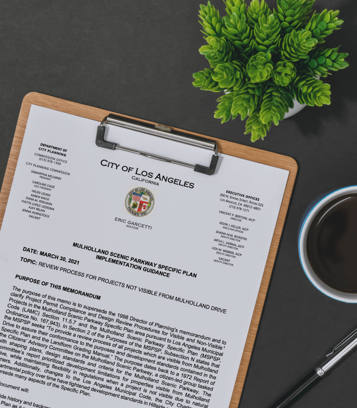
On March 30, the Department issued a new memo to clarify Project Permit Compliance and Design Review Procedures for “Visible” and “Non-Visible” projects located within the Mulholland Scenic Parkway Specific Plan. City Planning’s new implementation guidance stipulates that “Non-Visible” projects located within the plan area will no longer be subject to Design Review. However, they will still need to file a project application and will remain subject to planning review, including analysis per the California Environmental Quality Act.
For example, “Non-Visible” projects will still be subject to the Project Permit Compliance process for the Mulholland Specific Plan, as well as other regulations, including Residential Floor Area limitations, Hillside grading, and retaining wall limitations. As for "Visible" projects, they will remain subject to Design Review in keeping with the original intent of this plan area.
The Mulholland Scenic Parkway Specific Plan was established in 1992 to preserve the Mulholland Scenic Parkway corridor and its unique views of the mountains, ocean, and City. Created in 1913, Mulholland Drive is one of the most heavily traveled roads in the United States, known for its expansive vistas.
|
|
Healthy Buildings, Healthy Places |
|
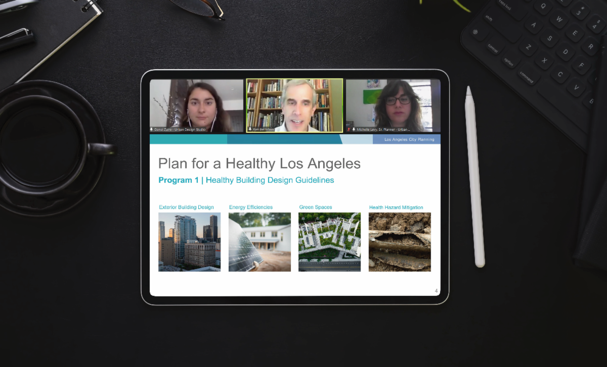
On April 10, the Urban Design Studio team attended the PlanCheckNC meeting to share information on the Healthy Buildings, Healthy Places design guide. In addition to providing an overview of the proposed concepts, the Department also collected feedback from the community.
Healthy Buildings, Healthy Places builds on previous planning initiatives, including the Plan for a Healthy Los Angeles and the Citywide Design Guidelines, by reinforcing linkages between health, equity, and planning. The guide recognizes the role that design plays in promoting favorable health outcomes, particularly in minority communities that have suffered from disinvestment.
|
|
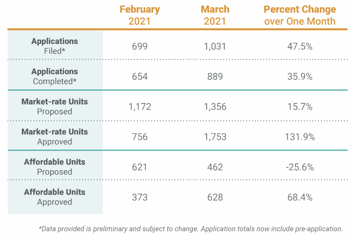
In March, more applications were filed and completed than during any other month in the Department's history. This milestone is the result of City Planning’s efforts to streamline case processing timelines and process more cases ministerially. Nearly 50% of the applications filed in March were administrative cases, which are processed relatively quickly. Apart from verifying compliance with existing zoning regulations or guidelines, planning review consists of a visit to the public counter or a discussion with the planner assigned to the project's geography. |
|
|
|
- Held Public Hearing and virtual open house events in December 2020
- Facilitated Community Planning 101 webinar sessions in November 2020
-
Released updated draft Zoning, Plan Text, Land Use Map, and Community Benefits Program in November 2020
- Extended the comment period for the Draft Environmental Impact Report (EIR) to December 4, 2020 and Draft Plan to January 13, 2021 to allow for additional input
- Conducted virtual office hours in September 2020
- Released updated draft Zoning, Plan Text, Land Use Map, and Community Benefits Program in August 2020
-
Released Draft EIR in August 2020 for a 120-day comment period
- Conducted office hours in January and February 2020
- Released Draft Zoning in October 2019
- Released Draft Plan and Land Use Map in July 2019
|
|
|
|
-
Released recorded webinars of the draft Land Use Designations in December 2020
-
Developed interactive StoryMap of proposed draft Land Use Designation maps and descriptions detailing the proposed ranges of intensities and uses in December 2020
-
Shared community feedback on the proposed draft Land Use Designations in the form of a guided survey or on the interactive comments map
|
|
|
|
- Planning for EIR Scoping Meeting in early 2021
-
Summarized community feedback in April 2021
-
Held a virtual public workshop to kick off the Venice Survey 2021 in November 2020
- Conducted a series of Office Hours in September/October 2020
-
Released Draft Concepts and held virtual open house webinars in July 2020
|
|
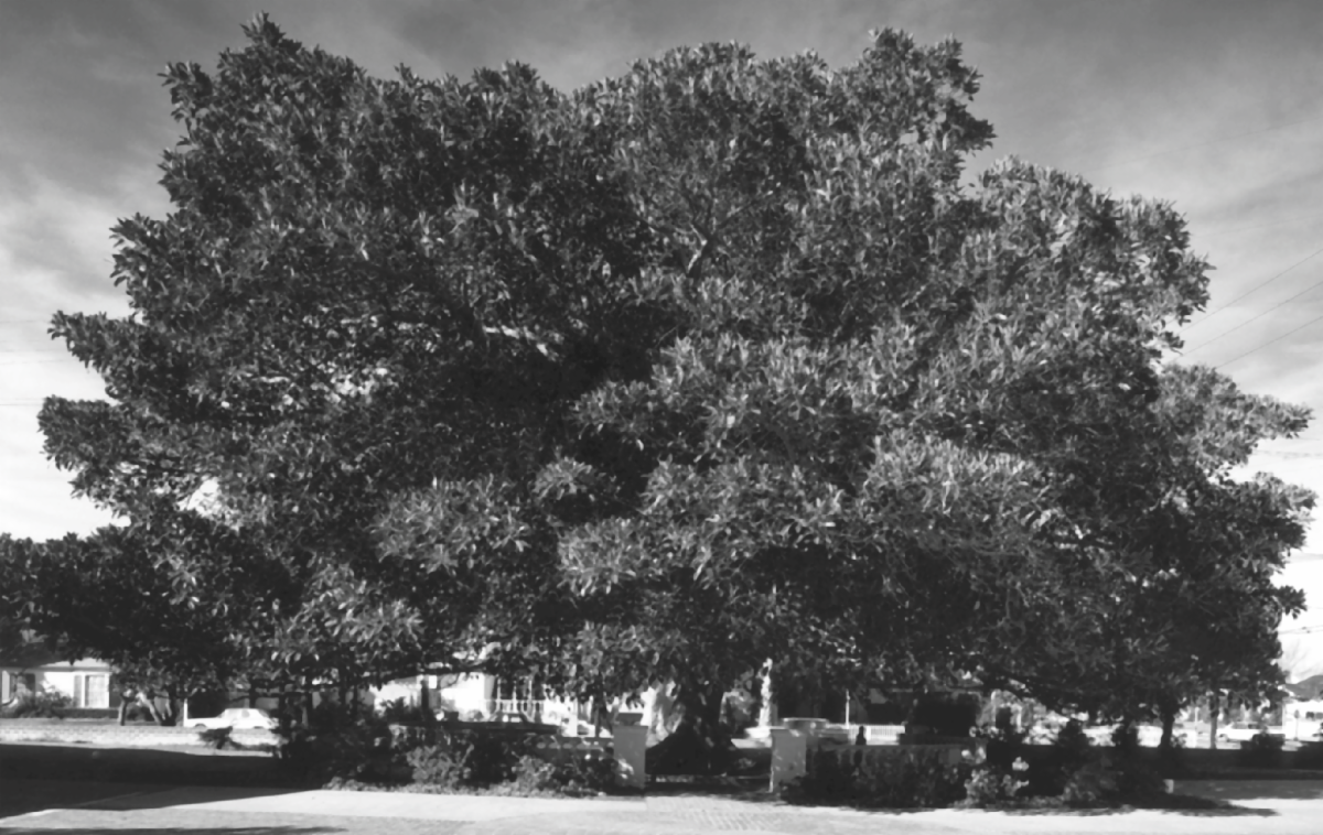
While Los Angeles contains a plethora of buildings, bridges, and other manmade structures that are historic resources, there are also many significant trees or groupings of trees throughout the City that have been designated as Historic-Cultural Monuments (HCMs). The first tree to receive HCM status is the Moreton Bay Fig Tree located at 11000 National Boulevard in Mar Vista, which was designated in 1963 as HCM #19. Planted in 1875, this stately tree still stands tall over the neighborhood almost 150 years later.
Other designated trees include the Cedar Trees along Los Feliz Boulevard in Los Feliz (HCM #67), the Pepper Trees along Canoga Avenue in Woodland Hills (HCM #93), the Mexican Fan Palm Trees along Avalon Boulevard in Wilmington (HCM #914), and the Canary Island Pine Trees along Martin Luther King Jr. Boulevard, Degnan Boulevard, Leimert Boulevard, and Crenshaw Boulevard that traverse various South Los Angeles neighborhoods.
These living monuments tell the stories of planned residential and commercial development districts, civic improvement projects, neighborhood beautification efforts, and the vital role trees play in defining our streetscapes. As the City commemorates Earth Month every April, Los Angeles is reminded of the importance of the Paris Agreement and its own commitment to promoting clean living and a healthy sustainable habitat for its residents and wildlife.
|
|
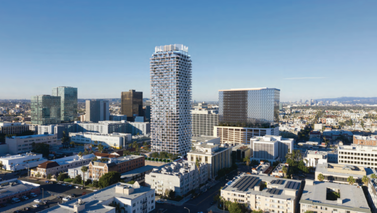
This month, the City Planning Commission reviewed a proposed 40-story mixed-use high rise in the Wilshire Plan Area. The project would demolish an existing private school and office building on-site. Of its 367 residential dwelling units, 11 percent would be affordable, with 6 percent reserved for Very Low Income households and 5 percent for Extremely Low Income households, for a total of 42 affordable dwelling units.
Also on the site is a church built in 1936, identified by SurveyLA as eligible for listing in the National Register of Historic Places and the California Register of Historical Resources, and as a local Historic-Cultural Monument. The building, a historic resource as defined by CEQA, is expected to be converted into a restaurant.
|
|
May City Planning
Commission Meetings
|
|
|
May Area Planning
Commission Meetings
|
|
Central: May 11 and 25
South Los Angeles: May 4 and 18
South Valley: May 13 and 27
West: May 5 and 19
East: May 12 and 26
Harbor: May 4 and 18
North Valley: May 6 and 20
|
|
LOS ANGELES
CITY PLANNING
|
|
Sign up to receive citywide planning updates by email
|
|
@Planning4LA
Planning4LA.com
|
|
|
|
|
|
|
|